Germfask Township, Michigan facts for kids
Quick facts for kids
Germfask Township, Michigan
|
|
|---|---|

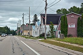
Community of Germfask along M-77
|
|

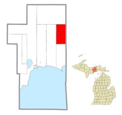
Location within Schoolcraft County
|
|
| Country | United States |
| State | Michigan |
| County | Schoolcraft |
| Area | |
| • Total | 71.63 sq mi (185.5 km2) |
| • Land | 66.43 sq mi (172.1 km2) |
| • Water | 5.20 sq mi (13.5 km2) |
| Elevation | 689 ft (210 m) |
| Population
(2020)
|
|
| • Total | 469 |
| • Density | 6.548/sq mi (2.5280/km2) |
| Time zone | UTC-5 (Eastern (EST)) |
| • Summer (DST) | UTC-4 (EDT) |
| ZIP code(s) |
49836 (Germfask)
49853 (McMillan) |
| Area code(s) | 906 |
| FIPS code | 26-31940 |
| GNIS feature ID | 1626347 |
Germfask Township is a small area of land in Schoolcraft County, Michigan. It is a type of local government area called a civil township. In 2020, about 469 people lived there.
Contents
What's in a Name? The Story of Germfask
The unique name "Germfask" comes from the first letters of eight early settlers' last names. These brave people arrived in 1881. Their names were John Grant, Matthew Edge, William Robinson, Thaddeus Mead, Dr. W. W. French, Ezekiel Ackley, Oscar (O.D.) Sheppard, and Hezekiah Knaggs.
The community also became a stop on the Manistique Railway. A post office was opened here on February 26, 1890. This helped the small town grow and connect with other places.
Exploring Germfask Township's Geography
Germfask Township covers a total area of about 71.63 square miles (185.5 km²). Most of this area, about 66.43 square miles (172.1 km²), is land. The rest, about 5.20 square miles (13.5 km²), is water. This means there are many lakes, rivers, or wetlands within the township.
Main Community: Germfask
The main community within the township is also called Germfask. It is an unincorporated community. This means it does not have its own separate city government. Instead, it is governed by the township.
This community is located in the northern part of the township. The Manistique River flows through it. You can find Germfask where the M-77 highway crosses the river. It sits right on the eastern edge of the Seney National Wildlife Refuge. The local ZIP Code for most of the township is 49836.
Who Leads Germfask Township?
Germfask Township has local leaders who help run things. The main leader is the Supervisor, currently Abby Burton. There is also a Clerk, Lynn Krupla. These leaders help manage the township's services and daily operations.
See also
 In Spanish: Municipio de Germfask para niños


