Gerton, North Carolina facts for kids
Quick facts for kids
Gerton, North Carolina
|
|
|---|---|
| Country | United States |
| State | North Carolina |
| County | Henderson County |
| Named for | Gertrude Freeman |
| Area | |
| • Total | 3.72 sq mi (9.63 km2) |
| • Land | 3.72 sq mi (9.63 km2) |
| • Water | 0.00 sq mi (0.00 km2) |
| Elevation | 2,782 ft (848 m) |
| Population
(2020)
|
|
| • Total | 290 |
| • Density | 77.96/sq mi (30.10/km2) |
| Time zone | UTC-5 (Eastern (EST)) |
| • Summer (DST) | UTC-4 (EDT) |
| ZIP code |
28735
|
| Area code(s) | 828 |
| GNIS feature ID | 2628627 |
| FIPS code | 37-25900 |
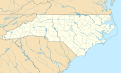
Gerton is a small community in Henderson County, North Carolina, United States. It is known as an "unincorporated community" and a "census-designated place" (CDP). This means it's a recognized area for counting people, but it doesn't have its own local government like a city or town. In 2020, about 290 people lived there. Gerton is part of the larger Asheville area.
Contents
Discover Gerton's Past
Gerton has an interesting history that goes back a long time.
Early Roads and Travelers
The area was first connected by a special path called a "Drovers' road." This was a natural route through the Blue Ridge Mountains. Drovers were people who moved farm animals, like turkeys, geese, hogs, and cattle, to markets. This road helped them travel in and out of the mountains.
The road was set up in 1798. It connected the Gerton area with Asheville. Today, parts of this old road are now U.S. Route 74A.
How Gerton Got Its Name
In 1883, a post office opened in the community. It was first called the "Pump" Post Office. This name came from a pump that brought water from Bearwallow Mountain down to the people living in the valley.
However, in 1902, something funny happened. The United States Post Office made a new stamp for the post office. But they accidentally misspelled "Pump" as "Rump." The people living there were very upset and embarrassed by this mistake.
So, they decided to change the community's name. They chose to honor a beloved school teacher named Gertrude Freeman. She was a very shy and modest person. To respect her wishes, they used a shorter version of her name, and that's how the community became known as Gerton.
Exploring Gerton's Location
Gerton is located along Gerton Highway, which is also US 74A.
Where is Gerton?
The community is about 19.7 miles (31.7 kilometers) northeast of Hendersonville. It sits along the banks of Hickory Creek. This creek is part of the Broad River system. Gerton is also about 17 miles (27 kilometers) southeast of Asheville, if you travel on US 74A.
Nature Around Gerton
Just northeast of Gerton, you can find the Florence Nature Preserve. This preserve has many miles of hiking trails. These trails connect to other paths around the town, making it a great place for outdoor adventures.
According to the U.S. Census Bureau, the Gerton area covers about 3.72 square miles (9.63 square kilometers) of land. There is no water area within the CDP.
Gerton's Population
| Historical population | |||
|---|---|---|---|
| Census | Pop. | %± | |
| 2020 | 290 | — | |
| U.S. Decennial Census | |||
The word "demographics" refers to information about the people living in a place, like how many there are. In 2020, the population of Gerton was 290 people.
Community Services
Gerton has its own fire department, Gerton Fire and Rescue. They provide fire protection for the community.
See also
 In Spanish: Gerton (Carolina del Norte) para niños
 | Madam C. J. Walker |
 | Janet Emerson Bashen |
 | Annie Turnbo Malone |
 | Maggie L. Walker |


