Gibraltar Rock State Natural Area facts for kids
Quick facts for kids Gibraltar Rock State Natural Area |
|
|---|---|
 |
|
| Lua error in Module:Location_map at line 420: attempt to index field 'wikibase' (a nil value). | |
| Type | Public, State |
| Location | Lodi, Wisconsin |
| Area | 68 acres (28 ha) |
| Created | 1969 |
| Operated by | Wisconsin Department of Natural Resources |
| Visitors | 73 |
Gibraltar Rock State Natural Area is a cool natural spot in southern Wisconsin, United States. It's about 68 acres (28 ha) big. This area sits right along the 1,000-mile-long (1,600 km) Ice Age Trail.
Contents
Exploring Gibraltar Rock: Location & Access
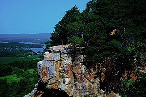
Gibraltar Rock State Natural Area is found in Columbia County, Wisconsin. From its higher points, you can enjoy amazing views of the Wisconsin River Valley and Lake Wisconsin.
This natural area is easy to reach. It's about 1.2 miles (1.9 km) from the meeting point of Highway 113 and County Highway V in West Point. County Road V goes right past the area. You'll find a parking lot off the road. From there, a walking trail leads you right to Gibraltar Rock.
A Look Back: History of Gibraltar Rock
Long ago, families like the Van Ness and Richmond families owned this land. In the 1920s, a famous landscape architect named Jens Jensen started working to protect this special place.
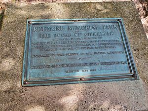
In 1920, he formed a group at the University of Wisconsin–Madison. This group managed to buy the land in 1927. They called it Richmond Park. Later, in 1969, Gibraltar Rock became a Wisconsin-designated natural area. The county owned it until 2007. Then, ownership was given to the Wisconsin Department of Natural Resources (WDNR). A celebration was held to mark this important change.
Managing and Enjoying the Natural Area
The Wisconsin Department of Natural Resources (WDNR) takes care of Gibraltar Rock State Natural Area. Before it became a state natural area, an artist named Howard Van Ness painted many pictures of the beautiful scenery.
A group called "Friends of Gibraltar Rock" helps out. They study the plants and animals in the area. The amazing views from Gibraltar Rock are a big reason why many people visit. There's a 1.4-mile (2.3 km) walking trail, but it's not set up for wheelchairs. Also, climbing the rocks in the park is not allowed.
The Geology of Gibraltar Rock
Gibraltar Rock is part of a larger rock formation called the Magnesian Escarpment or Black River Escarpment. The soil here is sandy and was shaped by glaciers long ago. This soil sits on top of dolomite and St. Peter sandstone.
Inside the natural area, you'll find a 200-foot-tall (61 m) flat-topped butte called "Gibraltar Rock." It's the highest point in Columbia County, sitting 1,246 feet (380 m) above sea level. A 0.75-mile-long (1.2 km) trail leads you up to the top of the Rock.
Wildlife and Plants of Gibraltar Rock
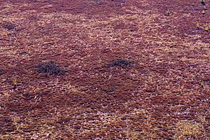
This natural area is home to many different plants. You might spot cliff goldenrod, columbine, and various ferns. Other plants include pale corydalis and red cedar.
Grasses like little blue-stem, side oats grama, and prairie drop-seed also grow here. Look for colorful flowers such as blue-eyed grass, bird's foot violet, bergamot, and pasque flower. You can also find leadplant, aster, whorled milkweed, and prairie smoke.


