
Goodrich, Wisconsin facts for kids
Quick facts for kids
Goodrich, Wisconsin
|
|
|---|---|

Goodrich Town Hall in November 2013
|
|

Location of Goodrich, Wisconsin
|
|
| Country | |
| State | |
| County | Taylor |
| Area | |
| • Total | 36.3 sq mi (94 km2) |
| • Land | 36.3 sq mi (94 km2) |
| • Water | 0 sq mi (0 km2) |
| Elevation | 1,453 ft (443 m) |
| Population
(2010)
|
|
| • Total | 510 |
| • Density | 14/sq mi (5.4/km2) |
| Time zone | UTC-6 (Central (CST)) |
| • Summer (DST) | UTC-5 (CDT) |
| Area code(s) | 715 & 534 |
| FIPS code | 55-29837 |
| GNIS feature ID | 1583290 |
| PLSS township | T31N R3E |
Goodrich is a small town located in Taylor County, Wisconsin, in the United States. In 2010, about 510 people lived there.
Contents
Goodrich Geography
Goodrich covers about 36.3 square miles (94 square kilometers) of land. The Big Rib River flows through the northeast part of the town.
Most of the land in Goodrich is quite flat. This flat land was formed by ancient glaciers. The soil in most of Goodrich is called Merrill till, which is a type of soil left behind by glaciers.
Goodrich History
The area around the Big Rib River in Goodrich might be where Father René Menard disappeared in 1661. He was trying to reach a group of Huron Indians near the Black River. He left his partner at some rapids and was never seen again.
Early Land Surveys
The first surveys of the land that would become Goodrich happened in 1851. Crews working for the U.S. government mapped the southern and eastern edges. In 1861, another team of surveyors marked all the corners of the land sections. They walked through forests and swamps to do this.
After their work, the surveyor described the area. He said the land was mostly gently rolling. The soil was good for farming. The area had many trees like hemlock, birch, and maple. There were also many small streams that flowed into the Rib River. At that time, no one lived in this area.
Railroad and Roads
Around 1873, the Wisconsin Central Railroad built a train line through the forest. This line went towards Ashland. To pay for this, the railroad was given half of the land for eighteen miles on each side of the tracks.
An 1880 map shows an early road entering the Goodrich area. It followed the path of modern Highway 64 for two miles. Then it turned south into Marathon County.
By 1900, there were a few more roads. One road followed Highway 64 for a few miles. Two other roads were in the southwest part of the town. The map showed five homes along these roads. But most of Goodrich still had no roads or settlers. Other nearby areas like Medford were already settled.
Town Formation
When Taylor County was created in 1875, the Goodrich area was part of a larger Town of Medford. In 1895, Browning and Goodrich were separated into a new, larger town called Browning. Finally, in 1903, the town of Goodrich became its own separate town.

The 1911 map showed more roads and settlers. Highway 64 was extended to a small community called Goodrich. This community had a sawmill and a school. A railroad also came into the town from the south. This was a logging railroad owned by the Copper River Land Co. More settlers were moving into the area.
Population and People
In 2010, Goodrich had 510 people living in 188 households. Most of the people (99.8%) were White. About 0.2% were of Hispanic or Latino background.
About 31.4% of households had children under 18 living with them. Most households (66.5%) were married couples. The average household had 2.71 people. The average family had 3.11 people.
The population's age range was spread out. About 24.5% were under 18 years old. About 11.6% were 65 years or older. The average age in Goodrich was 40.6 years.
Religion
The Town of Goodrich has two churches. They are Goodrich Community Church and St. Andrew's Lutheran Church.
Images for kids
-
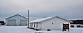
Goodrich Town Hall in November 2013
-
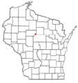
Location of Goodrich, Wisconsin
See also
 In Spanish: Goodrich (Wisconsin) para niños
