Grafton, Iowa facts for kids
Quick facts for kids
Grafton, Iowa
|
|
|---|---|

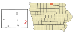
Location of Grafton, Iowa
|
|
| Country | |
| State | |
| County | Worth |
| Area | |
| • Total | 0.32 sq mi (0.83 km2) |
| • Land | 0.32 sq mi (0.83 km2) |
| • Water | 0.00 sq mi (0.00 km2) |
| Elevation | 1,230 ft (375 m) |
| Population
(2020)
|
|
| • Total | 216 |
| • Density | 672.90/sq mi (260.05/km2) |
| Time zone | UTC-6 (Central (CST)) |
| • Summer (DST) | UTC-5 (CDT) |
| ZIP code |
50440
|
| Area code(s) | 641 |
| FIPS code | 19-31890 |
| GNIS feature ID | 0457012 |
Grafton is a small city located in Worth County, Iowa, in the United States. It's a quiet place that is part of the larger Mason City area.
In 2020, about 216 people lived in Grafton. This number was a bit smaller than in 2000, when there were 290 residents.
Contents
History of Grafton, Iowa
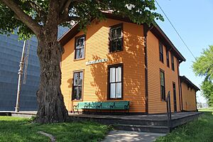
Grafton started to grow in 1878. This happened when the Chicago, Milwaukee and St. Paul Railway built its tracks through the area. The railroad helped the town develop and connect with other places.
Geography and Location
Grafton is located in a specific spot on the map, which helps us find it. Its coordinates are 43.329394 degrees North and -93.070164 degrees West.
The city covers a total area of about 0.33 square miles (0.83 square kilometers). All of this area is land, meaning there are no large lakes or rivers within the city limits.
Population Changes Over Time
The number of people living in Grafton has changed throughout the years. Here's a look at how the population has grown and shrunk over time:
| Historical population | |||
|---|---|---|---|
| Census | Pop. | %± | |
| 1900 | 156 | — | |
| 1910 | 183 | 17.3% | |
| 1920 | 233 | 27.3% | |
| 1930 | 249 | 6.9% | |
| 1940 | 256 | 2.8% | |
| 1950 | 278 | 8.6% | |
| 1960 | 273 | −1.8% | |
| 1970 | 254 | −7.0% | |
| 1980 | 255 | 0.4% | |
| 1990 | 282 | 10.6% | |
| 2000 | 290 | 2.8% | |
| 2010 | 252 | −13.1% | |
| 2020 | 216 | −14.3% | |
| U.S. Decennial Census | |||
Grafton's Population in 2020
In 2020, the city had 216 residents. There were 107 households, which are like homes where people live. Out of these, 68 were families.
The average number of people per square mile was about 673.5. This tells us how crowded or spread out the population is.
Most people in Grafton were White. A very small number of people were from other backgrounds.
The average age of people in Grafton was 47.5 years old.
- About 16.7% of residents were under 20 years old.
- About 20.8% of residents were 65 years old or older.
- The city had slightly more females (51.4%) than males (48.6%).
Grafton's Population in 2010
In 2010, Grafton had 252 people living there. There were 114 households.
About 26.3% of households had children under 18 living with them. Many households (52.6%) were married couples living together.
The average age in the city was 43.5 years.
- About 22.2% of residents were under 18.
- About 18.7% were 65 years or older.
- The city had slightly more males (51.2%) than females (48.8%).
Education in Grafton
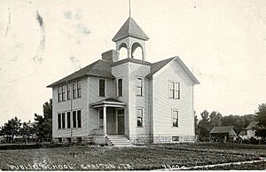
Students in Grafton attend schools that are part of the St. Ansgar Community School District. This district provides education for the children living in the area.
See also
 In Spanish: Grafton (Iowa) para niños


