Grahams Island facts for kids
| Geography | |
|---|---|
| Location | Devils Lake |
| Coordinates | 48°03′14″N 99°05′48″W / 48.0538881°N 99.0967958°W |
| Highest elevation | 1,496 ft (456 m) |
| Administration | |
| State | North Dakota |
| Counties | Benson, Ramsey |
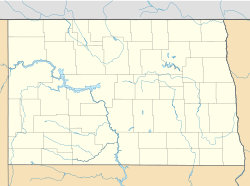
Grahams Island is an island in Devils Lake, a large lake in North Dakota, United States. The island covers about 9 square miles (23 square kilometers). It's located just outside the city of Devils Lake.
People live on Grahams Island all year round. However, the number of people on the island grows a lot during the warmer months. This is because many visitors come to enjoy the lake and the island's natural beauty.
Life on Grahams Island
The northern and central parts of Grahams Island are mostly used for farms. Here, you can see fields where crops are grown. The southern and southwestern parts of the island have thick, dense forests. These forests are home to various plants and animals.
Grahams Island State Park
A big part of Grahams Island is home to Grahams Island State Park. This park is located in the southeastern area of the island. It's part of the larger Devils Lake State Park system.
The park is a popular spot for outdoor fun. It covers about 1,122 acres (4.5 square kilometers). Visitors can enjoy many activities here. These include boating on the lake, fishing for different types of fish, and camping under the stars. It's a great place for families and friends to spend time outdoors.
Where is Grahams Island Located?
Most of Grahams Island is in an area called Lallie North. This area is in Benson County. It's considered an "unorganized territory," which means it doesn't have its own local government like a city or town.
The very eastern edge of the island is in a different area. This part is in Poplar Grove Township, which is located in Ramsey County. So, the island actually sits across two different counties in North Dakota.
See also
 In Spanish: Isla Grahams para niños
 | Precious Adams |
 | Lauren Anderson |
 | Janet Collins |


