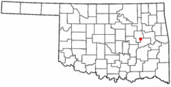
Grayson, Oklahoma facts for kids
Quick facts for kids
Grayson, Oklahoma
|
|
|---|---|

Location of Grayson, Oklahoma
|
|
| Country | United States |
| State | Oklahoma |
| County | Okmulgee |
| Area | |
| • Total | 1.13 sq mi (2.92 km2) |
| • Land | 1.13 sq mi (2.92 km2) |
| • Water | 0.00 sq mi (0.00 km2) |
| Elevation | 663 ft (202 m) |
| Population
(2020)
|
|
| • Total | 127 |
| • Density | 112.59/sq mi (43.48/km2) |
| Time zone | UTC-6 (Central (CST)) |
| • Summer (DST) | UTC-5 (CDT) |
| ZIP code |
74437
|
| Area code(s) | 539/918 |
| FIPS code | 40-31150 |
| GNIS feature ID | 2412707 |
Grayson is a small town in Okmulgee County, Oklahoma, United States. In 2020, 127 people lived there.
History of Grayson
Grayson was first called Wildcat. It was located in an area that later became McIntosh County. The town was named after a Muscogee chief, George W. Grayson. The Muscogee are a Native American people.
The name changed to Grayson when a post office opened on February 10, 1902. However, the town's official name stayed Wildcat until the 1960s. When Oklahoma became a state, Grayson had 375 residents. By 1910, the population grew a bit to 411 people, but then it started to get smaller.
Grayson was known as an "All-Black Town." These were towns and settlements created by African-Americans in Oklahoma between 1865 and 1920. There were more than fifty such towns.
In 1918, the border between McIntosh and Okmulgee counties changed. This change moved Grayson into Okmulgee County.
Grayson's Location
Grayson is about 11 miles (18 km) southeast of Okmulgee. Okmulgee is the main city and county seat of Okmulgee County.
The town covers a total area of 1.1 square miles (2.9 km2). All of this area is land, meaning there are no large bodies of water within the town limits.
Population Changes
The number of people living in Grayson has changed over the years. Here's a look at the population counts from different years:
| Historical population | |||
|---|---|---|---|
| Census | Pop. | %± | |
| 1910 | 411 | — | |
| 1920 | 298 | −27.5% | |
| 1930 | 134 | −55.0% | |
| 1940 | 188 | 40.3% | |
| 1950 | 147 | −21.8% | |
| 1960 | 142 | −3.4% | |
| 1970 | 142 | 0.0% | |
| 1980 | 150 | 5.6% | |
| 1990 | 66 | −56.0% | |
| 2000 | 134 | 103.0% | |
| 2010 | 159 | 18.7% | |
| 2020 | 127 | −20.1% | |
| U.S. Decennial Census | |||
In 2000, there were 134 people living in Grayson. These people lived in 55 households, and 32 of those were families. The population density was about 120 people per square mile (46 people per km2).
About 28.4% of the people were under 18 years old. About 21.6% were 65 years or older. The average age in the town was 40 years old.
See also
 In Spanish: Grayson (Oklahoma) para niños

