McIntosh County, Oklahoma facts for kids
Quick facts for kids
McIntosh County
|
|
|---|---|
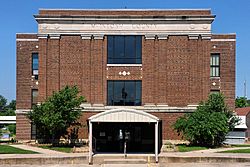
The McIntosh County Courthouse in Eufaula.
|
|
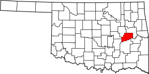
Location within the U.S. state of Oklahoma
|
|
 Oklahoma's location within the U.S. |
|
| Country | |
| State | |
| Founded | 1907 |
| Seat | Eufaula |
| Largest city | Checotah |
| Area | |
| • Total | 712 sq mi (1,840 km2) |
| • Land | 618 sq mi (1,600 km2) |
| • Water | 94 sq mi (240 km2) 13%% |
| Population
(2020)
|
|
| • Total | 18,941 |
| • Density | 26.603/sq mi (10.271/km2) |
| Congressional district | 2nd |
McIntosh County is a place in Oklahoma, a state in the United States. In 2020, about 18,941 people lived there. Its main town, called the county seat, is Eufaula. The county is named after an important Muscogee Creek family. Members of this family led their people to this area and were leaders for many years.
Most of McIntosh County is part of the land overseen by the Muscogee (Creek) Nation. A smaller part is under the care of the Cherokee Nation of Oklahoma.
Contents
History of McIntosh County
Ancient Times and Early People
Many old archaeological sites in McIntosh County show that people lived there a very long time ago. Some sites date back to 6000 BC. These early people lived in the area long before the Plains Indians. They were also there before the tribes who moved to the territory in the 1830s. These tribes came after being moved from the American Southeast.
Creek Nation and New Lands
In 1825, a group of Creek people from Georgia, led by William McIntosh, made a deal with the United States. This deal, called the Treaty of Indian Springs, traded their land in Georgia for new land in what is now Oklahoma. Much of this new land became part of McIntosh County. Chief McIntosh was later executed in Georgia. This happened because the Creek National Council had said no one could give away land without everyone agreeing.
His family and followers moved to this new land. Here, the Creek people often fought with the Osage, who had lived in this large area for a long time. In 1836, the Creek started a town called North Fork Town. It was near where Eufaula is today. This area became part of the Eufaula District of the Creek Nation.
Civil War and Railways
During the American Civil War, some Native American nations, including the Creek, allied with the Confederate States of America. They hoped to get their own state after the war. The Battle of Honey Springs, the biggest battle in Oklahoma during the war, happened near Rentiesville. The Union Army won this battle.
Later, in 1871–1872, the Missouri-Kansas-Texas Railway built a train line through the area. This led to the creation of towns like Checotah and Eufaula. Another railway was built in 1904–1905, which helped start the community of Hitchita.
Becoming a County
McIntosh County officially became a county in 1907, when Oklahoma became a state. At that time, about 17,975 people lived there. Before this, it was part of the Creek Nation's Eufaula District. The county's borders changed a bit in 1915 and 1918.
Between 1907 and 1909, the towns of Checotah and Eufaula had a disagreement. This was known as the McIntosh County Seat War. Checotah was chosen as the new county seat, but Eufaula refused to give up the county records. A group from Checotah tried to take the records by force, but Eufaula fought back. One year later, Eufaula was made the permanent county seat.
Today, most of the county is under the care of the Muscogee (Creek) Nation. A small part in the east is overseen by the Cherokee Nation of Oklahoma. More than 16% of the people in the county are Native American, mostly Muscogee.
Geography and Nature
McIntosh County covers about 712 square miles. About 618 square miles are land, and 94 square miles are water. A big part of the water is Eufaula Lake. This is the largest lake completely within Oklahoma. Checotah is the closest city to Lake Eufaula State Park. Rivers like the Deep Fork River, North Canadian River, and Canadian River flow through the county.
Main Roads
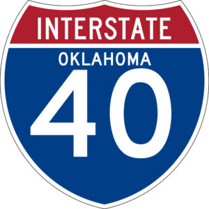
- Interstate 40
- U.S. Highway 69
- U.S. Highway 266
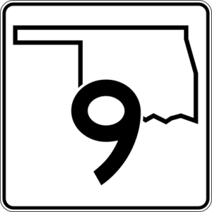
- State Highway 9
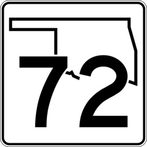
- State Highway 72
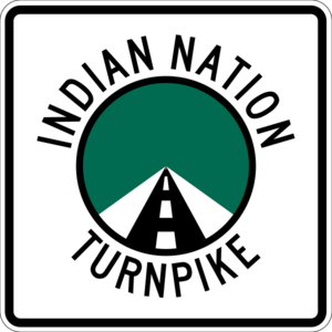
- Indian Nation Turnpike
Neighboring Counties
- Muskogee County (to the northeast)
- Haskell County (to the southeast)
- Pittsburg County (to the south)
- Hughes County (to the southwest)
- Okfuskee County (to the west)
- Okmulgee County (to the northwest)
People and Population
| Historical population | |||
|---|---|---|---|
| Census | Pop. | %± | |
| 1910 | 20,961 | — | |
| 1920 | 26,404 | 26.0% | |
| 1930 | 24,924 | −5.6% | |
| 1940 | 24,097 | −3.3% | |
| 1950 | 17,829 | −26.0% | |
| 1960 | 12,371 | −30.6% | |
| 1970 | 12,472 | 0.8% | |
| 1980 | 15,562 | 24.8% | |
| 1990 | 16,779 | 7.8% | |
| 2000 | 19,456 | 16.0% | |
| 2010 | 20,252 | 4.1% | |
| 2020 | 18,941 | −6.5% | |
| U.S. Decennial Census 1790-1960 1900-1990 1990-2000 2010 |
|||
In 2000, there were 19,456 people living in McIntosh County. The population density was about 12 people per square kilometer. By 2020, the population had gone down to 18,941.
Most people in the county are White (72.59%). About 16.20% are Native American, and 4.06% are Black or African American. About 1.27% of the population are Hispanic or Latino. Most people (96.4%) speak English at home.
The average age in the county in 2000 was 44 years old. About 22.60% of the population was under 18.
Economy and Jobs
The economy of McIntosh County used to be mostly about farming and ranching. Corn was a main crop, and then cotton became very important. Other crops like sorghum, oats, and wheat were also grown.
However, when Eufaula Lake was built in 1964, much of the best farmland was covered by water. This caused farming to decline a lot. Cotton farming mostly stopped by the mid-1970s. But raising cattle has remained important and has grown over the years. By 2000, there were 55,000 cattle in the county.
Eufaula Lake also brought new ways for the county to make money. It created hydroelectric power, which is electricity from water. It also brought more tourists and businesses like boat building and shops.
The county also has natural resources like oil, natural gas, and limestone.
Towns and Communities
Cities
Towns
Other Communities
Historic Places
Many places in McIntosh County are listed on the National Register of Historic Places. This means they are important historical sites.
- Checotah Business District, Checotah
- Checotah City Hall, Checotah
- Checotah MKT Depot, Checotah
- C. L. Cooper Building, Eufaula
- Eufaula Armory, Eufaula
- Eufaula Business District, Eufaula
- First Soil Conservation District Dedication Site, Eufaula
- Honey Springs Battlefield, Rentiesville
- Johnson Lake Shelters, Warner
- McIntosh County Courthouse, Eufaula
- Methodist Episcopal Church, South, Checotah
- Oklahoma Odd Fellows Home at Checotah, Checotah
- Rock Front, Vernon
- Slippery Moss Shelter, Texanna
- Tabor House, Checotah
See also
 In Spanish: Condado de McIntosh (Oklahoma) para niños
 | Stephanie Wilson |
 | Charles Bolden |
 | Ronald McNair |
 | Frederick D. Gregory |


