Greasbrough Canal facts for kids
Quick facts for kids Greasbrough Canal |
|
|---|---|

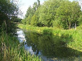
The canal above the A633 culvert
|
|
| Specifications | |
| Locks | 4 |
| Status | part extant |
| History | |
| Date of act | Privately built |
| Date of first use | 1780 |
| Date closed | 1918 |
| Geography | |
| Start point | Greasbrough |
| End point | Rotherham |
| Connects to | River Don Navigation |
The Greasbrough Canal was a private waterway built by the Marquess of Rockingham. He wanted it to help transport coal from his mines. These mines were located in and around the village of Greasbrough, near Rotherham, South Yorkshire, England.
The canal first opened in 1780. A part called the Newbiggin branch was added later. The main canal to Greasbrough closed in 1840. This happened because the Sheffield and Rotherham Railway was built. The canal stopped carrying goods for businesses during the First World War. Most of the canal has now been filled in. However, a small part near the River Don Navigation still has water.
Contents
Building the Canal
Before the canal, coal from mines near Bassingthorpe was moved by a special railway. This railway, called a waggonway, was finished by 1762. It connected the mines to the River Don Navigation.
To make coal transport better, the Marquess of Rockingham wanted a canal. He asked John Varley to find a good path for it. Varley was an assistant to a famous canal engineer, James Brindley. Varley suggested a canal about 1.5 miles (2.4 km) long. It would need three locks to handle a drop of about 25 feet (7.6 m).
Planning and Design
An engineer named John Smeaton looked at Varley's plan. He thought it was good but worried there might not be enough water. So, nothing happened right away. In 1775, Smeaton was asked to check the route again. This time, he suggested using five locks instead of three. He estimated the canal would cost about £5,952 to build. This included £2,500 just for the locks.
Still, no work started. In 1778, another survey was done by William Fairbank. Finally, William Jessop, another engineer, was asked to build the canal. Jessop decided to use four locks and added a reservoir to store water. Work began in 1779 and was likely finished the next year.
Canal Terminals
When it opened in 1780, the canal started from the River Don Navigation. It went under the road to Rawmarsh. It ended at a place where coal was loaded, on the east side of Greasbrough village. This main part was just under 1.5 miles (2.4 km) long.
A shorter branch, about 500 yards (457 m) long, left the main canal. It went northeast and ended near Taylors Lane at Parkgate. Here, it connected to tramways from coal mines like New Park Colliery. From 1823, one side of this branch faced the new Park Gate Iron Company works. This branch is sometimes called the Newbiggin Branch.
How the Canal Was Used
In 1834, the canal carried a lot of coal. About 10,452 tons of coal from Earl Fitzwilliam's mine at Park Gate passed onto the Sheffield Canal.
The canal used a clever system. Coal was loaded into special containers at the mine. These containers were then put into boats. Each boat could carry about 30 tons of coal. One horse could pull a train of three such boats.
The Railway Arrives
The canal's use quickly declined when the Sheffield and Rotherham Railway came along. In 1836, the railway got permission to build a branch line to the canal. This railway branch was finished and opened on August 7, 1839. It connected the main Sheffield and Rotherham railway line at Holmes to the tramways that served the canal.
This new railway meant Earl Fitzwilliam's coal could go to Sheffield without using the canal. This broke the near-monopoly that the Duke of Norfolk had on supplying coal to Sheffield. By 1840, the tramroads that fed the upper part of the canal were no longer used. Much of the main canal line was soon built over to create what is now called Coach Road.
The Newbiggin Colliery branch closed in the late 1800s. The lower part of the canal, which still exists, stopped being used by businesses after the First World War. The last boat to use it was probably a barge in 1928.
What Remains Today
The entrance to the canal from the Eastwood Cut can still be seen clearly. However, the old swing bridges for the towpath and railway have been replaced with fixed bridges. Just beyond that, the A633 road has been made wider. The canal now goes under the road through a tunnel.
A little further north, the Sheffield and Rotherham Railway was higher up. Its fixed bridge is still there. An old map from 1892 shows a coal loading area right after this bridge. Then there was a boat building yard. The canal still has water up to where the main line and the Newbiggin branch used to split.
Railway tracks used to cross the Newbiggin branch on a swing bridge to reach the Park Gate Iron Works. The canal also crossed under the railway just past the works to reach some lime kilns. The 1892 map does not show any sign of the original main line. However, it ran generally next to the stream that flows from Mill Dam at Greasbrough.
Points of Interest
| Point | Coordinates (Links to map resources) |
OS Grid Ref | Notes |
|---|---|---|---|
| Jn with River Don | 53°26′29″N 1°20′56″W / 53.4414°N 1.3488°W | SK433940 | |
| Sheffield and Rotherham Railway bridge | 53°26′39″N 1°21′01″W / 53.4443°N 1.3502°W | SK432943 | |
| End of watered section | 53°26′48″N 1°20′57″W / 53.4468°N 1.3491°W | SK433946 | Newbiggin junction |
| End of Newbiggin branch | 53°27′08″N 1°20′50″W / 53.4523°N 1.3473°W | SK434952 | |
| Cinder Bridge | 53°27′27″N 1°21′57″W / 53.4575°N 1.3659°W | SK422958 | Main line terminus |
 | Delilah Pierce |
 | Gordon Parks |
 | Augusta Savage |
 | Charles Ethan Porter |


