River Don Navigation facts for kids
Quick facts for kids River Don Navigation |
|
|---|---|
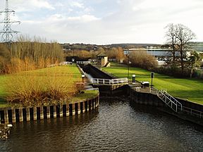
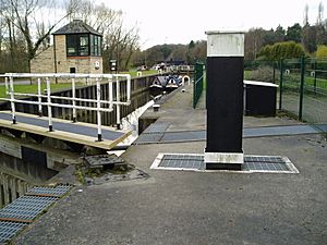
The Aldwarke Eurobarge Lock, complete with traffic lights
|
|
| Specifications | |
| Maximum boat length | 229 ft 8 in (70.00 m) (originally 62 ft 0 in or 18.90 m) |
| Maximum boat beam | 20 ft 0 in (6.10 m) (originally 16 ft 0 in or 4.88 m) |
| Locks | 13 |
| Status | Navigable |
| Navigation authority | Canal & River Trust |
| History | |
| Original owner | River Don Navigation Co |
| Date of act | 1726 |
| Date completed | 1751 |
| Geography | |
| Start point | Tinsley, Sheffield |
| End point | Bramwith |
| Connects to | New Junction Canal, Stainforth and Keadby Canal, Sheffield Canal |
The River Don Navigation is a special waterway in South Yorkshire, England. It's basically the River Don that was made easier for boats to travel on. This project started a long time ago, aiming to connect Fishlake and Sheffield.
In 1626, a Dutch engineer named Cornelius Vermuyden changed where the river flowed into the sea. This was to help with drainage and stop floods. His plan also included ways for boats to use the river. However, flooding continued to be a problem. So, in 1635, the Dutch River was dug to connect the new river channel to Goole.
The first law, called an Act of Parliament, to improve the river for boats was passed in 1726. This was pushed by a group of metalworkers from Sheffield. The next year, the town of Doncaster got its own law to improve the lower part of the river. Workers built locks and new channels. By 1751, boats could travel all the way to Tinsley.
Over time, more canals were built to connect to the River Don Navigation. The Stainforth and Keadby Canal opened in 1802, linking to the River Trent. The Dearne and Dove Canal opened in 1804, connecting to Barnsley. Then, the Sheffield Canal opened in 1819, making it even easier to reach Sheffield. The Don Navigation company eventually bought these canals in the 1840s. Later, railway companies owned them.
In 1889, a new company, the Sheffield and South Yorkshire Navigation Company, was formed. They managed to buy back the canals and the Don Navigation in 1895. They had big plans to make the waterways better, but they didn't have enough money. One big success was the opening of the New Junction Canal in 1905. This was built with help from the Aire and Calder Navigation.
In the 20th century, there were many ideas to make the Don Navigation bigger. The goal was to allow huge barges, carrying up to 700 tonnes, to use it. This upgrade finally happened in 1983. But by then, not as many big boats needed to use the river as expected. Today, most boats on the navigation are used for fun, like leisure boats. These boats look tiny next to the giant locks!
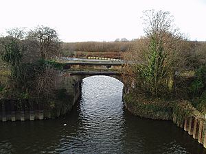
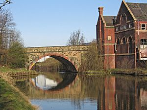
The navigation and river are crossed by many different kinds of bridges. There's a medieval bridge with a chapel on it, which is very rare. There's also a modern motorway bridge that was one of the first to use special rubber parts. Many railway bridges also cross the river. One old railway bridge at Conisbrough is now used by cyclists, high above the Don. The last part of the navigation, leading to Bramwith, is called the River Dun Navigation.
Contents
- Making the River Easier for Boats
- Early Plans and Challenges
- Laws to Improve the River
- Growing the Waterway Network
- Modern Upgrades and Uses
- Exploring the Route
- Bridges and Structures
- Bridges in Tinsley and Rotherham
- MS&L Railway Bridge
- Jordan Bridge
- Holmes Lock Bridge
- Midland Railway Bridges
- Lockhouse Bridge
- Centenary Way Bridge (South)
- Corporation Bridge
- Rotherham Lock Footbridge
- Bridge Street Bridge (Chantry Bridge) and Rotherham Bridge
- Centenary Way Bridge (North)
- Greasbrough Road Bridge
- Rawmarsh Road Bridge
- Eastwood Footbridge
- Wash Lane Bridge
- Steelworks Access (Road) Bridge
- Don (Rail) Bridge
- Thrybergh (Rail) Bridge
- Bridges in Kilnhurst and Mexborough
- Bridges in Conisbrough and Warmsworth
- Bridges in Doncaster Town Area
- Bridges in Barnby Dun Area
- Bridges in Tinsley and Rotherham
- Interesting Places Along the Way
Making the River Easier for Boats
A long time ago, before 1626, the River Don flowed in two directions. One part went east towards the River Trent. The other part, an old Roman boat channel, went north to the River Aire.
In 1626, Cornelius Vermuyden started a big project to drain the land around Hatfield Chase. As part of this, he built a bank along the River Don. This bank cut off the eastern branch of the river. He also built a special gate, called a navigable sluice, to let boats through.
But even with these changes, there was still a lot of flooding. So, in 1635, a new channel was dug. It was called the Dutch River and went from Thorne to Goole. This new channel helped water flow out to the Ouse. For many years, boats could reach Fishlake, and even Doncaster, especially when the tide was high.
Early Plans and Challenges
People wanted to make the River Don better for boats, but it was hard to get everyone to agree. Landowners didn't want their land affected. Towns like Sheffield, Rotherham, and Doncaster also had different ideas.
In 1698, a law was proposed to improve the river. Doncaster's leaders didn't like it because it might harm their mills. Sheffield also didn't support it, so the plan failed. In 1704, Doncaster tried again, but that plan also failed.
By 1722, Sheffield and Doncaster started to agree more. They thought Doncaster would handle the lower river, and Sheffield the upper part. But landowners still strongly opposed the idea, and their influence stopped the plan.
Laws to Improve the River
Finally, in 1726, the Cutlers of Sheffield asked for permission to make the river navigable. They wanted to connect Holmstile in Doncaster to Tinsley, near Sheffield. They worked hard to get landowners to agree.
On May 6, 1726, a law was passed. It allowed the Cutlers to make the river deeper and wider. This would let boats carrying 20 tons reach Tinsley. The law also protected existing water-powered mills and factories.
In 1727, Doncaster got its own law to improve the river below Holmstile. This law was very specific about what could be done, again to protect landowners.
Both laws were unusual because they allowed groups to borrow money but didn't officially create companies. So, both groups sold shares to raise money, even though they weren't fully allowed to. In 1730, the two groups decided to join forces.
In 1733, a new law officially created "The Company of the Proprietors of the Navigation of the River Don." This company could build a new channel near Rotherham. Work continued, and by 1740, boats could reach Rotherham.
Another law in 1740 allowed improvements from Barnby Dun to Fishlake Ferry. Despite strong opposition, this law passed. It gave the company power to make the river deeper and create channels to avoid shallow areas. The southern part of the river, up to Tinsley, was ready for boats by 1751.
From 1737, the navigation was rented out to shareholders. After 1758, the company managed it themselves. They collected a lot of money from tolls, showing how busy the river was with boats.
Growing the Waterway Network
The early 1800s saw new canals connecting to the Don Navigation.
- The Stainforth and Keadby Canal opened in 1802. It linked Bramwith Lock to the River Trent.
- The Dearne and Dove Canal opened in 1804. It connected to the Barnsley Canal near Barnsley.
- The Sheffield Canal opened in 1819. This canal connected Tinsley to the center of Sheffield.
The Don Navigation Company bought these three canals between 1846 and 1849. Then, in 1850, they joined with a railway company. This new company was called the South Yorkshire Railway and River Dun Company. Later, it was leased to another railway company.
Even with railways trying to take business, the canals stayed busy. They carried hundreds of thousands of tonnes of goods each year. However, canal users were unhappy because prices were higher than on railways. Also, steam boats were not allowed on the Don, even though they had been used on other canals for years.
In 1888, a plan was made to upgrade the waterways for bigger boats. A new company, the Sheffield and South Yorkshire Navigation Company, was formed in 1889. They wanted to buy the canals from the railway company. After long talks and legal fights, they finally bought them in 1895. But they didn't have enough money for all their big plans.
One important improvement was the New Junction Canal. This canal was approved in 1891 and was built together by the Aire and Calder Navigation and the Sheffield and South Yorkshire Navigation Company. It opened on January 2, 1905. This new canal was a much more direct route from Sheffield to Goole.
Modern Upgrades and Uses
After the First World War, Sheffield City Council wanted to make the navigation much better. They hoped the government would pay for it. The plan was to make the channel deeper and build 18 new, much larger locks. These new locks would be able to hold four 110-tonne barges or one 300-tonne barge. The cost was estimated to be very high, and the government didn't support it.
Between the two World Wars, the navigation struggled. It faced competition from railways and roads. Strikes in the coal industry also affected traffic. Traffic numbers went up and down, but much of it was for short distances, so the company didn't earn as much money.
In 1932, Bramwith Lock was made longer to allow special compartment boats to carry coal. Other improvements included straightening parts of the river and building new warehouses.
After the Second World War, oil became a major cargo on the navigation. By 1946, the company had paid off all its debts. In 1948, the British government took control of most canals, including the Don Navigation.
Improvements continued. New coal wharfs were built in Mexborough in 1954. Long Sandall Lock was made much longer in 1959. This allowed long trains of compartment boats to travel further up the navigation.
In the 1960s and 70s, there were more plans to upgrade the navigation for even larger barges. Finally, in 1983, the navigation was upgraded to handle 700-tonne "Eurobarges" as far as Rotherham. This involved making the channels deeper and enlarging the locks. Conisbrough lock was removed, and two Eastwood locks were combined into one. The new lock was opened on June 1, 1983. However, the expected increase in freight traffic didn't happen.
Today, the new locks are very large, about 198 feet long and 20 feet wide. They can handle boats with a deep bottom and needing about 10.5 feet of space above the water. Beyond Rotherham, the locks are smaller, limiting boats to about 60 feet long.
Exploring the Route
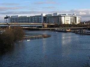
Let's start our journey at Tinsley Wharf, where the River Don Navigation used to end. This spot is near the Meadowhall Shopping Centre and the Tinsley Viaduct, which carries the M1 motorway over the Don valley.
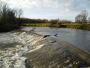
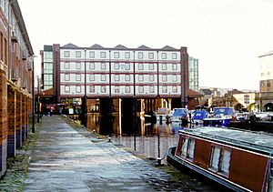
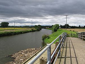
From Tinsley, you can walk along the towpath to Victoria Quays in Sheffield City Centre. Or you can follow the Five Weirs Walk along the River Don. The towpath also goes in the other direction towards Rotherham. Along the way, you'll pass Jordans Weir and three locks on the Holmes Cut. Near Jordans Weir, water from the Blackburn Meadows sewage treatment plant flows into the river. In dry weather, this adds a lot of treated water to the river's flow.
The towpath continues to Rotherham Lock, where the Rotherham cut begins. From here to Conisbrough, you can only see the navigation from a boat or from one of the bridges. North of the cut are the remains of the Greasbrough Canal. Eastwood lock marks the end of the Rotherham Cut. Then comes Aldwarke Lock, and Kilnhurst flood lock, which starts the Kilnhurst Cut.
In Swinton, a short part of the Dearne and Dove Canal branches off. There are three more locks before this cut ends. Right after this, the River Dearne flows into the Don. The towpath starts again here.
The route goes through a wooded valley, past the Sprotborough Flash. The towpath here is part of the Trans Pennine Trail. Sprotbrough lock and weir are just before Sprotborough. Near the lock, you can see the remains of an old engine house from the 1690s. It used a water wheel to pump river water up to supply a fountain and swimming pool at Sprotbrough Hall, and water for the village.
Soon, you reach Doncaster. Here, the River Don leaves the navigation for the last time, and the towpath also ends. Doncaster Town Lock is near Doncaster railway station. Between here and Long Sandall Lock, you can see how the river has changed over the years. The final section to Bramwith is usually called the River Dun Navigation.
At Bramwith, the waterway splits. The New Junction Canal goes north-east towards the Aire and Calder Navigation and Goole. The Stainforth and Keadby Canal goes east to the River Trent at Keadby. The River Don also goes north, then east where the Dutch River starts.
Bridges and Structures
This section describes some of the many bridges that cross the Don Navigation, starting from Tinsley and moving east.
Bridges in Tinsley and Rotherham
MS&L Railway Bridge
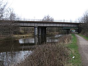
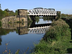
This bridge is near where the Sheffield Canal meets the river. It carries a railway line used only for freight, which opened in 1868. There are also two pipe bridges between this railway bridge and Jordan Bridge.
Jordan Bridge
This bridge, called "Jordan Bridge 21," used to carry a railway line. This railway connected the Blackburn Meadows Sewage Works to other parts of the plant. It was built in 1907. The eastern part has three brick arches. In 1922, a second bridge was built here for the railway to cross the river.
Holmes Lock Bridge
This bridge carries Steel Street, a small road. It still has railway tracks in its cobbled surface. These tracks were part of a network that served the Holmes Rolling Mills. The bridge also gave access to a crushing plant.
Midland Railway Bridges
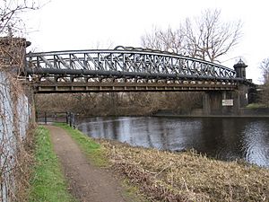
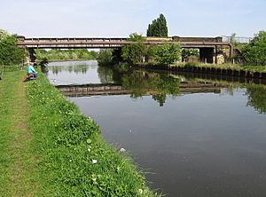
The western railway bridge was built in 1869 but is no longer used. The eastern bridge was built in 1840. It used to carry the main railway line from Derby to York. Now, it's only used for freight trains.
Lockhouse Bridge
Just east of Ickles Lock, this is actually two bridges. The western one carries Millmoor Lane, and the eastern one carries a freight-only railway line.
Centenary Way Bridge (South)
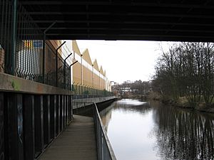
This bridge carries the Centenary Way dual carriageway over the navigation. This road (A630) is a main way to get into Rotherham from the M1 motorway. The towpath of the navigation, which is part of the Trans-Pennine Trail, goes under this bridge on a special walkway.
Corporation Bridge
This metal bridge carries Main Street over the navigation. Near this bridge, there used to be a wooden railway bridge that took trains into Westgate Station. It was taken down in 1952.
Rotherham Lock Footbridge
This footbridge lets people walk to the Court House from Forge Island. Forge Island used to be an iron works, but now it has a Tesco store. The River Don separates from the navigation above Forge Island.
Bridge Street Bridge (Chantry Bridge) and Rotherham Bridge
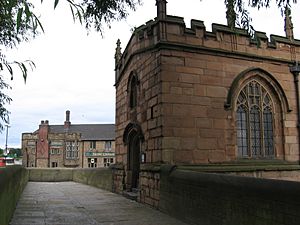
Bridge Street Bridge (Chantry Bridge) is a metal bridge that carries Bridge Street over the navigation. The street used to cross the river at Rotherham Bridge. Rotherham Bridge was built in 1483 and had four arches. It was widened in 1768. In 1930, a new bridge was built nearby. The old Rotherham Bridge was made smaller again, back to its original medieval width.
The chapel on Rotherham Bridge is very special. It's one of only three complete bridge chapels left in Britain! It was built around 1483. It was used as a chapel, then as homes, a prison, and even a shop. In 1924, it was made a chapel again, and its inside was restored in 1980.
Centenary Way Bridge (North)
This bridge also carries the Centenary Way dual carriageway over the navigation.
Greasbrough Road Bridge
Greasbrough Road is no longer a main road. Downstream of this bridge are three pipe bridges.
Rawmarsh Road Bridge
This bridge carries the A633 Rotherham Road. The A633 crosses the River Don at Grafton Bridge.
Eastwood Footbridge
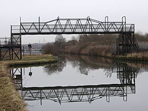
This footbridge connects the Eastwood area of Rotherham to the Parkgate Retail Park. When the Rotherham Cut was built in 1740, there was a swing bridge here. The current footbridge replaced it later.
Wash Lane Bridge
This bridge is near Aldwarke Weir and Aldwarke Lock. It was rebuilt in 1834. A newer, bigger road bridge (A6123) now crosses both the river and navigation. Wash Lane Bridge is now closed to people and cars.
Steelworks Access (Road) Bridge
This bridge provides access to two steelworks from the A630 road.
Don (Rail) Bridge
This bridge is part of the railway system within the two steelworks. It was built in 1901. It connected the Silverwood and Roundwood Collieries to wharfs on the Don Navigation.
Thrybergh (Rail) Bridge
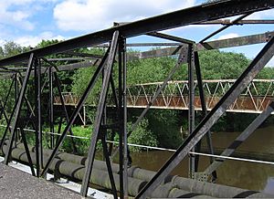
This bridge used to carry a railway line across the River Don. This line mainly served coal mines and didn't have regular passenger trains.
Bridges in Kilnhurst and Mexborough
Kilnhurst Station Road Bridge
This bridge carries the road to Hooton Roberts. The part over the navigation is new, but the part over the railway is original. "Station" in the name refers to Kilnhurst Central Station.
Kilnhurst Burton Ings Bridge
This bridge carries a service road over the Navigation and a railway. There used to be a large tar factory nearby, and this road likely connected it to other parts of the plant.
Swinton Talbot Road Bridge
This bridge connects the main road in Swinton (A6022) to an industrial area.
Mexborough Double Bridges
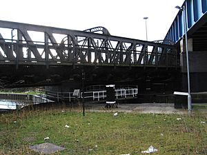
This is called "Double Bridges and Footbridge 49A." It carries a walkway and a double-track railway over the Navigation. This part of the navigation was tricky for large barges because the bridges are right next to a sharp bend.
Mexborough Station Road Bridge
This bridge carries the road that leads to Mexborough railway station.
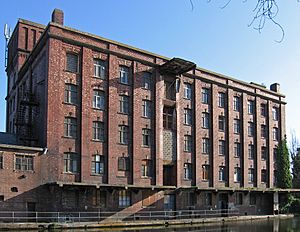
Mexborough BBCS Flour Mill
This large building and its wharf are on the north side of the Navigation. It started as the "Don Roller Mills" and was later owned by the Barnsley British Cooperative Society.
Bridges in Conisbrough and Warmsworth
Conisbrough Earth Centre Bridge
This bridge is called "Cadeby Colliery Bridge 57." It used to provide road access to Cadeby Colliery. From 1999 to 2004, it was the main entrance to the Earth Centre visitor attraction. Now, it's part of a public path.
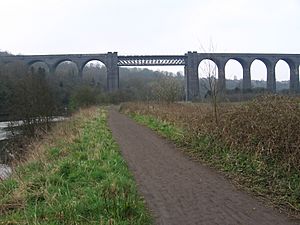
Conisbrough Viaduct
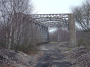
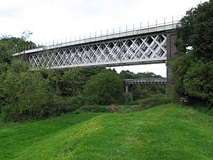
Conisbrough Viaduct was built in the early 1900s for the Dearne Valley Railway. This railway mainly served coal mines. The viaduct has 21 arches and is made of 12 million blue bricks. The central metal part is 150 feet long and crosses the Don 113 feet high. The viaduct was unused for many years until 2001. In 2008, it was opened as part of the National Cycle Network for cyclists.
Rainbow Bridge
Built in 1849, the Rainbow Bridge is still used today. It carries the railway line from Swinton to Doncaster.
Sprotbrough Bridge
Sprotbrough Bridge is actually two bridges that carry Mill Lane. The southern one crosses the weir stream, and the northern one crosses the lock cut. The first bridge was built in 1849. The southern bridge has three arches on each side. The northern bridge was replaced with a new metal bridge. A small toll house, where money was collected for crossing the bridge, still stands on the north bank.
A1 Don Viaduct
The A1 Don Viaduct carries the A1(M) motorway over the river. It opened in 1961. It has two separate structures, one for each direction of traffic. The longest part of the bridge crosses the river 70 feet high. This bridge was one of the first to use rubber bearings and a new way to waterproof the road surface.
Warmsworth Railway Viaducts
There are two railway viaducts at Warmsworth. The western one was finished in 1914 and was part of a railway line that served coal mines. It closed in 1958. For some years, it carried a conveyor belt over the Don. Now, it's part of the Trans-Pennine Trail. The eastern viaduct was completed in 1910 and still carries a freight-only railway line.
Bridges in Doncaster Town Area
Newtons Farm Footbridge
These are two bridges, one concrete and one wooden. They cross one of the two channels where the river leaves the navigation before Doncaster Town Lock.
Cheswold Hauling Bridge
This footbridge, also known as Cheswold High Bridge, is on the navigation towpath. It crosses the second channel where the river leaves the navigation. The small section of river between this bridge and where it rejoins the main River Don is called the River Cheswold.
North Bridge and St Marys Bridge
North Bridge Road crosses the railway and then the navigation at Doncaster Town Lock using North Bridge. It crosses the Don using St Mary's Bridge. North Bridge Road used to be part of the Great North Road. A new North Bridge was built in 2003.
Railway Bridges
Below North Bridge, six railway tracks cross the Don Navigation on three separate bridges. This area is called Marshgate Junction, where lines to Leeds, York, and Thorne split off.
Friars Gate Bridge
This bridge lets people cross the navigation from the center of Doncaster to businesses and car parks on the "island" between the river and navigation.
St George's Bridge
St George's Bridge is one of the newest bridges over the Don. It carries the dual carriageway New Bridge Road, which is now the main road north out of Doncaster. It opened in 2001 and was named after a public competition. It's a long steel bridge with parts crossing the River Don, the East Coast Main Line, and the Don Navigation.
Chappell Drive Bridge
This bridge allows access across the navigation from the center of Doncaster to businesses on the "island" between the river and navigation. It's near the Doncaster College campus. After this bridge, there's a gap of about 5 miles before the next public road crossing at Barnby Dun.
Bridges in Barnby Dun Area
Kirk Sandall Railway Bridge
This bridge carries the railway line from Doncaster to Hull over the Navigation. It has two parts, both with trusses above the deck. The older southern part is no longer used. The northern part carries both tracks of the railway. Another bridge to the west carries the railway over the River Don.
Kirk Sandall Pipe Bridge
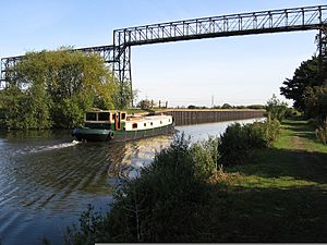
Here, the Navigation runs very close to the River Don. A pipe bridge high above both the Navigation and the River used to carry waste from a glass works. The glass works was a big employer in the area. It was built in the 1920s because it was close to the canal and railway, and had sandy land needed for glass making. The glass works closed in the 1990s.
Barnby Dun Lift Bridge
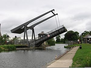
This bridge was built in 1983 to replace an older swing bridge. It's made of steel and uses electricity to lift. This replacement was part of a bigger project to upgrade the Navigation for 700-tonne Eurobarges. A control house was built for staff, but now boaters can also operate it. This bridge is very strong because it was designed to carry very heavy loads, like those going to the nearby Thorpe Marsh power station. Even though the power station is gone, the bridge is still busy with road traffic because it's one of the few crossings in the area.
Interesting Places Along the Way
| Point | Coordinates (Links to map resources) |
OS Grid Ref | Notes |
|---|---|---|---|
| Site of Turnbridge sluice | 53°41′51″N 0°59′07″W / 53.6974°N 0.9854°W | SE670228 | Where it met the River Aire |
| Newbridge | 53°40′26″N 0°59′27″W / 53.6738°N 0.9908°W | SE667201 | Where it met the Dutch River |
| Site of Stainforth Lock | 53°36′15″N 1°01′36″W / 53.6043°N 1.0266°W | SE645124 | Closed in 1939 |
| Start of New Junction Canal | 53°35′25″N 1°04′32″W / 53.5902°N 1.0755°W | SE612108 | Opened in 1905 |
| Doncaster Town lock | 53°31′33″N 1°08′28″W / 53.5259°N 1.1410°W | SE570035 | Below River Cheswold |
| Sprotbrough lock | 53°30′32″N 1°11′16″W / 53.5089°N 1.1879°W | SE539016 | |
| Mexborough low lock | 53°29′42″N 1°14′43″W / 53.4950°N 1.2452°W | SE501000 | Start of Kilnhurst cut |
| Eastwood lock | 53°26′37″N 1°20′16″W / 53.4436°N 1.3378°W | SK440943 | Start of Rotherham cut |
| Junction with Sheffield Canal | 53°25′06″N 1°23′57″W / 53.4183°N 1.3991°W | SK400914 | Halfpenny Bridge |
| Sheffield Basin | 53°23′05″N 1°27′32″W / 53.3847°N 1.4590°W | SK360876 | Opened in 1819 |
 | Lonnie Johnson |
 | Granville Woods |
 | Lewis Howard Latimer |
 | James West |


