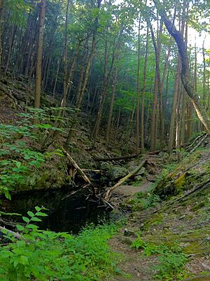
Green Fall River facts for kids
The Green Fall River is a cool river that flows through two states in the U.S.: Connecticut and Rhode Island. It's about 13 kilometers (or 8 miles) long, which is like walking for a couple of hours!
Where Does the River Start and Go?
The Green Fall River begins in a swampy area in a town called Voluntown, Connecticut. This is south of Rockville Road (also known as CT 138).
From there, the river flows straight south into a place called Green Fall Pond. After leaving the pond, it keeps flowing south through another town, North Stonington. Finally, it reaches Hopkinton, Rhode Island. Here, the Green Fall River meets up with another stream called Parmenter Brook. When these two waters join, they form a new river called the Ashaway River.
Roads That Cross the River
Many roads go over the Green Fall River as it flows along. Here are some of them, starting from where the river begins and moving downstream:
- In Voluntown, Connecticut:
- Sand Hill Road/Green Fall Road crosses the river just south of the Green Fall Pond Dam, close to the Rhode Island border.
- In North Stonington, Connecticut:
- Putker Road crosses the river.
- Clarks Falls Road (also known as CT 216) crosses the river two times!
Smaller Streams That Join In
The Green Fall River gets water from many smaller streams, called tributaries. Think of them as little helpers that add more water to the main river. Besides many tiny streams that don't have names, these brooks also feed into the Green Fall River:
- Peg Mill Brook
- Palmer Pond Brook
- Glade Brook
 | Ernest Everett Just |
 | Mary Jackson |
 | Emmett Chappelle |
 | Marie Maynard Daly |


