
Greenbelt (Ottawa) facts for kids
Quick facts for kids Greenbelt (Ottawa) |
|
|---|---|
 |
|

Map of Ottawa showing the Greenbelt surrounding the urban core
|
|
| Location | Eastern Ontario, Canada |
| Nearest city | Ottawa |
| Area | 203.5 km2 (78.6 sq mi) |
| Established | 1956 |
| Governing body | National Capital Commission |
The Greenbelt (which is called Ceinture de verdure in French) is a huge protected area of green space around Ottawa, Ontario, Canada. It covers about 203.5 square kilometers (78.6 square miles). This special area includes forests, farms, and wetlands. It stretches from Shirleys Bay in the west to Green's Creek in the east.
The National Capital Commission (NCC) owns and manages most of the Greenbelt. They look after about 149.5 square kilometers (57.7 square miles) of it. Other parts are owned by different government groups or private people. Building new homes or businesses inside the Greenbelt is very strictly controlled. This helps keep the area natural and open.
Contents
History of the Greenbelt
The idea for the Greenbelt came from a man named Jacques Gréber in 1950. He had a big plan for how Ottawa should grow. The Canadian government started buying land for the Greenbelt in 1956.
Why the Greenbelt Was Created
The main reasons for creating the Greenbelt were:
- To stop cities from spreading too much into the countryside. This is called urban sprawl.
- To create open spaces for farms, natural areas, and government buildings in the future.
- To make sure there was enough space for about 500,000 people to live comfortably. The inner edge of the Greenbelt was chosen based on where city services could easily reach.
Amazing Wildlife in the Greenbelt
The Greenbelt is a home for many different kinds of animals. It's a great place to see nature!

Mammals You Might See
- Bats
- Bears (American Black Bear)
- Beavers
- Coyotes
- Cottontail rabbits
- Fishers
- Muskrats
- Porcupines
- Raccoons
- Red foxes
- Red squirrels
- Snowshoe hares
- Skunks (Striped skunk)
- White-tailed deer
- Sometimes, even a moose!
Birds Flying High
- Barred owls
- Screech owls
- Great grey owls
- Canada geese
- Sandhill cranes
- Great blue herons
- Red-tailed hawks
- American kestrels
- Spruce grouse
- Woodcocks
- Blue jays
- Chickadees
Insects and More
- Walking sticks (Stick insect)
- Praying mantises (European mantis)
- Butterflies
Reptiles and Amphibians
- Common garter snakes
- Painted turtles
- Snapping turtles (Common snapping turtle)
Fun Places to Visit in the Greenbelt
The Greenbelt has many interesting spots to explore, from east to west.

- Green's Creek Conservation Area – This is a nature reserve with a small stream that flows into the Ottawa River. It has a beautiful clay valley. 45°28′00″N 75°34′35″W / 45.46667°N 75.57639°W
- Hornets Nest Soccer Fields – If you love soccer, this place has 11 outdoor fields. There's also a big dome for playing indoor soccer. 45°26′35″N 75°34′35″W / 45.44306°N 75.57639°W
- Pine View Golf Course – A large public golf course with 36 holes. 45°25′50″N 75°35′50″W / 45.43056°N 75.59722°W
- Mer Bleue Conservation Area – This is a huge peat bog, like a swampy area, covering 33 square kilometers. It has about 20 kilometers of walking trails, including a 1.2-kilometer boardwalk. You can see a special forest here, like those found much further north. Unique plants like black spruce, tamarack, bog rosemary, and blueberries grow here. The name "Mer Bleue" means "Blue Sea" in French, because of the blue fog that covers it on autumn mornings. 45°24′00″N 75°30′00″W / 45.40000°N 75.50000°W
- Pine Grove Forest – A 12 square kilometer forest where you can hike, watch wildlife, and learn about forestry. 45°21′30″N 75°36′00″W / 45.35833°N 75.60000°W
- Conroy Pit – This used to be a sand and gravel pit. Now, it's a popular park for dogs to run off-leash. In winter, it's a great spot for tobogganing. It has forest trails and open areas. 45°21′30″N 75°37′30″W / 45.35833°N 75.62500°W
- Hylands Golf Club – Another 36-hole public golf course. 45°19′00″N 75°38′35″W / 45.31667°N 75.64306°W
- Macdonald-Cartier International Airport – This is Ottawa's main airport, where planes take off and land for trips all over the world. 45°19′30″N 75°40′00″W / 45.32500°N 75.66667°W
- Agriculture Canada Research Farms – A large area where scientists study how to prevent and treat animal diseases. 45°19′08″N 75°45′12″W / 45.31889°N 75.75333°W
- The Log Farm – A farm from 1857 that has been restored. You can take guided tours to see what farm life was like long ago. 45°17′59″N 75°47′50″W / 45.29972°N 75.79722°W
- Bruce Pit – Like Conroy Pit, this was also a sand and gravel pit. Now, it's another popular off-leash dog park. It has trails for cross-country skiing and a toboggan hill. 45°19′30″N 75°48′00″W / 45.32500°N 75.80000°W
- Lime Kiln (Trail) – A trail that leads to the remains of an old 19th-century kiln, which was used to make lime. 45°17′13.7″N 75°48′48.8″W / 45.287139°N 75.813556°W
- Stony Swamp Conservation Area – A large wetland area, covering 20 square kilometers. It's the biggest forest in the Greenbelt and is great for hiking and outdoor fun. 45°18′00″N 75°50′20″W / 45.30000°N 75.83889°W
- Wesley Clover Parks – This place has facilities for horse riding and a public campground with many spots for tents and RVs. 45°20′22″N 75°51′10″W / 45.33944°N 75.85278°W and 45°19′50″N 75°52′00″W / 45.33056°N 75.86667°W
- The 19th Tee Driving Range – A place where you can practice hitting golf balls and play a fun 18-hole mini-golf course. 45°20′43″N 75°52′38″W / 45.34528°N 75.87722°W
- Connaught National Army Cadet Summer Training Centre – A training center for military and cadets. Private shooting groups also use it. 45°21′40″N 75°54′00″W / 45.36111°N 75.90000°W
- Shirleys Bay – An important wetland area on the Ottawa River. Many migratory birds and waterfowl live here, making it a perfect spot for bird watching. 45°23′00″N 75°55′00″W / 45.38333°N 75.91667°W
Images for kids
-
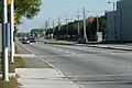
Hunt Club Road (2011)
-
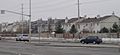
Barrhaven (2006)
-

Mer Bleue Bog boardwalk (2019)


.png)
See also
 In Spanish: Greenbelt (Ottawa) para niños
