
Grinzens facts for kids
Quick facts for kids
Grinzens
|
||
|---|---|---|
 |
||
|
||

Location in the district
|
||

Grinzens
Location in Austria
|
||
| Country | Austria | |
| State | Tyrol | |
| District | Innsbruck Land | |
| Area | ||
| • Total | 28.71 km2 (11.08 sq mi) | |
| Elevation | 945 m (3,100 ft) | |
| Time zone | UTC+1 (CET) | |
| • Summer (DST) | UTC+2 (CEST) | |
| Postal code |
6095
|
|
| Area code | 05234 | |
| Vehicle registration | IL | |
| Website | www.grinzens.tirol.gv.at | |

Grinzens is a small town, also called a municipality, in the Tyrol region of Austria. It's located in the Innsbruck-Land area. As of 2015, about 1,414 people lived there. Grinzens is found southwest of the big city of Innsbruck, sitting at an elevation of 945 meters (about 3,100 feet) above sea level.
Contents
How Many People Live Here?
Grinzens has grown quite a bit over the years! Here's a look at how its population has changed:
| Historical population | ||
|---|---|---|
| Year | Pop. | ±% |
| 1869 | 447 | — |
| 1880 | 471 | +5.4% |
| 1890 | 459 | −2.5% |
| 1900 | 479 | +4.4% |
| 1910 | 397 | −17.1% |
| 1923 | 409 | +3.0% |
| 1934 | 472 | +15.4% |
| 1939 | 492 | +4.2% |
| 1951 | 522 | +6.1% |
| 1961 | 629 | +20.5% |
| 1971 | 882 | +40.2% |
| 1981 | 1,095 | +24.1% |
| 1991 | 1,260 | +15.1% |
| 2001 | 1,280 | +1.6% |
| 2011 | 1,307 | +2.1% |
| 2015 | 1,414 | +8.2% |
Where is Grinzens Located?
Grinzens is nestled on a low mountain area southwest of Innsbruck. It sits right at the entrance to the beautiful Sellrain valley. Two rivers, the Melach and the Sendersbach, form the borders of the town.
How the Town is Spread Out
The town stretches out along a main road. This road connects Sellrain (including areas like Neder and Brandögg) to the western part of Axams (Moarhof and Bachl). In the center of Grinzens, this road splits into smaller, parallel streets.
The village has two main parts:
- Obergrinzens: This part is located higher up, above an area called the Anger.
- Untergrinzens: This part is lower down, near the village church.
Important Buildings in Grinzens
The heart of Grinzens has several key buildings. These include the main municipal building, which houses the elementary school, a kindergarten, and a crèche (a place for very young children). This building was made much bigger in 2013. You'll also find the village church and a multi-purpose building in the center.
The Senderstal Valley
The entire Senderstal valley, which leads south from Grinzens, is also part of the town's area. This valley reaches all the way to the impressive Kalkkögel mountains. Only about one-tenth of Grinzens' total area is suitable for people to live in all year round. This means that for the parts where people actually live, there are about 490 residents per square kilometer.
A Look at Grinzens' Past
Grinzens was first mentioned in official papers way back in 1288. At that time, it was called "Gratzinnes." The exact meaning of the town's name is very old and not completely clear today. It likely comes from an ancient word like Grinza or Grazinna. This name style is similar to other towns in the area, like Fritzens and Götzens, which have roots in a pre-Roman language.
Early Settlements and Farms
Around the year 1400, records from the Frauenchiemsee monastery show that there were nine farms in Grinzens. The Sender valley, which goes south from Grinzens, also started to be settled permanently around this time. In 1352, this valley was known as "perch in Senders" and was under the control of the Wilten monastery in Innsbruck. By the 16th century, these farms in the valley had become alpine pastures, used for grazing animals in the mountains.
Becoming an Independent Town
For a long time, until 1811, Grinzens was part of the nearby town of Axams. However, after the Tyrolean uprisings in 1809, when the region was occupied by Bavarian forces, Grinzens was made its own independent municipality. This meant it could govern itself. Later, in 1956, Grinzens also became its own parish, which means it got its own church and religious administration separate from other towns.
See also
 In Spanish: Grinzens para niños
Images for kids
-
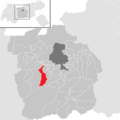
A map showing Grinzens within the Innsbruck-Land District.
