Guadalupe Mountains (Hidalgo County) facts for kids
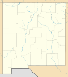
The Guadalupe Mountains of Hidalgo County (also called Sierra de Guadalupe in Spanish) are a small mountain range in the southwestern part of New Mexico. They are about 13 miles (21 kilometers) long. These mountains are right next to the border of Arizona. A tiny part of them even reaches into Arizona. The very southern tip of the mountains also touches the border of Sonora, a state in Mexico.
These mountains are connected to the southern end of a much larger mountain chain called the Peloncillo Mountains. The Peloncillo Mountains run from north to south along the Arizona border.
Quick facts for kids Guadaleupe Mountains |
|
|---|---|
| Highest point | |
| Peak | Guadalupe Mountain |
| Elevation | 6,450 ft (1,970 m) |
| Dimensions | |
| Length | 13 mi (21 km) N-S |
| Width | 9 mi (14 km) |
| Geography | |
| Country | United States |
| Settlements | Gray Ranch, Agua Prieta and Douglas |
| Range coordinates | 31°25′46″N 109°02′39″W / 31.4295°N 109.0442°W |
About the Guadalupe Mountains
The Guadalupe Mountains are a smaller part of a larger mountain system. They stretch about 13 miles (21 kilometers) from north to south. As you go further south, the mountains get narrower.
In the middle-west of the southern part of the range is a place called Guadalupe Canyon. A stream called Guadalupe Creek flows through this canyon, heading south. Then, the canyon turns west and opens up into Arizona.
The northern part of these mountains is home to their highest point, Guadalupe Mountain. This is where Guadalupe Creek starts. Other streams, like Cloverdale Creek, also begin in this northern area. Cloverdale Creek flows east from Guadalupe Mountain.
Highest Points in the Range
The tallest peak in the Guadalupe Mountains is called Guadalupe Mountain. It stands at 6,450 feet (1,966 meters) high. This peak is located in the north-central part of the range, slightly to the west.
South of Guadalupe Mountain, you'll find Guadalupe Spring. This spring is one of the sources for Guadalupe Creek and Guadalupe Canyon. To the east of the peak are the beginnings of Cloverdale Creek. This creek flows east towards the old ghost town site of Cloverdale.
Another important peak in the range is Bunk Robinson Peak. It is located in the central-west part of the mountains, right next to the Arizona border. Bunk Robinson Peak is 6,241 feet (1,902 meters) tall.
See also
 In Spanish: Sierra de Guadalupe (Nuevo México) para niños
 | Calvin Brent |
 | Walter T. Bailey |
 | Martha Cassell Thompson |
 | Alberta Jeannette Cassell |


