
Gualaceo facts for kids
Quick facts for kids
Gualaceo
|
||
|---|---|---|
|
City
|
||

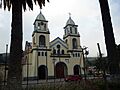
Gualaceo's Main Church
|
||
|
||
| Motto(s):
Justo Y Fuerte
|
||

Gualaceo
Location in Ecuador
|
||
| Country | Ecuador | |
| Province | Azuay | |
| Canton | Gualaceo | |
| Parish | Gualaceo | |
| Settled | 1534 | |
| Area | ||
| • City | 5.46 km2 (2.11 sq mi) | |
| Elevation | 2,330 m (7,640 ft) | |
| Population
(2022 census)
|
||
| • City | 13,843 | |
| • Density | 2,535.3/km2 (6,567/sq mi) | |
| Time zone | UTC-5 (GMT-5:00 (Quito, Bogota, Lima)) | |
| Website | www.gualaceo.gob.ec | |

Gualaceo is a vibrant city in the Azuay Province of Ecuador. It is often called “El Jardin del Azuay” (The Garden of Azuay). This nickname comes from its beautiful natural scenery and many different plants. Gualaceo is the main city of the Gualaceo Canton.
The city is about 35 kilometers (22 miles) east of Cuenca. It is one of the largest cities in the Azuay province. Gualaceo is located in the Sierra Region of Ecuador. It sits in the Santa Bárbara valley, about 2,330 meters (7,644 feet) above sea level. The climate is like a mountain valley, with an average temperature of 17 degrees Celsius (63 degrees Fahrenheit). Four rivers flow through Gualaceo: San Francisco, Santa Bárbara, Guaymincay, and San José. These rivers are all part of the Santiago river system.
Contents
History of Gualaceo
Early History: Before the Incas Arrived
Long ago, the area where Gualaceo is now was an important center for the Cañari people. It was part of a large Cañari kingdom called Hatun Cañar - Shabalula. This means it was a significant place for their leaders and culture.
The Arrival of the Spanish in Gualaceo
In April 1534, a Cañari leader named Llivicura helped Spanish explorers find their way to Gualaceo. These explorers included Sebastián de Benalcázar and others. They were looking for new lands in what was then called the Governorate of Nueva Castilla.
The Spanish set up a mining camp near a river they named Santa Bárbola. This river is now known as the Santa Bárbara River. They were interested in finding valuable minerals in the area.
Gualaceo During the Spanish Colonial Period
After 1547, a priest named Gómez de Tapia became the chaplain for the miners in the settlement. He helped the community grow. In the same year, Antonio de la Gama was made Governor and judge for the local people.
In 1557, Don Gil Ramírez Dávalos came to the mining town. He had orders from the Viceroy, Andrés Hurtado de Mendoza, to start a new city. So, on April 12, 1557, Captain Rodrigo Núñez de Bonilla, Gil Ramírez Dávalos, Father Gómez de Tapia, and 19 settlers left the mining town. Guided by chief Llivicura, they traveled to the Paucarbamba valley. There, they founded the city of Cuenca.
After Cuenca was founded, the mining settlement by the Santa Bárbara River lost its Spanish name, "Santa Ana de los Ríos." Instead, it began to be known by a Cañari name, which eventually became Gualaceo.
Climate and Weather in Gualaceo
Gualaceo has a mild climate, which means the weather is generally pleasant. It doesn't get too hot or too cold. This is because of its location in the Andes mountains. The average temperature is around 17 degrees Celsius (63 degrees Fahrenheit).
The city gets a good amount of rain throughout the year, especially from January to April. This rainfall helps keep the natural landscapes green and beautiful, which is why Gualaceo is called "The Garden of Azuay."
| Climate data for Gualaceo/Paute, elevation 2,280 m (7,480 ft), (1961–1990) | |||||||||||||
|---|---|---|---|---|---|---|---|---|---|---|---|---|---|
| Month | Jan | Feb | Mar | Apr | May | Jun | Jul | Aug | Sep | Oct | Nov | Dec | Year |
| Mean daily maximum °C (°F) | 24.3 (75.7) |
24.3 (75.7) |
24.2 (75.6) |
24.0 (75.2) |
24.0 (75.2) |
23.3 (73.9) |
22.6 (72.7) |
22.7 (72.9) |
23.0 (73.4) |
24.1 (75.4) |
24.7 (76.5) |
24.8 (76.6) |
23.8 (74.9) |
| Daily mean °C (°F) | 17.7 (63.9) |
17.7 (63.9) |
17.6 (63.7) |
17.5 (63.5) |
17.3 (63.1) |
16.7 (62.1) |
16.1 (61.0) |
16.2 (61.2) |
16.6 (61.9) |
17.5 (63.5) |
17.8 (64.0) |
17.8 (64.0) |
17.2 (63.0) |
| Mean daily minimum °C (°F) | 11.1 (52.0) |
11.1 (52.0) |
11.1 (52.0) |
11.1 (52.0) |
11.0 (51.8) |
10.5 (50.9) |
10.0 (50.0) |
10.0 (50.0) |
10.3 (50.5) |
10.6 (51.1) |
10.6 (51.1) |
11.0 (51.8) |
10.7 (51.3) |
| Average precipitation mm (inches) | 48.0 (1.89) |
63.0 (2.48) |
88.0 (3.46) |
85.0 (3.35) |
48.0 (1.89) |
61.0 (2.40) |
49.0 (1.93) |
38.0 (1.50) |
50.0 (1.97) |
65.0 (2.56) |
71.0 (2.80) |
62.0 (2.44) |
728 (28.67) |
| Source: FAO | |||||||||||||
Images for kids
-
Gualaceo's Main Church
-

Flag of Gualaceo Canton
See also
 In Spanish: Gualaceo para niños
