Guelma Province facts for kids
Quick facts for kids
Guelma Province
ولاية قالمة
|
|
|---|---|

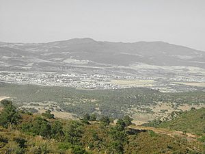
Guelma Valley as seen from Ben Djerrah, partially showing the metropolitan area of Guelma with the cities of Boumahra Ahmed, Belkheir, and Guelma visible (from right to left/east to west)
|
|

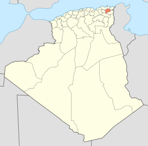
Map of Algeria highlighting Guelma
|
|
| Country | |
| Capital | Guelma |
| Area | |
| • Total | 4,101 km2 (1,583 sq mi) |
| Population
(2008)
|
|
| • Total | 482,261 |
| • Density | 117.596/km2 (304.57/sq mi) |
| Time zone | UTC+01 (CET) |
| Area Code | +213 (0) 37 |
| ISO 3166 code | DZ-24 |
| Districts | 10 |
| Municipalities | 34 |
Guelma Province is a special area in eastern Algeria, a country in North Africa. It is like a state or region within Algeria. The province gets its name from its biggest city, Guelma.
About 482,261 people lived here in 2008. This makes it a lively place with many towns and villages. The province covers an area of about 4,101 square kilometers (1,583 square miles).
Exploring Guelma Province
Guelma Province is known for its beautiful landscapes. It has green valleys and hills. The climate is usually warm, which helps plants grow well. Many people visit the province to see its natural beauty.
How Guelma Province is Organized
Like many other provinces in Algeria, Guelma is divided into smaller parts. These parts help with local government and services. It makes it easier to manage the different towns and villages.
Districts and Communes
Guelma Province has 10 main areas called districts. Each district then has smaller towns or groups of villages called communes or municipalities. There are 34 communes in total across the province.
These divisions help local leaders serve the people. They make sure that schools, hospitals, and other important services are available.
- Aïn Makhlouf
- Bouchegouf
- Guelaât Bou Sbaâ
- Guelma
- Hammam Debagh
- Hammam N'Bails
- Héliopolis
- Houari Boumédienne
- Khezaras
- Oued Zenati
See also
- In Spanish: Provincia de Guelma para niños
 | Selma Burke |
 | Pauline Powell Burns |
 | Frederick J. Brown |
 | Robert Blackburn |

