Guion, Indiana facts for kids
Quick facts for kids
Guion, Indiana
|
|
|---|---|

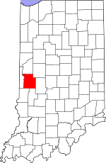
Parke County's location in Indiana
|
|
| Country | United States |
| State | Indiana |
| County | Parke |
| Township | Greene |
| Elevation | 656 ft (200 m) |
| Time zone | UTC-5 (Eastern (EST)) |
| • Summer (DST) | UTC-4 (EDT) |
| ZIP code |
47872 (Post Office: Rockville)
|
| Area code(s) | 765 |
| GNIS feature ID | 435552 |
Guion is a small, unincorporated community in Parke County, Indiana, in the United States. This means it's a place where people live, but it doesn't have its own local government like a city or town.
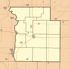
Guion is also known by other names, like Bruens Crossroads, Bruins, or Cross Roads. You can find it near where two roads, Indiana State Road 59 and Indiana State Road 236, meet. It's located within Greene Township, which is a smaller area inside Parke County.
History of Guion
Guion was officially planned out in 1882. When a place is "platted," it means someone drew a map to divide the land into smaller pieces, or lots, for buildings and streets.
The community got its name from William Howe Guion. He was a "railroad promoter," which means he helped organize and build railroads. Railroads were very important for travel and trade back then.
A post office, where people could send and receive mail, opened in Guion in 1878. It served the community for many years until it closed down in 1943.
Geography of Guion
Guion is located at specific coordinates: 39°50′34″N 87°06′41″W / 39.84278°N 87.11139°W. These numbers help pinpoint its exact spot on a map.
The community sits at an "elevation" of 656 feet. This means it is 656 feet above sea level. Knowing the elevation helps us understand how high up a place is compared to the ocean.
 | DeHart Hubbard |
 | Wilma Rudolph |
 | Jesse Owens |
 | Jackie Joyner-Kersee |
 | Major Taylor |


