Rockville, Indiana facts for kids
Quick facts for kids
Rockville, Indiana
|
|
|---|---|
|
Town
|
|
 |
|
| Nickname(s):
Covered Bridge Capital of the World
|
|

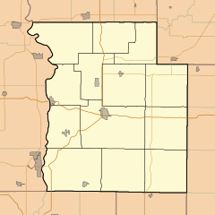
Location of Rockville in Parke County, Indiana.
|
|
| Country | |
| State | |
| County | Parke |
| Township | Adams |
| Founded | 1824 |
| Incorporated | 1854 |
| Area | |
| • Total | 1.49 sq mi (3.87 km2) |
| • Land | 1.49 sq mi (3.87 km2) |
| • Water | 0.00 sq mi (0.00 km2) 0% |
| Elevation | 692 ft (211 m) |
| Population
(2020)
|
|
| • Total | 2,510 |
| • Density | 1,682.31/sq mi (649.35/km2) |
| Time zone | UTC-5 (EST) |
| • Summer (DST) | UTC-4 (EDT) |
| ZIP code |
47872
|
| Area code(s) | 765 |
| FIPS code | 18-65520 |
| GNIS feature ID | 2396886 |
| Website | https://www.rockville-in.gov |
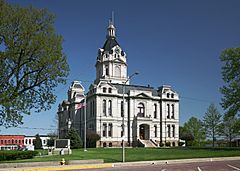
Rockville is a town located in Parke County, Indiana, in the U.S. state of Indiana. It is the main town, also called the county seat, of Parke County. Rockville is famous for being "The Covered Bridge Capital of the World." In 2020, about 2,510 people lived there.
Contents
History of Rockville
Rockville was first planned out in 1824. This was three years after Parke County was created. It quickly became the main town for the county. By 1825, between 500 and 600 people lived in Rockville. The town officially became an incorporated town in July 1854. This means its residents voted to form a local government.
Two important places in Rockville are listed on the National Register of Historic Places. These are the Rockville Chautauqua Pavilion and the Rockville Historic District. These places are protected because of their historical importance.
On June 17, 2021, a small earthquake happened in Rockville. It measured 3.8 on the moment magnitude scale. The USGS (United States Geological Survey) confirmed this event. People in nearby cities in Indiana and Illinois felt smaller shakes afterward.
Geography and Location
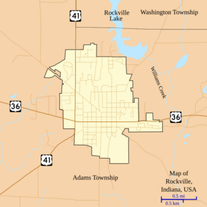
Rockville is found where two major roads meet. These are U.S. Route 36 and U.S. Route 41. It is about 30 miles (48 km) southwest of Crawfordsville.
The town covers a total area of about 1.49 square miles (3.87 square kilometers). All of this area is land.
Rockville's Climate
The weather in Rockville has hot and humid summers. Winters are usually mild to cool. This type of weather is called a humid subtropical climate. On climate maps, it is shown as "Cfa."
Population and People
| Historical population | |||
|---|---|---|---|
| Census | Pop. | %± | |
| 1850 | 726 | — | |
| 1860 | 728 | 0.3% | |
| 1870 | 1,187 | 63.0% | |
| 1880 | 1,684 | 41.9% | |
| 1890 | 1,689 | 0.3% | |
| 1900 | 2,045 | 21.1% | |
| 1910 | 1,943 | −5.0% | |
| 1920 | 1,908 | −1.8% | |
| 1930 | 1,832 | −4.0% | |
| 1940 | 2,208 | 20.5% | |
| 1950 | 2,467 | 11.7% | |
| 1960 | 2,756 | 11.7% | |
| 1970 | 2,820 | 2.3% | |
| 1980 | 2,785 | −1.2% | |
| 1990 | 2,706 | −2.8% | |
| 2000 | 2,765 | 2.2% | |
| 2010 | 2,607 | −5.7% | |
| 2020 | 2,510 | −3.7% | |
| U.S. Decennial Census | |||
How Many People Live Here?
In 2010, there were 2,607 people living in Rockville. They lived in 1,212 households. A household is a group of people living in one home. About 679 of these households were families.
Most of the people in Rockville were White (98.7%). A small number were from other racial groups. About 0.7% of the population was Hispanic or Latino.
The average age of people in Rockville was 44.8 years old. About 20.9% of residents were under 18 years old. Also, 22.3% were 65 years old or older. Slightly more than half of the residents were female (53.2%).
Education in Rockville
The town has a public library for its residents. It is called the Rockville Public Library. People can borrow books and other materials from this library.
Arts and Culture
Rockville is well-known for hosting the Parke County Covered Bridge Festival. This festival celebrates the many historic covered bridges in the area. It attracts many visitors each year.
Notable People from Rockville
Many interesting people have come from Rockville, Indiana.
- Mark L. De Motte - He was a Representative in the United States Congress.
- Morris K. Jessup - He was a writer known for his ideas about UFOs.
- Don Lash - He was a long-distance runner and also worked for the Federal Bureau of Investigation.
- J. Howard Moore - He was a zoologist, philosopher, and educator.
- Joseph A. Wright - He served as a former Governor of Indiana.
See also
 In Spanish: Rockville (Indiana) para niños
 | Bayard Rustin |
 | Jeannette Carter |
 | Jeremiah A. Brown |


