Héry, Yonne facts for kids
Quick facts for kids
Héry
|
|
|---|---|
| Country | France |
| Region | Bourgogne-Franche-Comté |
| Department | Yonne |
| Arrondissement | Auxerre |
| Canton | Seignelay |
| Area
1
|
21.19 km2 (8.18 sq mi) |
| Population
(2006)
|
1,921 |
| • Density | 90.66/km2 (234.80/sq mi) |
| Time zone | UTC+01:00 (CET) |
| • Summer (DST) | UTC+02:00 (CEST) |
| INSEE/Postal code |
89201 /89550
|
| Elevation | 94–192 m (308–630 ft) |
| 1 French Land Register data, which excludes lakes, ponds, glaciers > 1 km2 (0.386 sq mi or 247 acres) and river estuaries. | |
Héry is a commune, which is like a small town or village, located in the center of France. It is found in the Yonne department, which is a region known for its lovely landscapes and history. Héry is a quiet place where people live and work, enjoying the French countryside.
Contents
What is a Commune?
A commune is the smallest administrative area in France. Think of it as a local government area, similar to a town or a civil parish. Each commune has its own mayor and local council. These councils help manage local services for the people living there. Héry is one of many communes that make up the Yonne department.
Where is Héry Located?
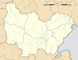
Héry is situated in the northern part of the Bourgogne-Franche-Comté region. It is part of the Auxerre arrondissement and the Seignelay canton. This means it's part of a larger administrative area that helps organize services and government. The commune is surrounded by green fields and small forests.
Population and Size
According to the 2006 census, Héry had a population of 1,921 people. This makes it a relatively small community. The total area of the commune is about 21.19 square kilometers (which is about 8.18 square miles). This size allows for both residential areas and open spaces.
Life in Héry
Life in Héry is typical of many small French communes. Residents enjoy a peaceful environment away from big cities. The local government works to provide essential services for the community. These services might include maintaining roads, managing local schools, and organizing community events. The mayor is the head of the commune and helps make decisions for the local people.
Geography and Landscape
The land in Héry varies in elevation. The lowest point is 94 meters (about 308 feet) above sea level. The highest point reaches 192 meters (about 630 feet). This difference in height creates a gently rolling landscape. The area is mostly rural, with farms and natural spaces. This makes it a nice place for outdoor activities like walking or cycling.
See also
 In Spanish: Héry (Yonne) para niños


