HMS Merlin (1666) facts for kids
Quick facts for kids History |
|
|---|---|
| Name | HMS Merlin |
| Builder | Shish, Rotherhithe |
| Launched | 1666 |
| Fate | Sold 30 August 1698 |
| General characteristics | |
| Class and type | 8-gun yacht |
| Tons burthen | 109 (bm) |
| Armament | 8 guns |
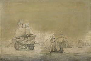
HMS Merlin was a special type of ship called an 8-gun yacht in the Royal Navy. It was launched in 1666. This ship is most famous for being part of an event that helped start the Third Anglo-Dutch War (1672-1674).
Contents
A Royal Yacht's Role
HMS Merlin was not a large warship. It was a yacht, often used for important people or special missions. It had 8 guns for defense.
The Flag Incident of 1671
In August 1671, an important event happened involving the Merlin. Lord Arlington, a key English official, ordered the Merlin to sail past Dutch ships. On board was Dorothy Osborne, the wife of the English ambassador.
When the Merlin passed Dutch ships near Brill, the Dutch ships lowered their flag. This was a sign of respect, as agreed in a treaty. However, they did not fire white smoke. Firing white smoke was another courtesy given to warships. The Dutch commander, Van Ghent, later said he wasn't sure if the Merlin counted as a warship. He didn't want to set a new rule for smaller ships.
Diplomatic Trouble
The English ambassador in The Hague, Sir George Downing, was told to demand action. He had to insist that those responsible for this "insult" be punished. However, the Dutch government, called the States General of the Netherlands, refused.
This incident was used by England as an excuse to start a war. It was meant to make the public support the war. But many people saw it as a made-up reason, and it didn't work as planned.
Mapping the Coastline
HMS Merlin had another very important job later in its life. Between 1681 and 1693, Captain Greenville Collins used the Merlin to map the entire British coastline. This was a huge project!
Great Britain's Coasting Pilot
The detailed maps and information gathered by Captain Collins were published in 1693. The book was called Great Britain's Coasting Pilot. This made HMS Merlin the first British warship used specifically for marine survey work. This means it was used to explore and map the seas and coastlines, not just for fighting.
The maps in Great Britain's Coasting Pilot were a big step forward. Even though they used some older Dutch maps and had a few errors, they were much better than anything before. Captain Collins is now known as one of the best English hydrographers. A hydrographer is someone who studies and maps bodies of water.
 | Tommie Smith |
 | Simone Manuel |
 | Shani Davis |
 | Simone Biles |
 | Alice Coachman |


