Halket Loch facts for kids
Quick facts for kids Halket Loch |
|
|---|---|

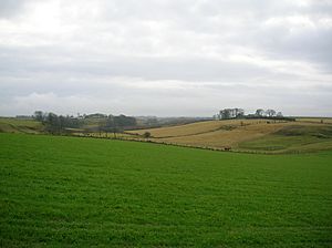
The site of Halket Loch
|
|
| Lua error in Module:Location_map at line 420: attempt to index field 'wikibase' (a nil value). | |
| Location | Lugton, East Ayrshire, Scotland |
| Type | Drained freshwater loch |
| Primary inflows | Rainfall and runoff |
| Primary outflows | Glazert Water |
| Basin countries | Scotland |
| Surface area | 40,000 square metres (9.9 acres) |
| Settlements | Lugton |
Halket Loch, also called Halkhead or Halketh, was a natural freshwater loch (a Scottish word for lake) located in East Ayrshire, Scotland. It was near the village of Lugton. Today, you can still see where it was as a dip in the ground, sometimes with a bit of water, surrounded by farms. This loch formed naturally in a hollow left behind by glaciers long ago. Its waters flowed out into the Glazert Water, which then joined the Annick Water.
Contents
History of Halket Loch
The Halket Loch and the land around it have a long history. Records show that in 1634, a man named Gabriel Porterfield and his wife Jean Maxwell had the right to use the land and the loch. Later, in 1648, their son John Porterfield owned it, and then his brother Alexander took over in 1653.
The loch and its lands eventually became part of the Barony of Robertland. This was officially recorded in 1676. Old maps also show the loch. For example, Blaeu's map from 1654, which was based on earlier work from the late 1500s, clearly shows 'Halkhead Loch' with a property nearby called Halkhead.
Another map from 1832 by Thomson called the loch 'Hawkhead'. There's a farm nearby called Lochridgehills, which means "hills by the loch ridge," showing how close it was to the old Halket Loch.
Why the Loch Was Drained
Farmers in the area had a problem: their crops often got mildew, a type of fungus. This was one of the main reasons why the loch was drained. The loch was mostly drained in either 1815 or 1830.
Even though the loch was drained, the Glazert Water was still marked on Thomson's map of 1828. By the mid-1800s, when the first Ordnance Survey maps were made, the outflow from the loch had been turned into a canal. This was likely part of the drainage work.
The cost of draining the loch was shared by the landowners nearby. The result was an "excellent meadow" where the loch used to be. More drainage work might have happened later. This could have been to provide jobs for Irish workers during the potato famines in the mid-1800s. Many drainage projects also took place after World War I, when soldiers returned home and needed work.
Craighead Law Hill
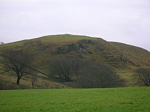
Craighead Law, also called Craighead Lea, is a hill that stands about 687 feet (209 meters) high. People believe it was once a Moot hill. A moot hill was a special place where local barons (important landowners in feudal times) would hold courts or meetings to make decisions and settle disputes.
There are stones on the top of Craighead Law that look like they were placed there on purpose. You can also see a grassy mound, which is likely a cairn (a pile of stones). A farmer from East Halket once moved one of these stones to make it easier to plough his field.
One stone on the summit has a deep hole, about four feet (1.2 meters) deep. This hole was probably used to hold a flagpole, similar to how a flagpole was set up at the Borestone near Beith. Another court hill is located near Aiket Castle. Some historians think Craighead Law was not only a moot hill but also a fort.
Interesting Facts About Halket
In April 1586, the 4th Earl of Eglinton was murdered in Stewarton. In one story about this event, it mentions that the horsemen rode past the Halket Loch. This suggests that the loch was quite large in the 1580s.
On the lands of East Halket, there used to be a tall standing stone, about 4 feet 6 inches (1.37 meters) high. It was made of a type of rock called highland grit. This stone was removed around 1905.
The surname Halket comes from the lands of Halkhead in Renfrewshire. However, a family named de Ross owned the property for a long time. The name of the place might have originally been Hawkwood. The first person recorded with a similar name was Sir Henry Hakette in 1230. Over time, the name Halkhead has been spelled in many different ways, including Halkit, Halkhet, Halkette, Haket, Hacet, Hacat, Hakkett, Holkat, Halkhaide, Halkheid, and Halkheide.
In 1896, a new road called Halket Road was built. It was about 7 furlongs (1.4 kilometers) long and connected the Duniflat and Bradlie Roads.
 | Janet Taylor Pickett |
 | Synthia Saint James |
 | Howardena Pindell |
 | Faith Ringgold |


