
Hampton Park Terrace facts for kids
Quick facts for kids |
|
|
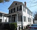
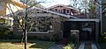
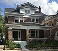
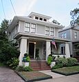
Hampton Park Terrace Historic District
|
|

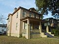
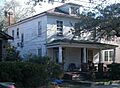
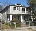
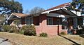
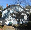
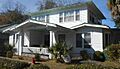
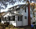
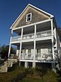
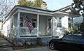
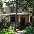
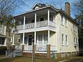
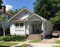
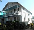
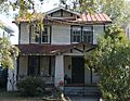
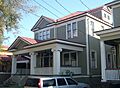
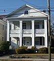
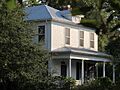
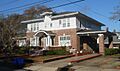
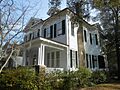
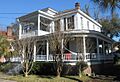
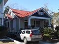
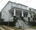
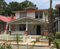
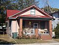
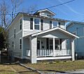
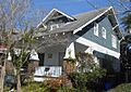
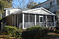
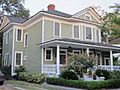
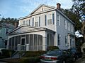
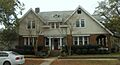
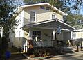
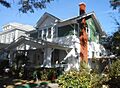
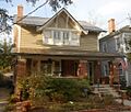
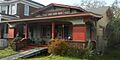
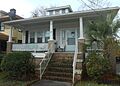
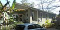
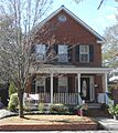
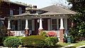
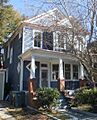
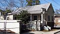
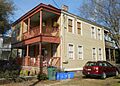
Houses along Huger St. produce a consistent streetscape.
|
|

Location in South Carolina

Location in the United States
|
|
| Location | Roughly bounded by Hagood, and Rutledge Aves., and Moultrie, and Congress Sts., Charleston, South Carolina |
|---|---|
| Area | 31 acres (13 ha) |
| Built | 1912 |
| Architectural style | Late 19th And Early 20th Century American Movements, Late 19th And 20th Century Revivals |
| NRHP reference No. | 97001186 |
| Added to NRHP | September 26, 1997 |

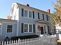
Hampton Park Terrace is a special place in Charleston, South Carolina. It's both a neighborhood where people live and a historic district. A historic district is an area recognized for its important old buildings.
The neighborhood is located on a peninsula. It's bordered by The Citadel (a military college) to the west. To the north is Hampton Park. Rutledge Avenue is to the east, and Congress Street is to the south.
Contents
History of Hampton Park Terrace
This area was mostly open land until about 1900. Around that time, some streets started to appear in the northern part of Charleston. A few small houses were built, but most of the land was still empty.
In 1912, big plans were made for three large parts of the neighborhood. These areas were developed by different companies. The Charleston Building & Investment Co. worked on one part. Hampton Park Terrace Inc. developed another. The Allan family developed the third section. The last part of the neighborhood was built up slowly through the 1930s.

At first, some people thought this new development would not be popular. It was on the very edge of Charleston's developed areas. But they were wrong! Within just one month, over 100 of the 251 lots were sold.
The area was near farms, but it had great benefits. It was close to the Ashley River and Hampton Park. A newspaper at the time said it was a perfect spot for homes. It was quiet, away from city noise, and had fresh breezes from the river. It was also high and dry, and close to good schools. People started to prefer living in this "suburban" area.
In March 2012, the residents of Hampton Park Terrace celebrated the neighborhood's 100th birthday. The celebration included music from The Citadel's band. They also revealed a special state historical marker.
Why is it a National Historic Place?
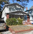
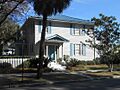
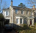
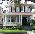
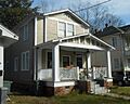
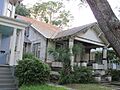
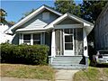
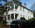
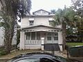
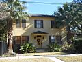
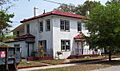
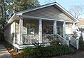
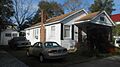
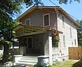
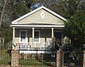
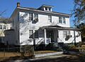
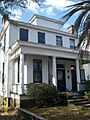
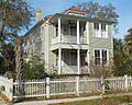
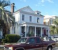
Most of the houses in Hampton Park Terrace were built between 1912 and 1925. The style of these houses was new for Charleston. It was different from the older, traditional buildings in other parts of the city.
Because it has so many well-preserved buildings from the early 1900s, the neighborhood was added to the National Register of Historic Places on September 26, 1997. The National Register is a list of places important to American history. Being on this list helps protect the historic character of the area.
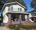
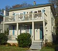
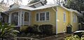
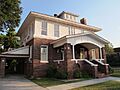
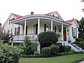
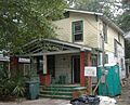
After the area became a historic district, many houses were restored. One house at 463 Huger Street even won an award for its excellent restoration! In 2009, the Preservation Society of Charleston held a special tour. They showed off the beautiful historic houses in Hampton Park Terrace.
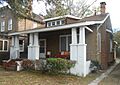
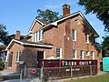
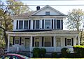
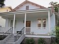
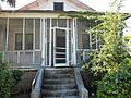
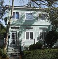
Streets in the Historic District
The Hampton Park Terrace National Register district includes historic buildings on these streets:
- Ashley Ave. (north of Congress St. to Huger St.)
- Congress St. (west of Rutledge Ave. to President St. (north side) and west of President St. (both sides))
- Elmwood Ave. (all)
- Glenwood Ave. (all)
- Hagood Ave. (north of Congress St. to Moultrie St. (east side))
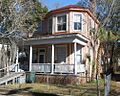
- Huger St. (west of Rutledge Ave. to Ashley Ave. (south side) and west of Ashley Ave. (both sides))
- Kenilworth Ave. (all)
- Moultrie St. (west of Ashley Ave.)
- North Allan Park (all)
- Parkwood Ave. (all)
- President St. (north of Sumter St. to Congress St. (west side) and north of Congress St. (both sides))
- Rutledge Ave. (north of Congress St. to Huger St. (west side))
- South Allan Park (all)
- Sumter St. (west of President St. (north side))
- Sutherland Ave. (all)
- Sutherland Ct. (all)
- Wesson Ave. (all)
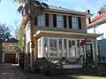
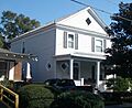
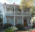
Images for kids
-
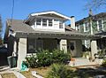
357 Ashley Ave. (1921)
-
360 Ashley Ave. (1919)
-
361 Ashley Ave. (1919) - Non-contributing
-
362 Ashley Ave. (1919)
-
364 Ashley Ave. (1922)
-
366 Ashley Ave. (1919)
-
368 Ashley Ave. (1920)
-
369 Ashley Ave. (1919)
-
176 Congress St. (1919)
-
180 Congress St. (1919)
-
182 Congress St. (1920)
-
184 Congress St. (1920)
-
188 Congress St. (1921)
-
204 Congress St. (1922)
-
212 Congress St. (1921)
-
216 Congress St. (1921)
-
216 Congress St. in 2007, before painting
-
218 Congress St. (1917)
-
220 Congress St. (1917)
-
230 Congress St. (1920)
-
232 Congress St. (1920)
-
236 Congress St. (1920)
-
238 Congress St. (1920)
-
247 Congress St. (1930) - Non-contributing
-
248 Congress St. (1919)
-
251 Congress St. (1936)
-
252 Congress St. (1931)
-
253 Congress St. (1930)
-
254 Congress St. (1931)
-
254 Congress St. in 2007
-
255 Congress St. (1925)
-
257 Congress St. (1926)
-
258 Congress St. (1921)
-
270 Congress St. (1915)
-
274 Congress St. (1920)
-
276 Congress St. (1919)
-
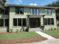
278 Congress St. (2009) - Non-contributing
-
286 Congress St. (1915)
-
288 Congress St. (1915)
-
292 Congress St. (1922)
-
294 Congress St. (1915)
-
296 Congress St. (1931)
-
304 Congress St. (1919)
-
306 Congress St. (1916)
-
310 Congress St. (1920)
-
312 Congress St. (1920)
-
314 Congress St. (1923)
-
1 Elmwood Ave. (1920) - Non-contributing
-
2 Elmwood Ave. (1916)
-
3 Elmwood Ave. (1915)
-
4 Elmwood Ave. (1920)
-
5 Elmwood Ave. (1916)
-
6 Elmwood Ave. (1914)
-
6 Elmwood Ave. in 2011, before restoration
-
7 Elmwood Ave. (1917)
-
8 Elmwood Ave. (1917)
-
9 Elmwood Ave. (1915)
-
10 Elmwood Ave. (1917)
-
13 Elmwood Ave. (1916) - Non-contributing
-
16 Elmwood Ave. (1915)
-
18 Elmwood Ave. (1922)
-
1 Glenwood Ave. (1919)
-
3 Glenwood Ave. (1917)
-
4 Glenwood Ave. (1921)
-
5 Glenwood Ave. (1916)
-
7 Glenwood Ave. (1919)
-
9 Glenwood Ave. (1916)
-
74 Hagood Ave. (1938)
-
76 Hagood Ave. (1922) - Non-contributing
-
78 Hagood Ave. (1922)
-
80 Hagood Ave. (1917)
-
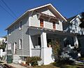
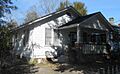
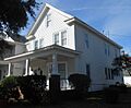
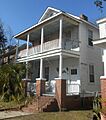
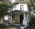
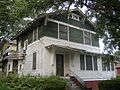
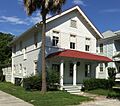
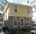
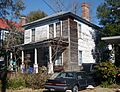
429 Huger St. (1913)
-
439 Huger St. (1922)
-
441 Huger St. (1914)
-
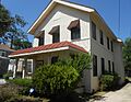
443 Huger St. (1913)
-
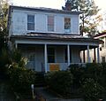
443 Huger St. in 2012, before restoration
-
447 Huger St. (1921)
-
451 Huger St. (1920)
-
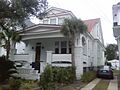
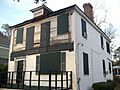
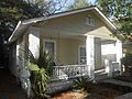
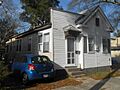
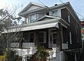
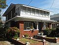
460 Huger St. (1912)
-
462 Huger St. (1912)
-
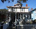
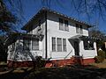
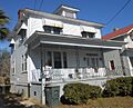
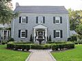
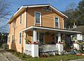
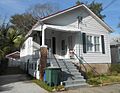
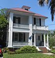
463 Huger St. (1921)
-
463 Huger St. in 2003
-
464 Huger St. (1923)
-
468 Huger St. (1914)
-
470 Huger St. (1917) - Non-contributing
-
471 Huger St. (1938)
-
472 Huger St. (1951) - Non-contributing
-
473 Huger St. (1920)
-
475 Huger St. (1919)
-
477 Huger St. (1915)
-
478 Huger St. (1937)
-
489 Huger St. (1920)
-
490 Huger St. (1914-1917) - Non-contributing
-
491 Huger St. (1920)
-
493 Huger St. (1917)
-
494 Huger St. (1918)
-
496 Huger St. (1915)
-
497 Huger St. (1915)
-
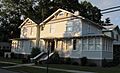
500 Huger St. (1914)
-
501 Huger St. (1914)
-
507 Huger St. (1914)
-
512 Huger St. (1912)
-
513 Huger St. (1914)
-
515 Huger St. (1916)
-
517 Huger St. (1914)
-
518 Huger St. (1912)
-
530 Huger St. (1916)
-
531 Huger St. (1921)
-
532 Huger St. (1919)
-
532 Huger St. in 2006
-
533 Huger St. (1914)
-
535 Huger St. (1939)
-
541 Huger St. (1921) - Non-contributing
-
542 Huger St. (1919)
-
545 Huger St. (1915)
-
549 Huger St. (1929)
-
548 Huger St. (1922)
-
550 Huger St. (1921)
-
551 Huger St. (1919)
-
554 Huger St. (1921)
-
555 Huger St. (1916)
-
565 Huger St. (1922)
-
567 Huger St. (1922) - Non-contributing
-
573 Huger St. (1919)
-
1 Kenilworth Ave. (1920) - Non-contributing
-
3 Kenilworth Ave. (1916)
-
4 Kenilworth Ave. (1916)
-
5 Kenilworth Ave. (1917)
-
6 Kenilworth Ave. (1915)
-
10 Kenilworth Ave. (1914)
-
11 Kenilworth Ave. (1919)
-
13 Kenilworth Ave. (1915)
-
14 Kenilworth Ave. (1920)
-
15 Kenilworth Ave. (1919)
-
16 Kenilworth Ave. (1917)
-
17 Kenilworth Ave. (1915)
-
18 Kenilworth Ave. (1916)
-
20 Kenilworth Ave. (1920)
-
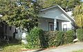
105 Moultrie St. (1915)
-
107 Moultrie St. (1927)
-
115 Moultrie St. (1920)
-
117 Moultrie St. (1920)
-
121 Moultrie St. (1937)
-
123 Moultrie St. (1937)
-
137 Moultrie St. (1955) - Non-contributing
-
143 Moultrie St. (1913) - Non-contributing
-
145 Moultrie St. (1935)
-
151 Moultrie St. (1916)
-
153 Moultrie St. (1922)
-
157 Moultrie St. (1916)
-
161 Moultrie St. (1914)
-
163 Moultrie St. (1921)
-
167 Moultrie St. (1923)
-
171 Moultrie St. (1923)
-
2 North Allan Park (1919)
-
2 North Allan Park in 2013
-
6 North Allan Park (1937)
-
8 North Allan Park (1950) - Non-contributing
-
4 Parkwood Ave. (1921)
-
6 Parkwood Ave. (1920)
-
10 Parkwood Ave. (1918)
-
12 Parkwood Ave. (1920)
-
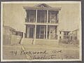
14 Parkwood Ave. (1917)
-
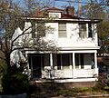
14 Parkwood Ave. in 1917
-
16 Parkwood Ave. (Year unknown) - Non-contributing
-
23 Parkwood Ave. (1917)
-
24 Parkwood Ave. (1931)
-
24 Parkwood Ave. in 2003
-
26 Parkwood Ave. (1917)
-
26 Parkwood Ave. in 2006
-
27 Parkwood Ave. (1914)
-
29 Parkwood Ave. (1922)
-
30 Parkwood Ave. (1914)
-
30 Parkwood Ave. in April 2006
-
31 Parkwood Ave. (1916)
-
31 Parkwood Ave. in 2010, before restoration
-
32 Parkwood Ave. (1919)
-
34 Parkwood Ave. (1917)
-
34 Parkwood Ave. in 1922
-
35 Parkwood Ave. (1916)
-
39 Parkwood Ave. (1917)
-
47 Parkwood Ave. (1951) - Non-contributing
-
48 Parkwood Ave. (1916)
-
49 Parkwood Ave. (1916)
-
52 Parkwood Ave. (1914) - Non-contributing
-
53 Parkwood Ave. (1914)
-
54 Parkwood Ave. (1913) - Non-contributing
-
56 Parkwood Ave. (1922)
-
287 President St. (1920)
-
291 President St. (1919)
-
293 President St. (1921)
-
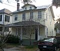
295 President St. (1920)
-
299 President St. (1919)
-
299 President St. in August 2007
-
301 President St. (1921)
-
303 President St. (1921)
-
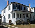
305 President St. (1925)
-
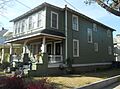
307 President St. (1910)
-
324 President St. (1919)
-
324 President St. in August 2007
-

329 President St. (1914)
-
330 President St. (1921)
-
331 President St. (1915)
-
332 President St. (1917)
-
335 President St. (1913)
-
336 President St. (1914)
-
337 President St. (1918)
-
338 President St. (1917)
-
340 President St. (1917)
-
340 President St. in April 2004
-
341 President St. (1916)
-
359 President St. (1928)
-
361 President St. (1914) - Non-contributing
-
362 President St. (1916)
-
363 President St. (1921)
-
364 President St. (1915)
-
365 President St. (1921)
-
367 President St. (1914)
-
368 President St. (1917)
-
368 President St. in January 2012
-
605 Rutledge Ave. (1922)
-
607 Rutledge Ave. (1922)
-
609 Rutledge Ave. (1920)
-
611 Rutledge Ave. (1920)
-
619 Rutledge Ave. (1920)
-
623 Rutledge Ave. (1924)
-
625 Rutledge Ave. (1919)
-
627 Rutledge Ave. (1990) - Non-contributing
-
1 South Allan Park (1919)
-
3 South Allan Park (1919)
-
5 South Allan Park (1920)
-
444 Sumter St. (1916)
-
2 Sutherland Ave. (1916)
-
1 Sutherland Ave. (1995) - Non-contributing
-
3 Sutherland Ave. (1915)
-
4 Sutherland Ave. (1917)
-
5 Sutherland Ave. (1916)
-
6 Sutherland Ave. (1931)
-
7 Sutherland Ave. (1973)
-
8 Sutherland Ave. (1920)
-
10 Sutherland Ave. (1913)
-
11 Sutherland Ave. (1913)
-
12 Sutherland Ave. (1914)
-
14 Sutherland Ave. (1913)
-
14 Sutherland Ave. in April 2011
-
1 Sutherland Ct. (1910)
-
3 Sutherland Ct. (after 1942) - Non-contributing
-
5 Sutherland Ct. (1938) - Non-contributing
-
5 Sutherland Ct. before brick veneer
-
6 Sutherland Ct. (1887-1902) - Non-contributing
-
1 Wesson Ave. (1916)
-
2 Wesson Ave. (1920)
-
3 Wesson Ave. (1915)
-
4 Wesson Ave. (1917)
-
5 Wesson Ave. (1915)
-
6 Wesson Ave. (1920)
-
7 Wesson Ave. (1914)
-
8 Wesson Ave. (1918)
-
9 Wesson Ave. (1915)
-
10 Wesson Ave. (1919)
-
11 Wesson Ave. (1924)


.jpg)


