Harrison, Indiana facts for kids
Quick facts for kids
Harrison, Indiana
|
|
|---|---|

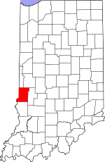
Vigo County's location in Indiana
|
|
| Country | United States |
| State | Indiana |
| County | Vigo |
| Township | Fayette |
| Elevation | 456 ft (139 m) |
| Time zone | UTC-5 (Eastern (EST)) |
| • Summer (DST) | UTC-4 (EDT) |
| ZIP code |
47885
|
| Area code(s) | 812, 930 |
| GNIS feature ID | 452218 |
Harrison is a small community in Indiana, a state in the United States. It's not a city or town with its own government. Instead, it's known as an "unincorporated community."
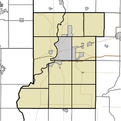
Harrison is located in Fayette Township, which is part of Vigo County. It is also considered part of the larger Terre Haute metropolitan area.
A Look Back in Time
Harrison was officially planned out on August 4, 1837. A person named Ann Potts helped create the layout for the community. It was built near a place called Fort Harrison.
This fort was an important military base in the area. It was built in 1811 by a famous general named William Henry Harrison. The community of Harrison is located on the west side of the river from where the old fort once stood.
Where is Harrison?
Harrison is located at specific coordinates: 39 degrees, 31 minutes, 43 seconds North and 87 degrees, 25 minutes, 20 seconds West. It sits at an elevation of 456 feet (about 139 meters) above sea level.
 | William Lucy |
 | Charles Hayes |
 | Cleveland Robinson |


