Haverhill, Iowa facts for kids
Quick facts for kids
Haverhill, Iowa
|
|
|---|---|

|
|

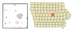
Location of Haverhill, Iowa
|
|
| Country | |
| State | |
| County | Marshall |
| Area | |
| • Total | 0.14 sq mi (0.36 km2) |
| • Land | 0.14 sq mi (0.36 km2) |
| • Water | 0.00 sq mi (0.00 km2) |
| Elevation | 1,014 ft (309 m) |
| Population
(2020)
|
|
| • Total | 165 |
| • Density | 1,187.05/sq mi (458.48/km2) |
| Time zone | UTC-6 (Central (CST)) |
| • Summer (DST) | UTC-5 (CDT) |
| ZIP code |
50120
|
| Area code(s) | 641 |
| FIPS code | 19-35220 |
| GNIS feature ID | 0457323 |
Haverhill is a small city in Marshall County, Iowa, in the United States. In 2020, about 165 people lived there.
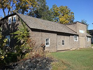
Haverhill is home to a few interesting places. You can find the Immaculate Conception oratory and the Matthew Edel Blacksmith Shop and House. There's also the Mid-Iowa Co-Op, which owns large grain storage buildings. You might also spot many tall wind turbines nearby, which help create electricity.
Contents
History of Haverhill
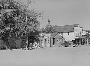
Haverhill has a long history, even before it was officially a city. A school and a church were built here in the 1870s. The city was officially planned in 1882 by a railroad company.
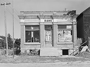
The railroad was very important for Haverhill. It carried goods and people, stopping in town three times a day. Haverhill was a place where farmers stored their grain. It also had small businesses like a lumber company, a blacksmith shop, a bank, and stores.
Over time, many of these businesses closed. The railroad stopped carrying passengers, and then freight traffic ended in 1980. The local bank closed in the 1920s. The public school joined a larger school district, and the Catholic school closed in 1968.
Haverhill officially became a city in 1968. This meant residents could elect their own government. They also started city services, like a fire department. Before becoming a city, new streets and homes were built. The town's roads were paved in the 1980s, and new sewer systems were added in the 1990s and early 2000s.
Geography of Haverhill
Haverhill is a very small city. According to the United States Census Bureau, it covers an area of about 0.13 square miles (0.36 square kilometers). All of this area is land.
People of Haverhill
Population in 2020
In 2020, there were 165 people living in Haverhill. These people lived in 67 households. Most residents were White (97.0%). A small number were from other racial backgrounds. About 1.2% of the population was Hispanic or Latino.
Many households (34.3%) had children under 18 living with them. The average age in Haverhill was 37.5 years old. About 29.7% of the people were under 20.
Population over time
Haverhill's population has stayed fairly steady over the years.
| Historical populations | ||
|---|---|---|
| Year | Pop. | ±% |
| 1970 | 160 | — |
| 1980 | 173 | +8.1% |
| 1990 | 144 | −16.8% |
| 2000 | 170 | +18.1% |
| 2010 | 173 | +1.8% |
| 2020 | 165 | −4.6% |
| Source:Iowa Data Center Source: |
||
Arts and Culture in Haverhill
The Matthew Edel Blacksmith Shop and House is a historic site in Haverhill. It is owned by the State Historical Society of Iowa. You can take tours there during the summer months.
The Immaculate Conception oratory is another important building. It used to hold regular church services, but these ended in 2007. The Haverhill Social Club is a popular spot for locals. It used to be a grocery store and a tavern, but now it's a bar and restaurant. In the middle of Haverhill, there is also a memorial park.
Every year, residents celebrate "Haverhill Days." This festival celebrates the town's history. It often includes tours of the Matthew Edel Blacksmith Shop.
Education in Haverhill
Students in Haverhill attend schools in the Marshalltown Community School District. Haverhill joined this school district in 1966, after its own local schools closed.
See also
 In Spanish: Haverhill (Iowa) para niños
 | Dorothy Vaughan |
 | Charles Henry Turner |
 | Hildrus Poindexter |
 | Henry Cecil McBay |


