Heath, Indiana facts for kids
Quick facts for kids
Heath, Indiana
|
|
|---|---|

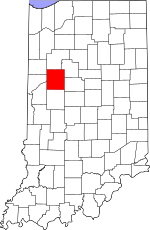
Tippecanoe County's location in Indiana
|
|
| Country | United States |
| State | Indiana |
| County | Tippecanoe |
| Township | Perry |
| Elevation | 669 ft (204 m) |
| Time zone | UTC-5 (Eastern (EST)) |
| • Summer (DST) | UTC-4 (EDT) |
| ZIP code |
47905
|
| Area code(s) | 765 |
| GNIS feature ID | 435952 |
Heath was a small community in Perry Township, Tippecanoe County, Indiana. It is now considered a ghost town, meaning it was once a lively place but is now mostly abandoned.
Contents
What is a Ghost Town?
A ghost town is a place where most or all of the people have left. These towns often become empty because their main reason for existing disappears. This could be due to a mine closing, a railroad changing its route, or a natural disaster. Heath is one such example in Indiana.
Where Was Heath Located?
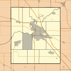
Heath was situated in Perry Township. It was found at specific coordinates: 40°27'41" North latitude and 86°44'00" West longitude. The town was built on a high piece of land, called a bluff. This bluff overlooked Wildcat Creek to the southeast.
Elevation and Surroundings
The elevation of Heath was about 669 feet (204 meters) above sea level. This means it was quite high up compared to the surrounding area. The location near Wildcat Creek would have been important for early settlers.
History of Heath
Like many small towns, Heath had a post office. This was a very important place for communication and connecting with the outside world. The post office in Heath was opened in 1888. It served the community for several years.
When Did Heath Disappear?
The post office in Heath was closed down in 1902. This often signals the decline of a small community. When a post office closes, it means fewer people are living there or relying on it. Even though it's a ghost town, a few buildings from Heath still exist today. The USGS still lists Heath on its maps.
 | Selma Burke |
 | Pauline Powell Burns |
 | Frederick J. Brown |
 | Robert Blackburn |


