Heinrich Bünting facts for kids
Heinrich Bünting (born 1545 – died 1606) was a German Protestant pastor and a scholar of religion. He is most famous for his book of maps, called Itinerarium Sacrae Scripturae. This means "Travel book through Holy Scripture." It was first published in 1581.
Life of Heinrich Bünting
Heinrich Bünting was born in Hannover, Germany, in 1545. He went to the University of Wittenberg to study theology. Theology is the study of religious faith and practice. He finished his studies in 1569.
After university, Bünting became a Protestant pastor in Lemgo. In 1575, he left this job and moved to Gronau an der Leine. Later, in 1591, he became a superintendent in Goslar. A superintendent is a leader in the church.
Around 1600, there was a disagreement about his teachings. Because of this, he left his church role. He then lived the rest of his life in Hannover as a private citizen. Heinrich Bünting passed away on December 30, 1606.
His Famous Map Book: Itinerarium Sacrae Scripturae
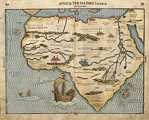
Heinrich Bünting's collection of maps was called Itinerarium Sacrae Scripturae. These maps were made using woodcuts. A woodcut is a way of printing images from a carved piece of wood. The book was first printed in Magdeburg in 1581.
This map book was very popular during its time. It was printed many times and translated into different languages. The book gave the best information about the geography of places mentioned in the Bible. It showed the Holy Land by following the journeys of important people from the Old and New Testaments.
Unique Figurative Maps
Besides regular maps, Bünting's book also had three very special maps. These maps showed places in a creative, symbolic way:
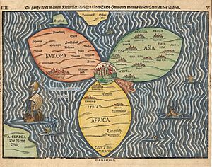
- The World as a Cloverleaf: One map showed the world shaped like a cloverleaf. This design might have represented the Trinity, which is a key idea in Christianity. The city of Jerusalem was placed right in the center of this map.
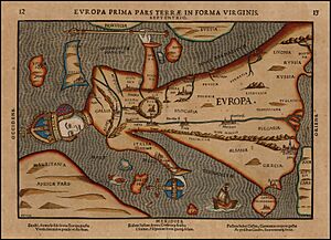
- Europe as a Woman: Another map showed Europe as a woman wearing a crown and robes.
- Asia as Pegasus: The third special map showed Asia as the winged horse Pegasus from Greek myths.
 | Misty Copeland |
 | Raven Wilkinson |
 | Debra Austin |
 | Aesha Ash |


