
Hen and Chicken Islands facts for kids

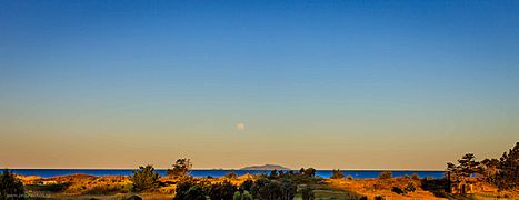
In the distance, from left to right: the Chickens, Hen Island, Sail Rock
|
|
| Geography | |
|---|---|
| Coordinates | 35°56′S 174°44′E / 35.933°S 174.733°E |
| Total islands | 9 |
| Area | 8.44 km2 (3.26 sq mi) |
| Highest elevation | 417 m (1,368 ft) |
| Administration | |
|
New Zealand
|
|
| Demographics | |
| Population | 0 |

The Hen and Chicken Islands are a group of islands found off the coast of northern New Zealand. They are often called the Hen and Chickens. These islands are about 12 kilometers (7.5 miles) east of Bream Head. They are also about 40 kilometers (25 miles) south-east of Whangārei. The islands cover a total area of 8.44 square kilometers (3.26 square miles).
Contents
History of the Islands
These islands were first seen by Captain James Cook. He sighted them on November 25, 1769. He gave them their name, which some people think came from an old name for the star cluster called the Pleiades.
The islands were originally owned by the Māori Ngā Puhi iwi (tribe). They sold the islands to the New Zealand Government in 1883. In 1908, the islands became a special scenic reserve. This was because of their rare plants and animals. Later, in 1953, they became a wildlife refuge.
Hen Island itself had a slightly different story. It was bought by Thomas Outhwaite in 1872. His daughter, Isa Outhwaite, later left the island to the nation when she passed away in 1927. Hen Island also became a scenic reserve.
In June 1940, a large ship called the RMS Niagara sank near the islands. It hit a mine in the water. Most of its cargo, which included valuable gold, was later recovered from the ocean.
Island Environment and Wildlife
The Hen and Chicken Islands are very important for their bird life. They have many colonies of seabirds. They also have forest birds that are now rare or no longer found on the mainland.
BirdLife International has named these islands an Important Bird Area. This is because they are home to a breeding group of about 500 pairs of Pycroft's petrels. These special birds come here to lay their eggs and raise their young.
Exploring the Islands
The archipelago includes Hen Island, also known as Māori: Taranga. It lies about 7 kilometers (4.3 miles) southwest of the other islands. Hen Island is much larger than the rest. The other islands are called the Chicken Islands, or Marotiri. These are a chain of six smaller islands. They stretch from north-west to south-east, north of Hen Island.
The Chicken Islands include:
- Wareware and Muriwhenua Islands (together known as North West Chicken)
- Mauitaha (West Chicken)
- Lady Alice Island or Motu Muka (Big Chicken)
- Whatupuke (Middle Chicken)
- Coppermine Island (Eastern Chicken)
Taranga (Hen) Island
Taranga is the biggest island by far. It covers about 4.7 square kilometers (1.8 square miles). It is long and thin, about 6 kilometers (3.7 miles) long. Its average width is less than 1,000 meters (1,094 yards).
This island is what's left of a volcano that erupted four million years ago. A rocky ridge runs along the island. Its highest point is called The Pinnacles, reaching about 417 meters (1,368 feet) high. Sail Rock is a tall rock stack that rises from the ocean. It is about 3 kilometers (1.9 miles) south of Hen Island. It is a well-known landmark for yachts.
By the late 1800s, Hen Island was the only place in New Zealand where the North Island saddleback bird still lived. This forest bird used to be common in the North Island. But it was almost wiped out by animals like rats and stoats that humans brought to New Zealand. In the 1960s, saddlebacks from Hen Island were moved to other safe island sanctuaries. This helped save the species.
Wareware and Muriwhenua Islands
These are two small, rocky islands. Together, they cover about 3 hectares (7.4 acres).
Mauitaha Island
This island is about 20 hectares (49 acres) in size. It is a rugged, rocky island covered in scrub. It lies about 1 kilometer (0.6 miles) south of Muriwhenua. Mauitaha rises to about 125 meters (410 feet) high.
The New Zealand Department of Conservation and the Ngati Wai iwi are working together. They have set up a sanctuary for the Polynesian rat, or kiore, on Mauitaha and Araara. The Ngati Wai tribe wants to protect the kiore's history. This is because the kiore's journey across the Pacific was similar to the migration of the New Zealand Maori people.
Lady Alice Island
Lady Alice Island is named after Lady Alice Fergusson. She was the wife of Governor General Sir Charles Fergusson. It is the largest of the five Chicken Islands. It is very important because of its unique plants and animals. The island covers about 1.4 square kilometers (0.54 square miles). It is surrounded by rocky reefs.
Māori people lived on the island until the 1820s. In the 1890s, it was used as a base for fishermen. Cattle were brought to the island around that time. However, they were removed in the 1920s.
Whatupuke Island
This island was once known as Whakahau. It has a large eastern part and a peninsula to the southwest. The coast of the peninsula forms a main feature of the island chain. This is a 300-meter (328-yard) wide bay called Starfish Bay. The island covers about 1 square kilometer (0.39 square miles). It is steep, rising to about 234 meters (768 feet) high.
Coppermine Island
Coppermine Island covers an area of about 75 hectares (185 acres). It is made of two sections connected by a short strip of land. As its name suggests, there are copper deposits on the island. People tried to mine copper there in 1849 and 1898. However, these attempts were not successful because it was not profitable.
Gallery
-
Hen and Chicken Islands from Department of Conservation Campsite, Uretiti, New Zealand.

