Henry Inlet facts for kids
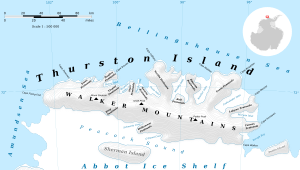
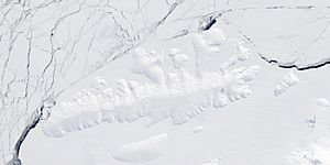
Henry Inlet is a long, narrow bay in Antarctica. It is filled with ice and stretches for about 22 kilometers (12 nautical miles). This inlet cuts into the northern coast of Thurston Island. It is located just east of a place called Hughes Peninsula.
What is Henry Inlet?
An inlet is like a small arm of the sea, or a narrow bay, that reaches into the land. Henry Inlet is special because it's mostly covered in ice. It's a significant geographic feature on the coast of Thurston Island.
Where is Henry Inlet located?
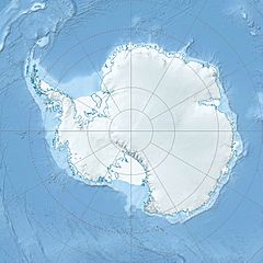
Henry Inlet is found in a very cold part of the world: Antarctica. Specifically, it's on the north side of Thurston Island. Thurston Island itself is a large, ice-covered island off the coast of Ellsworth Land. The inlet helps shape the coastline of this remote island.
How was Henry Inlet discovered and named?
Henry Inlet was first mapped using special photos taken from the air. These photos were captured during a United States Navy mission called "Operation Highjump" between 1946 and 1947. This mission explored parts of Antarctica.
The inlet was later named by the Advisory Committee on Antarctic Names. They chose the name to honor Robert Henry. He was a photographer who worked with the U.S. Navy's Bellingshausen Sea Expedition. In February 1960, Robert Henry took many pictures from helicopters. These photos helped record important features along the Eights Coast of Antarctica.
 | William Lucy |
 | Charles Hayes |
 | Cleveland Robinson |


