Hext, Oklahoma facts for kids
Quick facts for kids
Hext
|
|
|---|---|
| Country | United States |
| State | Oklahoma |
| County | Beckham |
| Elevation | 1,923 ft (586 m) |
| Time zone | UTC-6 (Central (CST)) |
| • Summer (DST) | UTC-5 (CDT) |
| GNIS feature ID | 1100490 |
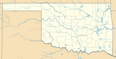
Hext is a small, quiet community in Beckham County, Oklahoma, in the United States. It's called an "unincorporated area," which means it doesn't have its own local government like a city or town. This community was named after a person who lived there, William Hext. You can find Hext located between two important roads: Interstate 40 and the old US Route 66, which is now called Interstate 40 Business Route.
Contents
History of Hext
Hext began to grow when the Choctaw, Oklahoma and Gulf Railroad built a train track through the area. This railroad later became known as the Rock Island Railroad.
Early Services
For a short time, Hext had its own post office. It was open from June 4, 1901, until November 29, 1902. This shows that people were living and receiving mail in the community during that period.
Route 66 Connection
In 1929, the famous US Route 66 was changed to pass directly through Hext. This section of the road was known as 5th Street in the community. Hext was one of the last places along Route 66 to be replaced by Interstate 40. This happened in 1975, when Interstate 40 became the main highway.
Old Buildings in Hext
If you visit the western part of Hext, on the south side of the old Route 66, you can see an interesting old stone building. It used to be a gas station, but after the gas pumps were removed, the service area was turned into a house.
Economy and Activities
Today, there are no businesses operating in Hext. The main activities that support the people living in this area are horse breeding and farming. These activities are important to the local economy.
 | Jackie Robinson |
 | Jack Johnson |
 | Althea Gibson |
 | Arthur Ashe |
 | Muhammad Ali |


