
Hickory Island, Michigan facts for kids

USGS aerial imagery of Hickory Island
|
|

Hickory Island
Location in Wayne County, Michigan

Hickory Island
Location in Michigan

Hickory Island
Location in the United States
|
|
| Geography | |
|---|---|
| Location | Michigan |
| Coordinates | 42°05′15″N 83°09′20″W / 42.08750°N 83.15556°W |
| Highest elevation | 581 ft (177.1 m) |
| Administration | |
|
United States
|
|
| State | |
| County | Wayne |
Hickory Island is an island in the Detroit River. It is in Wayne County, in southeast Michigan. Its coordinates are 42°05′15″N 83°09′20″W / 42.08750°N 83.15556°W, and the United States Geological Survey gave its elevation as 581 ft (177 m) in 1980.
Images for kids
-
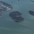
Hickory Island and Meso Island viewed from the south in a 2016 aerial photo
.jpg)

All content from Kiddle encyclopedia articles (including the article images and facts) can be freely used under Attribution-ShareAlike license, unless stated otherwise. Cite this article:
Hickory Island, Michigan Facts for Kids. Kiddle Encyclopedia.