
Wayne County, Michigan facts for kids
Quick facts for kids
Wayne County
|
|||||
|---|---|---|---|---|---|
| Charter County of Wayne | |||||
|
Left to right, top to bottom: Downtown Detroit, Ford World Headquarters, James Scott Memorial Fountain, Gateway Bridge, the Uniroyal Giant Tire and the Detroit Metropolitan Airport
|
|||||
|
|||||

Location in Michigan
|
|||||

Municipalities in Wayne County
|
|||||
| Country | United States | ||||
| State | Michigan | ||||
| Region | Metro Detroit | ||||
| Incorporated | 1796 (created) 1815 (organized) |
||||
| Named for | Anthony Wayne | ||||
| County seat and Largest city | Detroit | ||||
| Area | |||||
| • Total | 673 sq mi (1,740 km2) | ||||
| • Land | 612 sq mi (1,590 km2) | ||||
| • Water | 61 sq mi (160 km2) | ||||
| Population
(2020)
|
|||||
| • Total | 1,793,561 | ||||
| • Estimate
(2023)
|
1,751,169 |
||||
| • Density | 2,665.0/sq mi (1,029.0/km2) | ||||
| Demonym(s) | Detroiter | ||||
| GDP | |||||
| • Total | $112.857 billion (2022) | ||||
| Time zone | UTC−5 (Eastern Time Zone) | ||||
| • Summer (DST) | UTC−4 (Eastern Daylight Time) | ||||
| Area codes | 313, 734, 248 | ||||
.jpg)


Wayne County is the county with the most people in the state of Michigan. In 2020, about 1.8 million people lived here. This makes it one of the most populated counties in the whole United States. The main city and county seat is Detroit.
Wayne County was created in 1796 and officially started in 1815. It is part of the larger Detroit Metropolitan Area. The county is named after Anthony Wayne, a famous general from the American Revolutionary War.
Contents
History of Wayne County

Wayne County was the sixth county formed in the Northwest Territory. This happened on August 15, 1796. It was named after General Anthony Wayne, also known as "Mad Anthony" Wayne.
When it was first created, Wayne County was huge! It covered all of what is now the Lower Peninsula of Michigan. It also included most of the Upper Peninsula. Plus, it had parts of northern Ohio, Indiana, Illinois, and Wisconsin.
The first parts of the county were divided into townships on November 1, 1798. These were Detroit, Hamtramck, Mackinaw, and Sargent. These townships were much bigger than today's townships.

Over time, the county's borders changed. This happened as Indiana and Illinois became states. Also, new counties were formed within the Michigan Territory.
Geography and Location
Wayne County covers about 673 square miles. About 612 square miles are land, and 61 square miles (9%) are water. This water includes parts of the Detroit River and Lake St. Clair.
Neighboring Areas
Wayne County shares borders with several other counties and even another country:
- To the west: Washtenaw County
- To the south: Monroe County
- To the north: Oakland County and Macomb County
- To the east: Essex County, Ontario, Canada
The eastern border is a water border with Essex County, Ontario, Canada. You can cross this border by car using the Detroit–Windsor Tunnel or the Ambassador Bridge. Some southern communities in the county are called Downriver. This is because they are located downstream from downtown Detroit.
Grosse Ile is the largest island in Wayne County. It connects to the mainland by two bridges. The highest point in the county is near Northville. It is found in Maybury State Park.
Protected Natural Areas
- Detroit River International Wildlife Refuge (part of it is in Wayne County)
Transportation in Wayne County
Wayne County Department of Public Services
The Wayne County Department of Public Services helps build and maintain roads. It started in 1906 as the Wayne County Road Commission.
Some important people were its first leaders. These included Edward N. Hines and Henry Ford, who founded Ford Motor Company. Edward N. Hines is famous for inventing the idea of painting a line down the middle of a road to separate traffic. This idea was later used everywhere!
The commission also built the country's first mile of concrete-paved rural highway. This was a section of Woodward Avenue, just outside Detroit. Many of the roads built by the commission are now listed as historic places.
Public Transit Options
 The Detroit station serves Amtrak trains. These trains connect Wayne County to other cities.
 The Detroit Bus Station offers bus trips to places across the Midwest.
- Local bus services are provided by the Detroit Department of Transportation and Suburban Mobility Authority for Regional Transportation.
- The QLine is a streetcar that runs along Woodward Avenue.
Main Highways
Wayne County has many important highways:
 I-75 goes through the county. It connects to Toledo in the south and Flint in the north.
 I-94 runs east-west. It connects to Port Huron to the east and Chicago to the west. It also connects to the Detroit Metro Airport.
 I-96 ends in Detroit. It connects to other parts of Michigan and beyond.
 I-275 runs mostly in Wayne County. It serves the southern part of the Detroit Metro Airport.
 I-375 is a short highway in Downtown Detroit. There are plans to change it into a boulevard.
 US 12 starts in Downtown Detroit. It goes west through Michigan and other states. It's also known as Michigan Avenue.
 US 24 goes through the county. It's a good alternative to I-75. It's known as Telegraph Road.
 M-1 starts in Downtown Detroit. It's also known as Woodward Avenue.
 M-3 starts in Downtown Detroit. It's known as Gratiot Avenue.
 M-10 connects Downtown Detroit to Southfield.
 M-14 starts in Livonia. It connects to Plymouth and Ann Arbor.
 M-39 runs through Lincoln Park and Allen Park. It's known as the Southfield Freeway.
 M-85 is completely in Wayne County. It connects Downtown Detroit to the Downriver area. It's known as West Fort and South Fort.
Airports in Wayne County
 Detroit Metropolitan Wayne County Airport is in Romulus. It's a major airport for flights.
- Willow Run Airport is in Van Buren Township. It's used for cargo and private flights.
- Grosse Ile Municipal Airport is on Grosse Ile. It's a smaller airport for general aviation.
- Coleman A. Young International Airport (also called Detroit City Airport) is near Downtown Detroit. It has two runways but no scheduled flights.
Population and People
| Historical population | |||
|---|---|---|---|
| Census | Pop. | %± | |
| 1810 | 2,227 | — | |
| 1820 | 3,574 | 60.5% | |
| 1830 | 6,781 | 89.7% | |
| 1840 | 24,173 | 256.5% | |
| 1850 | 42,756 | 76.9% | |
| 1860 | 75,547 | 76.7% | |
| 1870 | 119,068 | 57.6% | |
| 1880 | 168,444 | 41.5% | |
| 1890 | 257,114 | 52.6% | |
| 1900 | 348,793 | 35.7% | |
| 1910 | 531,591 | 52.4% | |
| 1920 | 1,177,645 | 121.5% | |
| 1930 | 1,888,946 | 60.4% | |
| 1940 | 2,015,623 | 6.7% | |
| 1950 | 2,435,235 | 20.8% | |
| 1960 | 2,666,297 | 9.5% | |
| 1970 | 2,666,751 | 0.0% | |
| 1980 | 2,337,843 | −12.3% | |
| 1990 | 2,111,687 | −9.7% | |
| 2000 | 2,061,162 | −2.4% | |
| 2010 | 1,820,584 | −11.7% | |
| 2020 | 1,793,561 | −1.5% | |
| 2023 (est.) | 1,751,169 | −3.8% | |
| U.S. Decennial Census 1790–1960 1900–1990 1990–2000 2010–2019 2020 census |
|||
In 2020, Wayne County had a population of 1,793,561 people. This was a small decrease from 2010.
Who Lives Here?
Wayne County is a diverse place. In 2020, the population was made up of:
- About 47.8% White people (not Hispanic)
- About 37.3% Black or African American people (not Hispanic)
- About 3.6% Asian people (not Hispanic)
- About 4.0% people of two or more races (not Hispanic)
- About 6.6% Hispanic or Latino people (who can be of any race)

In 2010, about 25.4% of the people were under 18 years old. The average age was 37 years. The average household income was around $39,408.
Religious Groups
Many different religious groups are found in Wayne County. In 2010, the largest group was the Catholic Church. There were also many non-denominational Christians and Baptists. A large number of Muslims also live in the county. Other groups include Lutherans, Pentecostals, Methodists, and Presbyterians.
Cities and Towns
Cities
- Allen Park
- Belleville
- Dearborn
- Dearborn Heights
- Detroit (county seat)
- Ecorse
- Flat Rock
- Garden City
- Gibraltar
- Grosse Pointe
- Grosse Pointe Farms
- Grosse Pointe Park
- Grosse Pointe Shores
- Grosse Pointe Woods
- Hamtramck
- Harper Woods
- Highland Park
- Inkster
- Lincoln Park
- Livonia
- Melvindale
- Northville
- Plymouth
- River Rouge
- Riverview
- Rockwood
- Romulus
- Southgate
- Taylor
- Trenton
- Wayne
- Westland
- Woodhaven
- Wyandotte
Townships
- Brownstown Charter Township
- Canton Charter Township
- Grosse Ile Township
- Huron Charter Township
- Northville Charter Township
- Plymouth Charter Township
- Redford Charter Township
- Sumpter Township
- Van Buren Charter Township
Other Communities
- Beech
- Belleville North
- Cherry Hill
- Cherry Island
- Denton
- East Rockwoood
- Edgewater Heights
- French Landing
- Grand View Acres
- Maple Beach
- Martinsville
- Milleville Beach
- New Boston
- Rawsonville
- Roulo
- Sheldon
- Waltz
- West Sumpter
- Willow
Education in Wayne County
School Districts
Many different school districts serve the children of Wayne County:
- Airport Community School District
- Allen Park Public Schools
- Crestwood School District
- Dearborn City School District
- Dearborn Heights School District 7
- Detroit Public Schools Community District
- Ecorse Public School District
- Flat Rock Community Schools
- Garden City School District
- Gibraltar School District
- Grosse Ile Township Schools
- Grosse Pointe Public Schools
- Hamtramck Public Schools
- Harper Woods City Schools
- Highland Park City Schools
- Huron School District
- Lincoln Consolidated School District
- Lincoln Park Public Schools
- Livonia Public Schools
- Melvindale-North Allen Park School District
- Northville Public Schools
- Plymouth-Canton Community Schools
- Redford Union School District
- River Rouge School District
- Riverview Community School District
- Romulus Community Schools
- South Redford School District
- Southgate Community School District
- Taylor School District
- Trenton Public Schools
- Van Buren Public Schools
- Wayne-Westland Community School District
- Westwood Community Schools
- Woodhaven-Brownstown School District
- Wyandotte City School District
Colleges and Universities
Students can also attend several colleges and universities in Wayne County:
- Wayne State University
- Henry Ford College
- University of Detroit Mercy
Images for kids
-
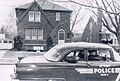
A Detroit Police car in 1955.

See also
 In Spanish: Condado de Wayne (Míchigan) para niños
