Inkster, Michigan facts for kids
Quick facts for kids
Inkster, Michigan
|
|
|---|---|
| City of Inkster | |

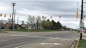
Facing west at Beech Daly and Michigan Avenue
|
|

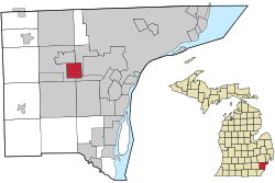
Location within Wayne County
|
|
| Country | |
| State | |
| County | Wayne |
| Settled | 1835 |
| Incorporation | 1926 (village) 1964 (city) |
| Government | |
| • Type | Council–manager |
| Area | |
| • City | 6.25 sq mi (16.20 km2) |
| • Land | 6.25 sq mi (16.19 km2) |
| • Water | 0.00 sq mi (0.00 km2) |
| Elevation | 623 ft (190 m) |
| Population
(2020)
|
|
| • City | 26,088 |
| • Density | 4,172.08/sq mi (1,610.91/km2) |
| • Metro | 4,285,832 (Metro Detroit) |
| Time zone | UTC-5 (EST) |
| • Summer (DST) | UTC-4 (EDT) |
| Zip code(s) |
48141
|
| Area code(s) | 313 and 734 |
| FIPS code | 26-40680 |
| GNIS feature ID | 0629039 |
Inkster is a city in Wayne County, Michigan, in the United States. It is a western suburb of Detroit, located about 14 miles (23 km) southwest of downtown Detroit. As of the 2020 census, the city had a population of 26,088 people.
Contents
History of Inkster
The area where Inkster is now located was first home to Native Americans. People from other places began to settle here in 1825. A post office called "Moulin Rouge" opened in December 1857.
How Inkster Got Its Name
A Scotsman named Robert Inkster was born in 1828. He ran a steam sawmill in the early 1860s near what is now Inkster Road. The post office was renamed "Inkster" in July 1863, taking its name from him.
Becoming a City
By 1878, Inkster had a train station on the Michigan Central Railroad. It officially became a village in 1926. This happened when parts of Nankin Township and Dearborn Township joined together. After some discussions about its exact borders, Inkster became a city in 1964.
Growth and Community
In the 1920s and 1930s, many African-Americans moved to Inkster. They worked in Henry Ford's factories in Dearborn. Inkster was a good place for them to live because it was close to their jobs.
In 2015, a legal case involving the city resulted in a settlement. This settlement was paid for by a special property tax on Inkster residents.
Geography of Inkster
According to the United States Census Bureau, the city covers a total area of 6.25 square miles (16.20 km²). All of this area is land.
Population and People
| Historical population | |||
|---|---|---|---|
| Census | Pop. | %± | |
| 1930 | 4,440 | — | |
| 1940 | 7,044 | 58.6% | |
| 1950 | 16,728 | 137.5% | |
| 1960 | 39,097 | 133.7% | |
| 1970 | 38,595 | −1.3% | |
| 1980 | 35,190 | −8.8% | |
| 1990 | 30,772 | −12.6% | |
| 2000 | 30,115 | −2.1% | |
| 2010 | 25,369 | −15.8% | |
| 2020 | 26,088 | 2.8% | |
| U.S. Decennial Census | |||
2020 Census Information
The 2020 census showed that Inkster had a population of 26,088 people. The table below shows the racial and ethnic makeup of the city. Please note that Hispanic/Latino is an ethnic category and people of any race can be Hispanic/Latino.
| Race / Ethnicity (NH = Non-Hispanic) | Pop 2000 | Pop 2010 | Pop 2020 | % 2000 | % 2010 | % 2020 |
|---|---|---|---|---|---|---|
| White alone (NH) | 7,379 | 4,959 | 4,562 | 24.50% | 19.55% | 17.49% |
| Black or African American alone (NH) | 20,267 | 18,413 | 18,984 | 67.30% | 72.58% | 72.77% |
| Native American or Alaska Native alone (NH) | 111 | 70 | 83 | 0.37% | 0.28% | 0.32% |
| Asian alone (NH) | 1,023 | 409 | 197 | 3.40% | 1.61% | 0.76% |
| Pacific Islander alone (NH) | 3 | 4 | 3 | 0.01% | 0.02% | 0.01% |
| Some Other Race alone (NH) | 83 | 46 | 153 | 0.28% | 0.18% | 0.59% |
| Mixed Race/Multi-Racial (NH) | 767 | 815 | 1,308 | 2.55% | 3.21% | 5.01% |
| Hispanic or Latino (any race) | 482 | 653 | 798 | 1.60% | 2.57% | 3.06% |
| Total | 30,115 | 23,369 | 26,088 | 100.00% | 100.00% | 100.00% |
2010 Census Information
In 2010, Inkster had 25,369 people living there. There were 9,821 households, which are groups of people living together. The city had about 4,059 people per square mile (1,567 per km²).
The population was made up of:
- 73.2% African American
- 20.5% White
- 0.3% Native American
- 1.6% Asian
- 0.1% Pacific Islander
- 0.7% from other races
- 3.6% from two or more races
About 2.6% of the population was Hispanic or Latino.
In terms of age, the average age in Inkster was 34.2 years. About 27.9% of residents were under 18 years old. Also, 11.3% were 65 years or older. The city had slightly more females (53.2%) than males (46.8%).
Education in Inkster
Several different school districts serve parts of Inkster. These include Wayne-Westland Community Schools, Westwood Community Schools, Taylor School District, and the Romulus School District.
Local Schools
Westwood Community Schools operates Daly Elementary School and Tomlinson Middle School within Inkster. Students in this district usually attend Robichaud High School in Dearborn Heights.
Wayne-Westland Community Schools has David Hicks Elementary School in Inkster. Students from certain areas of Inkster go to Hicks. After elementary school, they might attend Marshall Upper Elementary School, Stevenson Middle School, and John Glenn High School in Westland. Other students might go to Adams Upper Elementary School, Franklin Middle School, and Wayne Memorial High School in Wayne.
Students in the Taylor School District part of Inkster attend Taylor Parks Elementary School, Hoover Middle School, and Taylor High School in Taylor.
For students in the Romulus School District, Romulus Senior High School is the secondary school.
The Burger Baylor School for Students with Autism is also located in Inkster. It is part of the Garden City School District.
Changes in School Districts
Before 2013, most of Inkster was part of the Inkster Public Schools district. However, this district was closed in the summer of 2013. Students were then divided among the Taylor, Romulus, Wayne-Westland, and Westwood districts. Inkster High School, which was the high school for the Inkster district, also closed in 2013.
The city was divided into four sections for the new school assignments:
- North of Michigan Avenue and west of Middlebelt went to Wayne-Westland.
- North of Michigan Avenue and east of Middlebelt went to Westwood.
- South of Michigan Avenue and west of Middlebelt went to Romulus.
- South of Michigan Avenue and east of Middlebelt went to Taylor.
Students in the Taylor district part of Inkster used to go to Harry S. Truman High School. This school merged into Taylor High in 2018.
Notable People from Inkster
Many interesting people have connections to Inkster:
- Vern Buchanan – A U.S. Representative from Florida, who grew up in Inkster.
- Geraldine Doyle – A woman who might have been the model for the famous "We Can Do It!" poster.
- Marcus Fizer – A professional basketball player.
- Wade Flemons – A well-known R&B singer, musician, and songwriter. He wrote "Stand By Me" and was a member of Earth, Wind, and Fire.
- Earl Jones – A middle-distance runner who won a bronze medal in the 1984 Olympics.
- Jewell Jones – The youngest person in Michigan to be elected as a councilman and then as a state representative.
- J'Leon Love – A professional boxer.
- Keshawn Martin – A professional football player.
- Jeralean Talley – Was once the world's oldest living person before she passed away.
- Tyrone Wheatley – A professional football player and MVP of the 1993 Rose Bowl for Michigan. He was born in Inkster.
- The Marvelettes – A famous R&B singing trio in the Vocal Group Hall of Fame. Members include:
- Katherine Anderson
- Gladys Horton
- Georgeanna Tillman
- Wanda Young
- Juanita Cowart
See also
 In Spanish: Inkster (Míchigan) para niños
 | William L. Dawson |
 | W. E. B. Du Bois |
 | Harry Belafonte |


