
Melvindale, Michigan facts for kids
Quick facts for kids
Melvindale, Michigan
|
|
|---|---|
| City of Melvindale | |
.jpg)
Oakwood Boulevard and Hanna Street
|
|
| Motto(s):
The Little City with a Big Heart
|
|

Location within Wayne County
|
|

Melvindale, Michigan
Location in Michigan

Melvindale, Michigan
Location in the United States
|
|
| Country | |
| State | |
| County | Wayne |
| Incorporated | 1924 (village) 1933 (city) |
| Government | |
| • Type | Mayor–council |
| Area | |
| • Total | 2.75 sq mi (7.13 km2) |
| • Land | 2.73 sq mi (7.06 km2) |
| • Water | 0.02 sq mi (0.06 km2) |
| Elevation | 587 ft (179 m) |
| Population
(2020)
|
|
| • Total | 12,851 |
| • Density | 4,712.50/sq mi (1,819.58/km2) |
| Time zone | UTC-5 (EST) |
| • Summer (DST) | UTC-4 (EDT) |
| ZIP code(s) |
48122
|
| Area code(s) | 313 |
| FIPS code | 26-52940 |
| GNIS feature ID | 0632086 |
Melvindale is a city located in Wayne County, Michigan, in the United States. In 2020, about 12,851 people lived there. The city's motto is "The Little City with a Big Heart."
Contents
A Look at Melvindale's History
Melvindale started as a small settlement called Oakwood Heights in the early 1920s. It was not yet an official town. This area was created to provide homes for people working at the Ford River Rouge Plant in nearby Dearborn.
The city got its name from Melvin Wilkinson, one of the people who helped develop the settlement. In 1922, part of Oakwood Heights became part of Detroit. The rest of the area officially became the village of Melvindale that same year. Later, in 1933, the village grew and became a city.
Geography and Location
Melvindale covers about 2.76 square miles (7.13 square kilometers). Most of this area is land, with a small part being water.
Railroad Connections
Melvindale is an important place for trains in the Metro Detroit area. Several major railroad lines pass through or near the city.
- The Norfolk Southern Railway Oakwood Yard divides the city into two parts.
- The Canadian National Railway Dearborn Subdivision forms the city's western border.
- The Conrail Shared Assets Lincoln Secondary goes through the industrial areas in the southeast. This route connects Detroit and Toledo, Ohio.
Population and People
Melvindale has seen its population change over the years. Here's a quick look at how many people have lived in the city:
| Historical population | |||
|---|---|---|---|
| Census | Pop. | %± | |
| 1930 | 4,053 | — | |
| 1940 | 4,764 | 17.5% | |
| 1950 | 9,483 | 99.1% | |
| 1960 | 13,089 | 38.0% | |
| 1970 | 13,862 | 5.9% | |
| 1980 | 12,322 | −11.1% | |
| 1990 | 11,216 | −9.0% | |
| 2000 | 10,735 | −4.3% | |
| 2010 | 10,715 | −0.2% | |
| 2020 | 12,851 | 19.9% | |
| U.S. Decennial Census | |||
Recent Population Changes
According to the 2020 census, Melvindale had 12,851 residents. This was a notable increase from the 10,715 people counted in 2010. It was the first time since 1970 that the city's population grew.
In 2010, the city had 10,715 people living in 4,420 households. About 31.2% of these households had children under 18. The average age of residents was 36.5 years.
Education in Melvindale
The Melvindale-Northern Allen Park Public Schools district serves the students of Melvindale. The main high school for the district is Melvindale High School.
In 2005, a private school, St. Mary Magdalen Elementary School, closed down. This school was part of the Roman Catholic Archdiocese of Detroit.
Notable People from Melvindale
Many interesting people have come from Melvindale, including:
- Al Cicotte, a baseball player
- Mickey Goodwin, a light-heavyweight boxer
- Raymond Kalisz, a Roman Catholic bishop
- Mike Jolly, a football player for the University of Michigan and the Green Bay Packers
- Jessica Smith, an Olympic speed skater who competed in 2014
Gallery
-
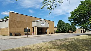
Melvindale Civic Center and John J. Kessey Fieldhouse
-
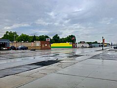
Shops on Allen Road

.jpg)
See also
 In Spanish: Melvindale (Míchigan) para niños
