
Canton, Michigan facts for kids
Quick facts for kids
Canton Township, Michigan
|
|
|---|---|
|
Charter township
|
|
| Charter Township of Canton | |

The Canton Municipal Building in 2010
|
|
| Motto(s):
"Michigan's Community of Vision!"
|
|

Location within Wayne County
|
|

Canton Township, Michigan
Location in Michigan

Canton Township, Michigan
Location in the United States
|
|
| Country | |
| State | |
| County | Wayne |
| Settled | 1825 |
| Organized | 1834 |
| Area | |
| • Charter township | 36.14 sq mi (93.6 km2) |
| • Land | 36.11 sq mi (93.5 km2) |
| • Water | 0.03 sq mi (0.08 km2) |
| Elevation | 679 ft (207 m) |
| Population
(2020)
|
|
| • Charter township | 98,659 |
| • Density | 2,732.2/sq mi (1,054.9/km2) |
| • Metro | 4,285,832 (Metro Detroit) |
| Time zone | UTC-5 (EST) |
| • Summer (DST) | UTC-4 (EDT) |
| ZIP code(s) |
48187, 48188
|
| Area code(s) | 734 |
| FIPS code | 26-13120 |
| GNIS feature ID | 1626030 |
Canton Township, often just called Canton, is a special type of town called a charter township in Wayne County, Michigan. It's a western suburb of Detroit, located about 23 miles (37 km) west of downtown Detroit. It's also about 15 miles (24 km) east of Ann Arbor.
In 2020, Canton had a population of 98,659 people. This makes it Michigan's second most populated township. It's also the ninth most populated city or town overall in Michigan. Canton is known for being a high-income area and is often ranked as one of the safest cities in Michigan and the U.S.
Contents
Communities in Canton
Canton Township is made up of a few smaller communities.
- Canton is a community within the township. The name often refers to the whole township. It has its own post office, which started in 1852.
- Cherry Hill is another community in the northwest part of the township. It has a mix of new neighborhoods and old historic buildings.
- Hoffman was a historic settlement located west of the city of Wayne in 1880.
- Sheldon (or Sheldon's Corners) is a community in the southern part of the township. It's on U.S. Highway 12. This community dates back to 1825, even before Canton Township was officially created. The Sheldon Inn was built here in 1825. Sheldon is a Michigan State Historic Site.
History of Canton Township
The area where Canton Township is located has a long history.
On March 7, 1834, the Michigan government officially created the Township of Canton. It was formed from a southern part of Plymouth Township. The township was named after the city of Canton in Imperial China. The first meeting to organize the township happened in April 1834.
In 2002, a bug called the emerald ash borer was found in Canton. This bug caused problems for ash trees in the Great Lakes region.
The Canton Historical Society and Museum opened in 1982. It's located in an old one-room schoolhouse.
On August 24, 2023, a small tornado hit Canton.
Geography
Canton Township covers about 36.14 square miles (93.60 km2). Most of this area is land, with only a tiny bit being water.
The southern part of the township is drained by the Lower River Rouge. The northeastern part is drained by Tonquish Creek and Garden Creek. These are all small rivers and streams.
Economy
Canton Township has many businesses and job opportunities.

Top Employers
Here are some of the biggest employers in Canton Township:
| # | Employer | # of Employees |
|---|---|---|
| 1 | Plymouth-Canton Community Schools | 1,957 |
| 2 | Yazaki North America | 970 |
| 3 | Walmart | 785 |
| 4 | A. D. Transport Express | 545 |
| 5 | Sysco Detroit | 404 |
| 6 | Charter Township of Canton | 373 |
| 7 | The Home Depot | 316 |
| 8 | IKEA | 301 |
| 9 | Target | 285 |
| 10 | Meijer | 265 |
The company Visible Ink Press, which publishes books, also has its main office in Canton.
Transportation
Canton has several ways to get around.
Major Highways
 I-275 runs north and south along the eastern side of the township.
 US 12 (Michigan Avenue) runs east and west through the southern part of the township.
 M-153 (Ford Road) runs east and west through the middle of the township.
Airport
- Canton–Plymouth Mettetal Airport is a public airport in the northeast part of the township.
Trails
- The I-275 Metro Trail is a path for bicycles that runs next to Interstate 275.
Education
Canton Township is served by three main school districts:
- Plymouth-Canton Community Schools (P-CCS) serves most of Canton.
- Wayne-Westland Community Schools serves the southeastern part.
- Van Buren Public Schools serves the southwestern part.
Schools in Canton
Wayne-Westland Community Schools
Some areas of Canton are part of the Wayne-Westland Community Schools. Students in these areas might go to Walker-Winter Elementary School in Canton or Roosevelt-McGrath Elementary School in Wayne. For middle school, they might attend Stevenson Middle School in Westland or Franklin Middle School in Wayne. High school students go to John Glenn High School in Westland or Wayne Memorial High School in Wayne.
Plymouth-Canton Community Schools
Many schools are part of the Plymouth-Canton Community Schools.
Elementary Schools
- Bentley Elementary School
- Bird Elementary School
- Dodson Elementary School
- Eriksson Elementary School
- Farrand Elementary School
- Field Elementary School
- Gallimore Elementary School
- Hoben Elementary School
- Hulsing Elementary School
- Isbister Elementary School
- Miller Elementary School
- Smith Elementary School
- Tonda Elementary School
- Workman Elementary School
Middle Schools
- Discovery Middle School
- East Middle School
- Liberty Middle School
- Pioneer Middle School
- West Middle School
High Schools
- Canton High School
- Plymouth High School
- Salem High School
- Starkweather Center (for alternative education)
These three high schools (Canton, Plymouth, and Salem) are all part of the Plymouth-Canton Educational Park.
Public Charter Schools
Canton also has several public charter schools:
- Canton Charter Academy
- Achieve Charter Academy
- South Canton Scholars Charter Academy
- Plymouth Scholars Charter Academy
- Canton Preparatory High School
Private Schools
There are also private schools in the area:
- All Saints Catholic School
- Plymouth Christian Academy
- Plymouth Canton Montessori
- Crescent Academy International
- Banyan Montessori Academy
Further Education
- Michigan Institute of Aviation and Technology offers programs for higher education.
Demographics
.jpg)
The population of Canton Township has grown a lot over the years.
| Historical population | |||
|---|---|---|---|
| Census | Pop. | %± | |
| 1850 | 1,333 | — | |
| 1860 | 1,547 | 16.1% | |
| 1870 | 1,350 | −12.7% | |
| 1880 | 1,392 | 3.1% | |
| 1890 | 1,184 | −14.9% | |
| 1900 | 1,218 | 2.9% | |
| 1910 | 1,113 | −8.6% | |
| 1920 | 1,219 | 9.5% | |
| 1930 | 1,583 | 29.9% | |
| 1940 | 2,111 | 33.4% | |
| 1950 | 3,761 | 78.2% | |
| 1960 | 5,313 | 41.3% | |
| 1970 | 11,057 | 108.1% | |
| 1980 | 48,616 | 339.7% | |
| 1990 | 57,047 | 17.3% | |
| 2000 | 76,366 | 33.9% | |
| 2010 | 90,173 | 18.1% | |
| 2020 | 98,659 | 9.4% | |
| 2023 (est.) | 98,041 | 8.7% | |
In 2010, there were 90,173 people living in Canton. About 29% of the population was under 18 years old. The average age was 33 years. Many families live in Canton, with about 63.4% of households being married couples.
The median income for a household in Canton was about $82,669 in 2007. This means half the households earned more than that, and half earned less. Only a small percentage of families and people were living below the poverty line.
Notable People
Many interesting people have come from Canton Township:
- Precious Adams, a ballet dancer.
- Andrew Bazzi, a singer-songwriter.
- Kyle Brindza, an American football player.
- Brian Calhoun, a former running back for the Detroit Lions.
- Paul Cotter, a professional ice hockey player.
- Alex Foster, a professional ice hockey player.
- Michael Jordan, a football player for the Carolina Panthers.
- Robert L. McKenzie, a policy analyst and scholar.
- Alec Pantaleo, a national champion in freestyle wrestling.
- Nathan Perkovich, a professional ice hockey player.
- Nate Robertson, a former MLB pitcher for the Detroit Tigers.
- Matt Roy, a professional ice hockey player.
- Allison Schmitt, an Olympic gold medalist swimmer.
- Jason Stollsteimer, a musician from the band The Von Bondies.
- Emily Turner, a professional basketball player.
- Charles Williams (ice hockey), a professional hockey player.
- James Wisniewski, a professional ice hockey player.
- Brandi Rhodes, a professional wrestling personality.
Gallery
-

The Village Theater
-
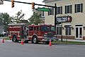
Canton Twp. Fire Rescue Truck
-
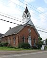
Cherry Hill United Methodist Church, erected 1882
-
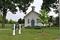
Cherry Hill School
-
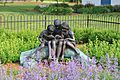
Bronze statue, Cherry Hill School
-
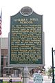
Cherry Hill School historical marker
-
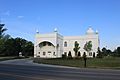
Gurudwara Sahib Sikh Temple, Canton Center Rd.


See also
 In Spanish: Municipio de Canton (Míchigan) para niños
