Hillsboro Gap facts for kids
Quick facts for kids Hillsboro Gap |
|
|---|---|
| The Gap in the Short Hill | |
| Elevation | 510 ft (155 m) |
| Traversed by | |
| Location | Loudoun County, Virginia, United States |
| Range | Short Hill Mountain Blue Ridge Mountains |
| Coordinates | 39°12′N 77°42′W / 39.2°N 77.7°W |
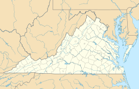
Hillsboro Gap is a special place in Loudoun County, Virginia. It's also called the Gap in the Short Hill. This gap is a natural opening in the Short Hill Mountain. It was formed by the North Fork of the Catoctin Creek. The town of Hillsboro is right inside this gap. Virginia State Route 9 runs through the gap and the town.
| Top - 0-9 A B C D E F G H I J K L M N O P Q R S T U V W X Y Z |
What is Hillsboro Gap?
Hillsboro Gap is a type of landform called a water gap. This means a river or stream has cut a path through a mountain ridge. In this case, the Catoctin Creek carved its way through the Short Hill Mountain. This created a natural passage. The gap is about 510 feet (155 meters) above sea level. It offers an easier way to travel through the mountains.
A Look at Its History
For a long time, Hillsboro Gap has been an important travel route. In the past, during colonial times, a main road passed through it. This road connected Alexandria to Winchester. It was known as Vestal's Gap Road.
Over time, this historic road changed. It became the Charles Town Pike. Today, it is part of Virginia State Route 9. This shows how important the gap has always been for connecting different places.
Traveling Through the Gap
Today, Virginia Route 9 still uses Hillsboro Gap. However, the historic town of Hillsboro fills the gap completely. This makes it hard to make the road wider. The road can get very busy. To expand Route 9, it might need to go around or even over the Short Hill Mountain. This shows the challenge of balancing modern needs with preserving history.
 | Delilah Pierce |
 | Gordon Parks |
 | Augusta Savage |
 | Charles Ethan Porter |


