
Holway, Wisconsin facts for kids
Quick facts for kids
Holway, Wisconsin
|
|
|---|---|
 |
|

Location of Holway, Wisconsin
|
|
| Country | |
| State | |
| County | Taylor |
| Area | |
| • Total | 36.4 sq mi (94.2 km2) |
| • Land | 36.4 sq mi (94.2 km2) |
| • Water | 0.0 sq mi (0.0 km2) |
| Elevation | 1,335 ft (407 m) |
| Population
(2000)
|
|
| • Total | 854 |
| • Density | 23.5/sq mi (9.1/km2) |
| Time zone | UTC-6 (Central (CST)) |
| • Summer (DST) | UTC-5 (CDT) |
| Area code(s) | 715 & 534 |
| FIPS code | 55-35525 |
| GNIS feature ID | 1583406 |
| PLSS township | T30N R1W |
Holway is a small town located in Taylor County, Wisconsin, in the United States. In the year 2000, about 854 people lived there.
Contents
Exploring Holway's Geography
Holway covers an area of about 36.4 square miles (94.2 square kilometers). Almost all of this area is land, with very little water. The land here is mostly flat. It was not touched by the last glacier that shaped areas to the north. The soil in most of Holway is called Merrill till.
Holway's Past: A Look at Its History
Early Surveys and First Descriptions
The area that is now Holway was first mapped in the summer of 1847. This was done by a team working for the U.S. government. In 1854, another team marked all the section corners in the township. They walked through forests and swamps, using chains and compasses.
After their work, the surveyor described the area. He said the land was mostly flat and the soil was not very rich. He noted that the area had many hemlock and birch trees. There were also a few white pine trees, but they were not very good quality. The surveyor also mentioned many small streams with clean water. At that time, there were no settlers living in the township.
How Holway Became a Town
When Taylor County was formed in 1875, the area that would become Holway was part of a larger town called Little Black. An 1880 map showed no roads in the Holway area yet. However, two roads reached its eastern edge from nearby communities. The map also showed one farm in section 29, owned by A.E. Sawyer, a logging businessman.
The town of Holway was officially separated in 1895. It was first named Pine-lake. Later, its name was changed to Holway. This new name honored Nymphus B. Holway, who was a wealthy lumberman from Maine.
Growth and Development in Holway
By 1900, a lot of settlement activity was happening in Holway. The main road network was mostly finished in the eastern part of the town. A wagon road, similar to modern Elm Avenue, crossed the entire town. Another road, like Apple Avenue today, reached almost to the western end. Settlers began building their homes along these new roads.
The 1900 map also showed two rural schools and a church on Apple Avenue. It seems there were two more schools along Elm Avenue. There were also two sawmills in the southern part of the town. Holway's Dam was marked on Trappers Creek. The western part of the town still had fewer settlers. J.M. Holway owned most of the land there. The Wisconsin Central Railroad also owned some land. This land was given to them for building the railroad in the 1870s.
By 1911, the plat map showed even more settlers. Roads had also been extended further. A sawmill was still operating at Holway's dam. The western end of the town still had fewer people. N.B. Holway and Benson & Anderton were the biggest landowners there.
Amish Community in Holway
Amish families started moving to Holway in 1921. They first came from Kansas, and then from other places. In the early years, they bought land that had been cleared of trees for $30 per acre. These families are Old Order Amish. They call themselves the Curtiss Colony, and their community is centered in Holway. By 1974, this colony had grown and was divided into several church districts.
Holway's Population: Demographics
As of the census in 2000, there were 854 people living in Holway. These people lived in 263 households, and 213 of these were families. The town had about 23.5 people per square mile (9.1 people per square kilometer). Most of the people (99.77%) were White. A small number were Native American or from two or more races.
Many households (42.2%) had children under 18 living with them. Most households (67.7%) were married couples living together. About 16.7% of all households were made up of individuals living alone.
The population was spread out by age:
- 32.4% were under 18 years old.
- 10.9% were between 18 and 24.
- 30.7% were between 25 and 44.
- 17.3% were between 45 and 64.
- 8.7% were 65 years or older.
The average age in the town was 30 years.
The median income for a household in Holway was $37,500. For families, the median income was $44,464. About 14.9% of families and 20.8% of the total population lived below the poverty line. This included 23.3% of those under 18 and 25.0% of those aged 65 or older.
Images for kids
-
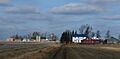
Farms in Holway, Wisconsin
-
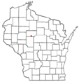
Location of Holway, Wisconsin
See also
 In Spanish: Holway (Wisconsin) para niños
