Home Place, Indiana facts for kids
Quick facts for kids
Home Place, Indiana
|
|
|---|---|
|
Neighborhood
|
|
 |
|

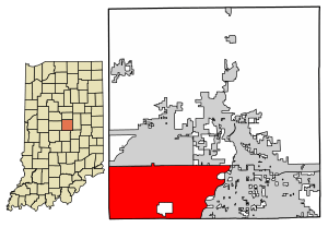
Map of Hamilton County showing Home Place within the city limits of Carmel
|
|
| Country | United States |
| State | Indiana |
| County | Hamilton |
| Settled | 1832 |
| Town plotted | 1914 |
| Area | |
| • Total | 1.59 sq mi (4.1 km2) |
| • Land | 1.57 sq mi (4.1 km2) |
| • Water | 0.02 sq mi (0.05 km2) 1.26% |
| Elevation | 846 ft (258 m) |
| Time zone | UTC-5 (EST) |
| • Summer (DST) | UTC-5 (EST) |
| ZIP codes |
46280
|
| Area code(s) | 317, 463 |
| GNIS feature ID | 436367 |
| Website | Home Place, Indiana website |
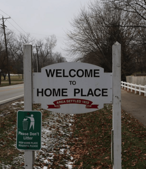
Home Place is a neighborhood located in the city of Carmel, Indiana, in the United States. Before 2018, it was an independent community. It covered about 1,017 acres in Clay Township, Hamilton County, Indiana.
For many years, Home Place residents did not want to become part of Carmel. Carmel had tried to add Home Place to its city limits since 2004. In June 2016, a judge decided that Carmel could go ahead with the plan. This decision was supported by the Indiana Court of Appeals in October 2017. Finally, on March 1, 2018, Home Place officially became part of Carmel.
History of Home Place
Home Place was first planned in 1914. It was built along an old electric train line called the Union Traction interurban line. This line connected Indianapolis to places further north.
Even though Home Place is now part of Carmel, it still uses its original Indianapolis postal code. Mail for Home Place is delivered by the Nora, Indianapolis post office. This post office is located in nearby Marion County, Indiana.
 | Delilah Pierce |
 | Gordon Parks |
 | Augusta Savage |
 | Charles Ethan Porter |

