
Homewood, Pennsylvania facts for kids
Quick facts for kids
Homewood, Pennsylvania
|
|
|---|---|

Old Homewood Park
|
|

Location in Beaver County and the U.S. state of Pennsylvania.
|
|
| Country | United States |
| State | Pennsylvania |
| County | Beaver |
| Settled | 1859 |
| Incorporated | 1910 |
| Government | |
| • Type | Borough Council |
| Area | |
| • Total | 0.17 sq mi (0.44 km2) |
| • Land | 0.17 sq mi (0.44 km2) |
| • Water | 0.00 sq mi (0.00 km2) |
| Elevation | 971 ft (296 m) |
| Population
(2020)
|
|
| • Total | 104 |
| • Density | 615.38/sq mi (236.99/km2) |
| Time zone | UTC-5 (Eastern (EST)) |
| • Summer (DST) | UTC-4 (EDT) |
| Zip code |
15208
|
| Area code(s) | 724 |
| FIPS code | 42-35488 |
Homewood is a small town, also called a borough, located in northern Beaver County, Pennsylvania, United States. In 2020, only 104 people lived there, making it a very small community! It is also part of the larger Pittsburgh area.
Contents
Exploring Homewood's Location and Features
Homewood is found in the northern part of Beaver County. It is completely surrounded by another town called Big Beaver.
A major highway, the Pennsylvania Turnpike (Interstate 76), goes through the northeast part of Homewood. A state road, Pennsylvania Route 18, also runs along the eastern edge of the borough.
Homewood's Size and Natural Wonders
According to official measurements, Homewood covers a total area of about 0.44 square kilometers (0.17 square miles), and all of it is land.
The borough is home to a beautiful waterfall called Buttermilk Falls. This name was given to it in 1870. The water from the falls drops into a natural pool made of solid sandstone. This special sandstone layer is even named after the town; it's called the Homewood Formation.
Water from Homewood flows into Clarks Run, which then joins the Beaver River nearby.

People Living in Homewood
| Historical population | |||
|---|---|---|---|
| Census | Pop. | %± | |
| 1880 | 267 | — | |
| 1920 | 310 | — | |
| 1930 | 343 | 10.6% | |
| 1940 | 357 | 4.1% | |
| 1950 | 316 | −11.5% | |
| 1960 | 305 | −3.5% | |
| 1970 | 212 | −30.5% | |
| 1980 | 188 | −11.3% | |
| 1990 | 162 | −13.8% | |
| 2000 | 147 | −9.3% | |
| 2010 | 109 | −25.9% | |
| 2020 | 104 | −4.6% | |
| 2021 (est.) | 103 | −5.5% | |
| Sources: | |||
In 2000, there were 147 people living in Homewood, making up 59 households and 37 families. The town had 62 housing units in total.
Most people living in Homewood are White (about 94.5%). A small number of residents are African American (2%) or Native American (3.4%).
Homewood Households and Families
Out of the 59 households, about 15% had children under 18 living with them. Nearly half (47.5%) were married couples. Some households (10.2%) had a female head without a husband present. About 35.6% of households were not families.
Almost 29% of all households were made up of single individuals. About 8.5% of households had someone living alone who was 65 years old or older. On average, each household had about 2.5 people, and families had about 3 people.
Age Groups in Homewood
The population in Homewood is spread across different age groups. About 15% of the people are under 18 years old. Around 13.6% are between 18 and 24. The largest group, about 26.5%, is between 25 and 44. People aged 45 to 64 make up about 27.9% of the population. Finally, about 17% of the residents are 65 years old or older. The average age in Homewood is 42 years.

Education for Homewood Students
Children who live in Homewood attend schools within the Big Beaver Falls Area School District. The schools that serve students from Homewood are:
- Big Beaver Elementary School – for students in kindergarten through 5th grade.
- Beaver Falls Middle School – for students in 6th, 7th, and 8th grades.
- Beaver Falls High School – for older students in 9th through 12th grades.
Images for kids
-
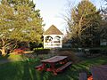
Old Homewood Park
-
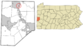
Location in Beaver County and the U.S. state of Pennsylvania.
See also
 In Spanish: Homewood (Pensilvania) para niños
