Horsepen Creek (Little Nottoway River tributary) facts for kids
Quick facts for kids Horsepen Creek |
|
|---|---|
|
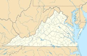
Location of Horsepen Creek mouth with Little Nottoway River
|
|
| Other name(s) | Tributary to the Little Nottoway River |
| Country | United States |
| State | Virginia |
| County | Nottoway |
| Physical characteristics | |
| Main source | divide between Horsepen Creek and Nottoway River about 0.1 miles east of Winnie, Virginia 460 ft (140 m) 37°04′29″N 078°07′46″W / 37.07472°N 78.12944°W |
| River mouth | Little Nottoway River about 2 miles southwest of Blackstone, Virginia 239 ft (73 m) 37°02′39″N 078°02′32″W / 37.04417°N 78.04222°W |
| Length | 6.56 mi (10.56 km) |
| Basin features | |
| Progression | generally southeast |
| River system | Nottoway River |
| Basin size | 7.17 square miles (18.6 km2) |
| Tributaries |
|
| Waterbodies | Lake Amtoco |
| Bridges | Doswell Road |
Horsepen Creek is a small stream, about 6.56 miles (10.56 km) long, located in the state of Virginia in the United States. It flows into the Little Nottoway River. This creek is an important part of the larger Chowan-Albemarle drainage system, which means its waters eventually flow towards the Albemarle Sound. The area around Horsepen Creek is mostly covered by forests and farms.
Contents
Where Does Horsepen Creek Flow?
Horsepen Creek starts its journey about 0.1 miles (0.16 km) east of a place called Winnie, Virginia. This starting point is on the high ground that separates Horsepen Creek from the Nottoway River.
The Creek's Path
From its source, the creek generally flows towards the southeast and then east. On its way, it passes through a body of water known as Lake Amtoco. Finally, Horsepen Creek joins the Little Nottoway River about 2 miles (3.2 km) southwest of Blackstone.
Understanding the Horsepen Creek Watershed
A watershed is like a giant bowl or basin where all the rain and snowmelt drain into a common stream, river, or lake. The Horsepen Creek watershed covers an area of about 7.17 square miles (18.6 square kilometers).
What is a Watershed?
Imagine dropping a raindrop anywhere within this 7.17 square mile area. That raindrop would eventually flow into Horsepen Creek. This entire area is called the watershed.
Rainfall and Land Use
The Horsepen Creek watershed receives about 45.6 inches (116 cm) of rain each year. A large part of this area, about 76%, is covered by forests. The rest of the land is used for farming or other purposes.
 | John T. Biggers |
 | Thomas Blackshear |
 | Mark Bradford |
 | Beverly Buchanan |


