
Horseshoe Pass facts for kids
Quick facts for kids Horseshoe Pass |
|
|---|---|
| Welsh: Bwlch yr Oernant | |
 |
|
| Elevation | 417 m (1,368 ft) |
| Location | Denbighshire, north-east Wales |
| Coordinates | 53°00′49″N 3°12′58″W / 53.0135°N 3.2162°W |
The Horseshoe Pass is a famous mountain pass in north-east Wales, found in Denbighshire. Its Welsh name is Welsh: Bwlch yr Oernant, which means "Pass of the Cold Stream." This pass gets its English name because the road winds around a valley in a shape like a horseshoe!
The Horseshoe Pass sits between two mountains. To the west is Llantysilio Mountain. To the east is Cyrn-y-Brain, which is 565 metres (1,854 feet) tall. The A542 road goes right through the pass, connecting the towns of Llandegla and Llangollen. At its highest point, the road reaches 417 metres (1,368 feet) above sea level.
Contents
Exploring the Horseshoe Pass
The Horseshoe Pass is a popular spot for many reasons. It offers amazing views and is a great place to visit if you love the outdoors.
A Road with History
The road through the Horseshoe Pass was built a long time ago, back in 1811. It was originally a "turnpike" road. This meant people had to pay a fee to use it, which helped pay for its upkeep.
Just like other roads in the Clwydian Range area, you might sometimes see sheep wandering on the road. Drivers need to be careful! Also, because it's high up, the road can sometimes close in winter due to heavy snow or even small landslides.
Fun at the Pass
At the highest point of the pass, you'll find the Ponderosa Cafe. This cafe is very well-known and a favorite stop for many visitors. The pass and the cafe are especially popular with people who enjoy cycling and motorcycling.
If you love hiking, there are many walking paths and routes nearby to explore. You can also find several campsites in the area, making it a great place for a longer outdoor adventure.
Nature's Challenges
In 2018, the area around the Horseshoe Pass faced a big challenge. Wildfires broke out on July 19th and continued for a long time, until September 25th. These fires sadly damaged a large amount of land, about 715 acres.
Gallery
-
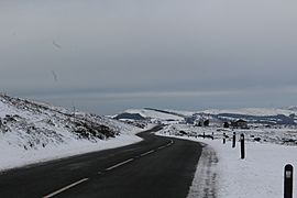
A winter view of the pass and the Ponderosa Cafe
-
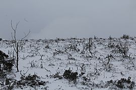
Scrubland covered in snow
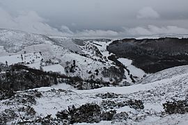
-
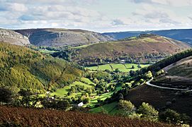
The Eglwyseg valley seen from Horseshoe Pass
-
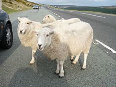
Sheep resting in a lay-by
-
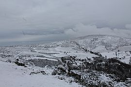
Looking north-east from the pass
-
Looking south-east from the pass


.jpg)


