Houghton Bay facts for kids
Quick facts for kids Houghton Bay / Valley |
|
|---|---|
 |
|
| Basic information | |
| Local authority | Wellington City |
| Coordinates | 41°21′S 174°47′E / 41.350°S 174.783°E |
| Surrounds | |
| North | Melrose |
| South | Cook Strait |
| West | Island Bay |
| Northwest | Southgate |
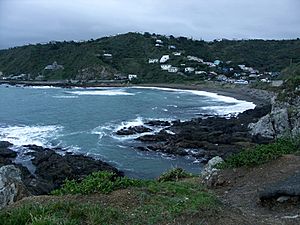
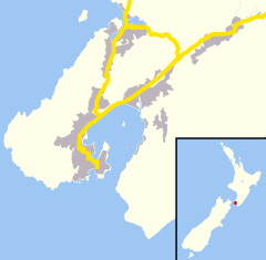
Houghton Bay and Valley is a cool suburb in the southern part of Wellington, New Zealand. It sits right between Island Bay and Lyall Bay. This area is known for its rocky coastline along the Cook Strait. It has two main beaches, Houghton Bay and Princess Bay, which are super popular for surfing, swimming, and diving.
Contents
A Look Back in Time
Houghton Bay got its name from Captain Robert Houghton. He was in charge of the powder magazine on Matiu / Somes Island. Later, he managed the signal station at Mount Albert, which is a hill above Houghton Bay.
In the 1800s, a person known as The Hermit of Island Bay lived in a cave nearby.
What Makes Houghton Bay Special?
Houghton Bay and Valley is mostly a place where people live. But it also has some great outdoor spots and community places.
Outdoor Adventures
You can find the southern part of Wellington's Southern Walkway here. This is a walking track that offers amazing views. There's also the Buckley Road reserve, a nice green space to explore.
The area is a fantastic spot for recreational diving. It's part of the Taputeranga Marine Reserve, which protects the ocean life. In 2005, a old navy ship called HMNZS Wellington was sunk off Houghton Bay. It's now an artificial reef and a popular place for divers to explore. Houghton Bay is also a top surfing spot, just like nearby Lyall Bay.
Nature and Views
Houghton Valley and Bay are home to many musicians and artists. You can also find the Haewai Meadery and a Wind Farm here.
On the hill overlooking the ocean waves is The Pines. This is a local venue for dancing and dining.
If you're lucky, you might even see the Aurora Australis (also known as the Southern Lights) from here. The hills along the coast help block out some of the city lights. This makes it easier to see the beautiful, glowing sky. Remember, most aurora displays are faint at this latitude, so a very dark sky is needed.
Learning in Houghton Valley
Houghton Valley School is a public primary school for students from Year 1 to Year 6. It's a co-educational school, meaning both boys and girls attend. As of , the school has February 2024 students.
 | James Van Der Zee |
 | Alma Thomas |
 | Ellis Wilson |
 | Margaret Taylor-Burroughs |


