Houston River (Louisiana) facts for kids
Quick facts for kids Houston River |
|
|---|---|
| Country | United States |
| State | Louisiana |
| City | Near Starks to Westlake |
| Physical characteristics | |
| Main source | Confluence of bayous/forests/Bear Head Creek Near Starks in Calcasieu Parish, Louisiana, United States 30°20′01″N 93°37′47″W / 30.3337°N 93.6298°W |
| River mouth | West Fork Calcasieu River Near Westlake in Calcasieu, Calcasieu Parish, Louisiana, United States 30°17′41″N 93°16′28″W / 30.2948°N 93.2745°W |
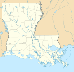
The Houston River is a waterway located in Louisiana, United States. It starts near a town called Starks in Calcasieu Parish. The river begins where Bear Head Creek meets LA 12.
The Houston River flows through the landscape until it reaches its end. It joins another river, the West Fork Calcasieu River. This meeting point is found on the southwest edge of Sam Houston Jones State Park.
What's in a Name? Other Names for Houston River
The Houston River has a couple of other names! Sometimes people call it Houston Creek. It is also sometimes mistakenly called the West Fork Calcasieu River.
The U.S. government has a group called the Geographic Names Information System (GNIS). This group actually considers the Houston River to be a stream. A stream is a smaller flowing body of water.
Where Does the Water Go? The River's Basin
Every river has a 'drainage basin.' This is an area of land where all the rain and snowmelt eventually flow into that river. Think of it like a giant funnel.
The Houston River is part of a larger area called the Calcasieu-Mermentau Basin. It is also a smaller part, or 'sub-basin,' of the West Fork Calcasieu area. This system helps organize how water flows across the land.
 | Kyle Baker |
 | Joseph Yoakum |
 | Laura Wheeler Waring |
 | Henry Ossawa Tanner |


