Howard, Georgia facts for kids
Quick facts for kids
Howard, Georgia
|
|
|---|---|
| Country | United States |
| State | Georgia |
| County | Taylor |
| Area | |
| • Total | 2.91 sq mi (7.54 km2) |
| • Land | 2.89 sq mi (7.49 km2) |
| • Water | 0.02 sq mi (0.05 km2) |
| Elevation | 584 ft (178 m) |
| Population
(2020)
|
|
| • Total | 50 |
| • Density | 17.28/sq mi (6.67/km2) |
| Time zone | UTC-5 (Eastern (EST)) |
| • Summer (DST) | UTC-4 (EDT) |
| ZIP code |
31039
|
| Area code(s) | 478 |
| GNIS feature ID | 2587037 |
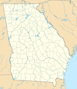
Howard is a small place in Taylor County, Georgia, United States. It's known as an unincorporated community, which means it's not officially a city or town with its own local government. It's also a census-designated place (CDP), which is an area the government defines for counting people during a census. In 2020, 50 people lived in Howard.
Howard has its own post office with the ZIP code 31039. A main road, Georgia State Route 96, goes right through the community.
Population Changes in Howard
Howard was first counted as a census-designated place in the 2010 census. Back then, 110 people lived there. By the 2020 census, the population had decreased to 50 people.
| Historical population | |||
|---|---|---|---|
| Census | Pop. | %± | |
| 2010 | 110 | — | |
| 2020 | 50 | −54.5% | |
| U.S. Decennial Census 1850-1870 1870-1880 1890-1910 1920-1930 1940 1950 1960 1970 1980 1990 2000 2010 2020 |
|||
Who Lives in Howard?
The U.S. Census collects information about the people living in different places. This helps us understand the community better. In Howard, the population is mostly made up of people who identify as White. In 2020, about 74% of the residents were White. There were also smaller numbers of people identifying as Black or African American, Asian, and those of mixed races. About 14% of the population identified as Hispanic or Latino in 2020.
See also
 In Spanish: Howard (Georgia) para niños
 | Bayard Rustin |
 | Jeannette Carter |
 | Jeremiah A. Brown |


