Hoytville, Ohio facts for kids
Quick facts for kids
Hoytville, Ohio
|
|
|---|---|
|
Village
|
|

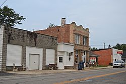
Main Street (State Routes 18/235)
|
|

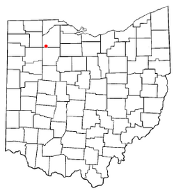
Location of Hoytville, Ohio
|
|

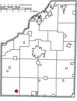
Location of Hoytville in Wood County
|
|
| Country | United States |
| State | Ohio |
| County | Wood |
| Township | Jackson |
| Area | |
| • Total | 0.75 sq mi (1.95 km2) |
| • Land | 0.74 sq mi (1.92 km2) |
| • Water | 0.01 sq mi (0.03 km2) |
| Elevation | 709 ft (216 m) |
| Population
(2020)
|
|
| • Total | 220 |
| • Density | 296.90/sq mi (114.57/km2) |
| Time zone | UTC-5 (Eastern (EST)) |
| • Summer (DST) | UTC-4 (EDT) |
| ZIP code |
43529
|
| Area code(s) | 419 |
| FIPS code | 39-36568 |
| GNIS feature ID | 2398551 |
Hoytville is a small village located in Wood County, Ohio, in the United States. In 2020, about 220 people lived there.
Contents
History of Hoytville
Hoytville was officially mapped out in 1873. This happened when a railroad line was built to reach that area. The village got its name from William Hoyt. He was one of the first owners of the land where the town was built.
Before it was called Hoytville, it was known as Hoyts Corners. A post office opened there in 1872 under the name Hoyts Corners. The name changed to Hoytville in 1874. The village became an official town in 1886.
Geography of Hoytville
Hoytville is a small place. According to the United States Census Bureau, the village covers a total area of about 0.75 square miles. Most of this area, about 0.74 square miles, is land. A very small part, about 0.01 square miles, is water.
Population and People in Hoytville
The number of people living in Hoytville has changed over the years. Here's a look at the population from different census counts:
| Historical population | |||
|---|---|---|---|
| Census | Pop. | %± | |
| 1890 | 395 | — | |
| 1900 | 431 | 9.1% | |
| 1910 | 404 | −6.3% | |
| 1920 | 367 | −9.2% | |
| 1930 | 341 | −7.1% | |
| 1940 | 361 | 5.9% | |
| 1950 | 340 | −5.8% | |
| 1960 | 334 | −1.8% | |
| 1970 | 403 | 20.7% | |
| 1980 | 315 | −21.8% | |
| 1990 | 301 | −4.4% | |
| 2000 | 296 | −1.7% | |
| 2010 | 303 | 2.4% | |
| 2020 | 220 | −27.4% | |
| U.S. Decennial Census | |||
Hoytville Population in 2010
In 2010, there were 303 people living in Hoytville. These people lived in 96 different homes. About 77 of these homes were families. The village had about 409 people per square mile. There were 105 housing units in total.
Most people in Hoytville were White, making up about 89.8% of the population. There were also people who identified as African American, Native American, and Asian. About 15.8% of the population identified as Hispanic or Latino.
Many homes had children under 18 living there, about 50%. The average age of people in the village was 33.8 years old. About 33.3% of residents were under 18. About half of the population was male (50.2%) and half was female (49.8%).
See also
 In Spanish: Hoytville (Ohio) para niños
 | James B. Knighten |
 | Azellia White |
 | Willa Brown |

