Huaral facts for kids
Quick facts for kids
Huaral
|
|||
|---|---|---|---|
|
|||
| Nickname(s):
"Capital de la Agricultura" (Capital of the Agriculture)
|
|||
| Country | |||
| Region | Lima | ||
| Province | Huaral | ||
| District | Huaral | ||
| Elevation | 188 m (617 ft) | ||
| Population
(2017)
|
|||
| • Total | 99,915 | ||
| Demonym(s) | Huaralino/a | ||
| Time zone | UTC-5 (PET) | ||
| Website | www.munihuaral.gob.pe | ||
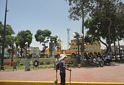
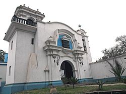
Huaral is a lively town located in the central part of Peru. It is the main city and capital of the Huaral Province, which is part of the Department of Lima. Huaral is often called the "Capital of Agriculture" because farming is very important there. In 2017, about 99,915 people lived in Huaral. People from Huaral are called Huaralino (for boys and men) or Huaralina (for girls and women).
Contents
What Does the Name Huaral Mean?
The name Huaral has an interesting history, with two main ideas about where it came from:
The Cacique's Name
- One idea comes from historian Jesus Elias Ipinze. He believes the name Huaral came from a local leader, or cacique, named Martín Guaral Paico. A cacique was like a chief or important person in the community back in the 1500s. Over time, the name Guaral might have changed into Huaral.
Aymara Language Roots
- Another idea comes from archaeologist Julio C. Tello. He thought the name Huaral came from older Aymara words. These words could be huaralí, huararo, huararí, or huallalí. Aymara is a language spoken by some native people in the Andes Mountains.
Where is Huaral Located?
Huaral is found north of Lima, the capital city of Peru. It is about 80 kilometers (50 miles) away from Lima.
Geographical Features of Huaral
- The city's land starts near the coast, around kilometer 58 of the North Panamerican Highway. This area is known for a winding road called "Serpentín de Pasamayo."
- Huaral's territory stretches across the Chancay valley. This valley is very important for farming.
- The land also reaches up to the high mountains, including peaks like Vichaycocha. This is where the Chackal or Pasacmayo River, also known as the "Moon River," begins.
A Brief History of Huaral
Huaral has a long and rich history, going back even before the Spanish arrived in Peru.
Early Communities: Guaral Viejo
- Before the Spanish came, the area where Huaral is now was home to groups of people called ayllus. An ayllu was a traditional community or family group in the Andes. The Spanish later called this early settlement "Guaral Viejo," meaning "Old Guaral."
Founding by the Spanish
- Huaral was officially founded by the Spanish on March 21, 1551. At that time, Antonio de Mendoza was the Viceroy of Peru. The Spanish named the new town "San Juan de Guaral" and called it a "Settlement of the Indies."
- After it was founded, Huaral grew stronger. People focused on farming, which helped the town become an important trading center during the time of the Spanish colony.
Becoming an Independent Province
- For a while, Huaral was connected to the nearby town of Chancay. But as Huaral grew, it became strong enough to be its own independent town.
- This independence was officially recognized by President Remigio Morales Bermúdez. He signed a special order, called a decree, on October 31, 1890, creating the new province of San Juan de Huaral.
- Even though the province was created in 1890, the first local government, or municipality, was set up a few years later on April 1, 1893.
See also
 In Spanish: Huaral para niños
Black History Month on Kiddle
Famous African-American Scientists:
 | Percy Lavon Julian |
 | Katherine Johnson |
 | George Washington Carver |
 | Annie Easley |

All content from Kiddle encyclopedia articles (including the article images and facts) can be freely used under Attribution-ShareAlike license, unless stated otherwise. Cite this article:
Huaral Facts for Kids. Kiddle Encyclopedia.


