Hudson Branch (Hyco River tributary) facts for kids
Quick facts for kids Hudson Branch |
|
|---|---|
|
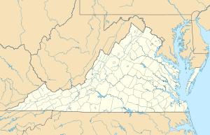
Location of Hudson Branch mouth
|
|
| Other name(s) | Tributary to Hyco River |
| Country | United States |
| State | Virginia |
| County | Halifax |
| Physical characteristics | |
| Main source | Grassy Creek divide pond in Centerville, Virginia 448 ft (137 m) 36°38′36″N 078°51′27″W / 36.64333°N 78.85750°W |
| River mouth | Hyco River about 2.5 miles southeast of Centerville, Virginia 320 ft (98 m) 36°37′58″N 078°49′21″W / 36.63278°N 78.82250°W |
| Length | 2.19 mi (3.52 km) |
| Basin features | |
| Progression | southeast |
| River system | Roanoke River |
| Basin size | 2.12 square miles (5.5 km2) |
| Tributaries |
|
| Bridges | none |
Hudson Branch is a small but important stream located in Halifax County, Virginia. It's like a smaller helper stream that flows into a bigger river. This stream is about 2.19 mi (3.52 km) long. It eventually joins the Hyco River, which is part of the larger Roanoke River system.
The Journey of Hudson Branch
Hudson Branch begins its journey in a pond near a place called Centerville, Virginia. From there, it flows towards the southeast. After traveling for about 2.5 miles (4 kilometers), it meets and joins the Hyco River.
What is a Watershed?
Every stream and river has something called a watershed. Think of a watershed as all the land area where rainwater or snowmelt drains into a specific stream or river. For Hudson Branch, its watershed covers about 2.12 square miles (5.5 km2) (5.5 square kilometers) of land. This area gets about 45.7 inches (116 centimeters) of rain each year. A big part of this watershed, about 67%, is covered by forests.
 | William M. Jackson |
 | Juan E. Gilbert |
 | Neil deGrasse Tyson |


