
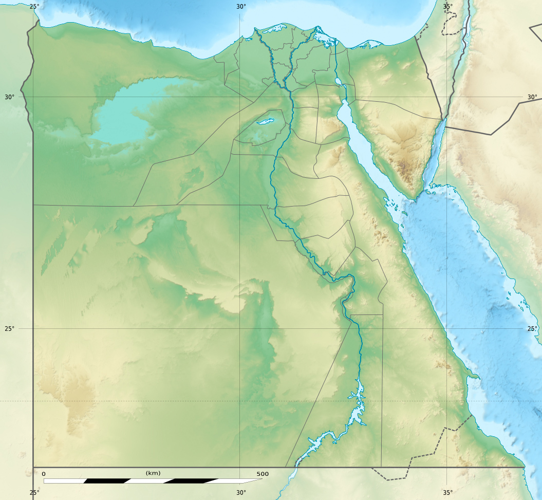
Image: Egypt relief location map
Description: Physical location map of Egypt. Showing new governorate boundaries since 14 April 2011, after the dissolution of the 6th of October and Helwan Governorates. Also showing the Libyan Desert and its northern Qattara Depression, and the northern Eastern Desert.
Title: Egypt relief location map
Credit: Topographic background map: Own work Source of data: SRTM30 Plus All other data taken from File:Egypt_location_map.svg created by NordNordWest under GFDL/CC-BY-SA 3.0
Author: Eric Gaba (Sting - fr:Sting) and NordNordWest
Permission: Attribution and Share-Alike required Any use of this map can be made as long as you credit me (Eric Gaba – Wikimedia Commons user: Sting) and Wikimedia Commons user: NordNordWest as the authors and distribute the copies and derivative works under the same license(s) that the one(s) stated below. A message with a reply address would also be greatly appreciated.
Usage Terms: Creative Commons Attribution-Share Alike 3.0
License: CC BY-SA 3.0
License Link: https://creativecommons.org/licenses/by-sa/3.0
Attribution Required?: Yes
Image usage
The following 12 pages link to this image:
