
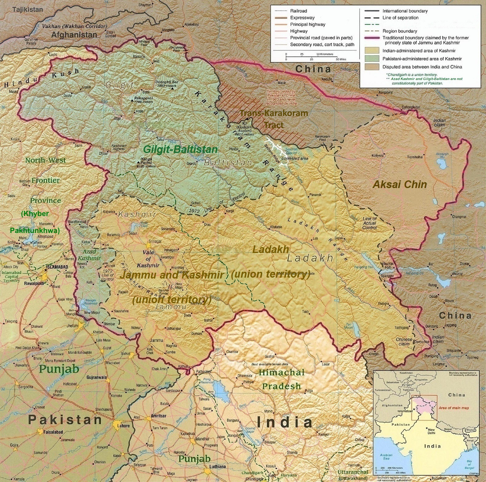
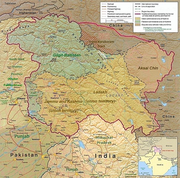
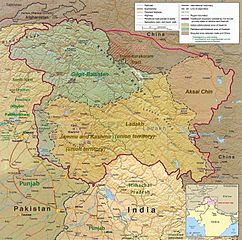
Image: Kashmir Region November 2019
Size of this preview: 604 × 599 pixels. Other resolutions: 242 × 240 pixels | 1,579 × 1,566 pixels.
Original image (1,579 × 1,566 pixels, file size: 1.27 MB, MIME type: image/jpeg)
Description: A map of the disputed region created by the US Central Intelligence Agency and hosted by the University of Texas-Austin Perry-Castañeda Library Map Collection; altered to show new jurisdictions,[1][2][3][4] by Fowler&fowler (talk) 06:29, 14 November 2019 (UTC)
Title: Kashmir Region November 2019
Credit: Map of Kashmir region created by the US Central Intelligence Agency, 2004; altered by Fowler&fowler (talk) 06:29, 14 November 2019 (UTC)
Author: US Central Intelligence Agency
Usage Terms: Public domain
License: Public domain
Attribution Required?: No
Image usage
The following 6 pages link to this image:

All content from Kiddle encyclopedia articles (including the article images and facts) can be freely used under Attribution-ShareAlike license, unless stated otherwise.