
Image: Map Pick–Sloan Missouri Basin Program

Size of this preview: 800 × 534 pixels. Other resolutions: 320 × 213 pixels | 1,892 × 1,262 pixels.
Original image (1,892 × 1,262 pixels, file size: 2.27 MB, MIME type: image/png)
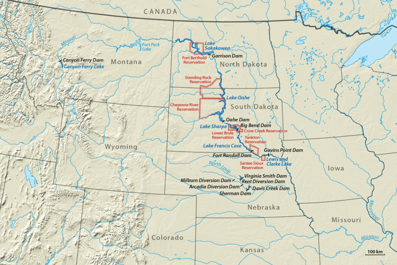
Description: Missouri River stretching from Montana to Missouri with dams and reservoirs built in the Pick–Sloan Program and Indian reservations affected by reservoir flooding (red)
Title: Map Pick–Sloan Missouri Basin Program
Credit: Own work using: World Data Base II data GTOPO30 data
Author: NordNordWest
Usage Terms: Creative Commons Attribution-Share Alike 3.0 de
License: CC BY-SA 3.0 de
License Link: https://creativecommons.org/licenses/by-sa/3.0/de/deed.en
Attribution Required?: Yes
Image usage
The following 6 pages link to this image:

All content from Kiddle encyclopedia articles (including the article images and facts) can be freely used under Attribution-ShareAlike license, unless stated otherwise.