
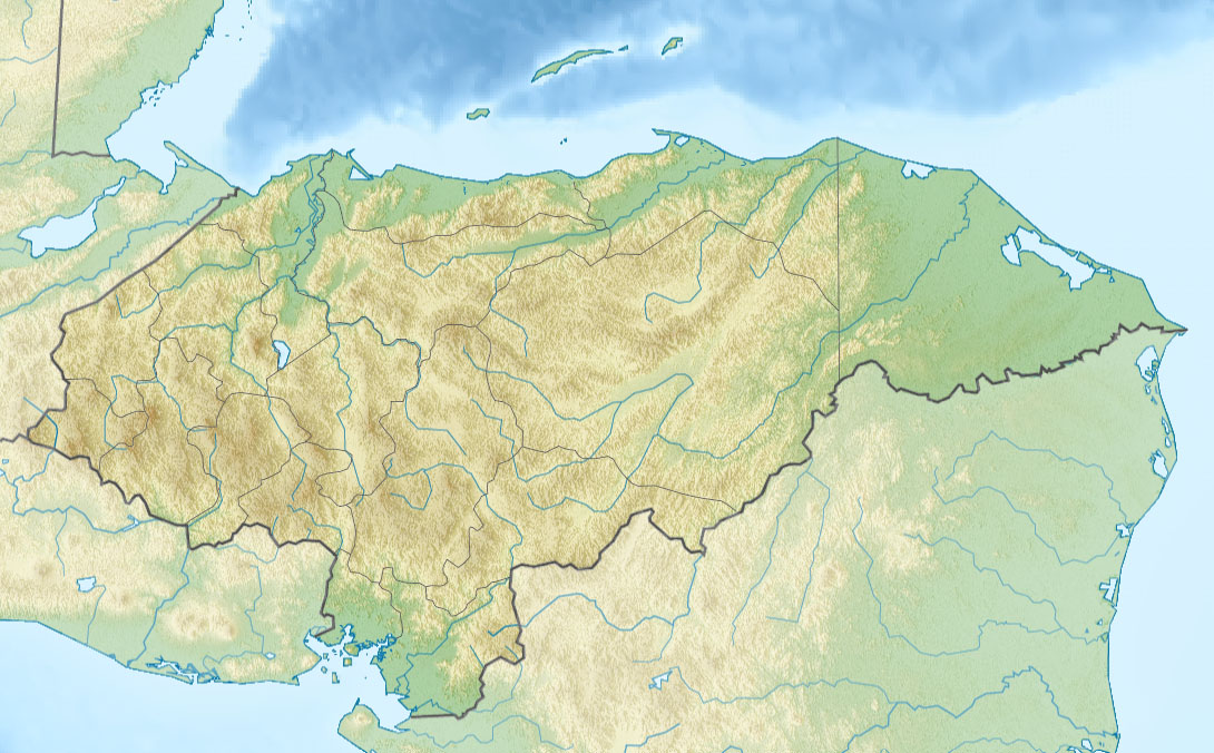
Image: Relief map of Honduras
Size of this preview: 800 × 496 pixels. Other resolutions: 320 × 198 pixels | 1,090 × 676 pixels.
Original image (1,090 × 676 pixels, file size: 221 KB, MIME type: image/jpeg)
Description: Физическая карта Гондураса Проекция — равноугольная цилиндрическая Координаты краёв карты: | top = 16.7 | bottom = 12.8 | left = -89.5 | right = -83.0
Title: Relief map of Honduras
Credit: File:Honduras location map.svg ETOPO1 SRTM3
Author: Виктор В
Usage Terms: Creative Commons Attribution-Share Alike 2.0
License: CC BY-SA 2.0
License Link: http://creativecommons.org/licenses/by-sa/2.0
Attribution Required?: Yes
Image usage
The following 17 pages link to this image:

All content from Kiddle encyclopedia articles (including the article images and facts) can be freely used under Attribution-ShareAlike license, unless stated otherwise.